A Winter Storm Warning has been issued for: Allegany, Anne Arundel, Baltimore, Baltimore City, Calvert, Caroline, Carroll, Cecil, Charles, Frederick, Garrett, Harford, Howard, Kent, Montgomery, Prince George's, Queen Anne's, Talbot…
A Winter Weather Advisory remains in effect for: Allegany, Anne Arundel, Calvert, Caroline, Charles, Frederick, Garrett, Howard, Montgomery, Prince George's, Queen Anne's, St. Mary's, Talbot and Washington counties A Winter…
A Winter Weather Advisory remains in effect for: Anne Arundel, Baltimore, Baltimore City, Calvert, Caroline, Carroll, Charles, Frederick, Harford, Howard, Kent, Montgomery, Prince George's, Queen Anne's, St. Mary's and Talbot…
A Winter Weather Advisory has been issued for: Anne Arundel, Baltimore, Baltimore City, Calvert, Caroline, Carroll, Charles, Frederick, Harford, Howard, Kent, Montgomery, Prince George's, Queen Anne's, St. Mary's and Talbot…
A Winter Weather Advisory has been issued for: Allegany, Garrett and Washington counties. A Winter Storm Warning has been issued for: Anne Arundel, Baltimore, Baltimore City, Calvert, Carroll, Caroline, Cecil,…
A Winter Storm Warning continues for: Allegeny and Washington counties. A Winter Weather Advisory continues through tomorrow evening for: Anne Arundel, Baltimore, Baltimore City, Calvert, Caroline, Caroll, Cecil, Charles, Dorchester,…
A Winter Storm Warning has been issued from tonight through tomorrow evening for: Allegeny and Washington counties. A Winter Weather Advisory has been issued from late tonight through tomorrow evening…
A Winter Storm Warning has been issued for: Allegeny and Washington counties. A Winter Storm Watch has been issued for: Caroline, Cecil, Kent, Queen Anne's and Talbot counties. A Winter…
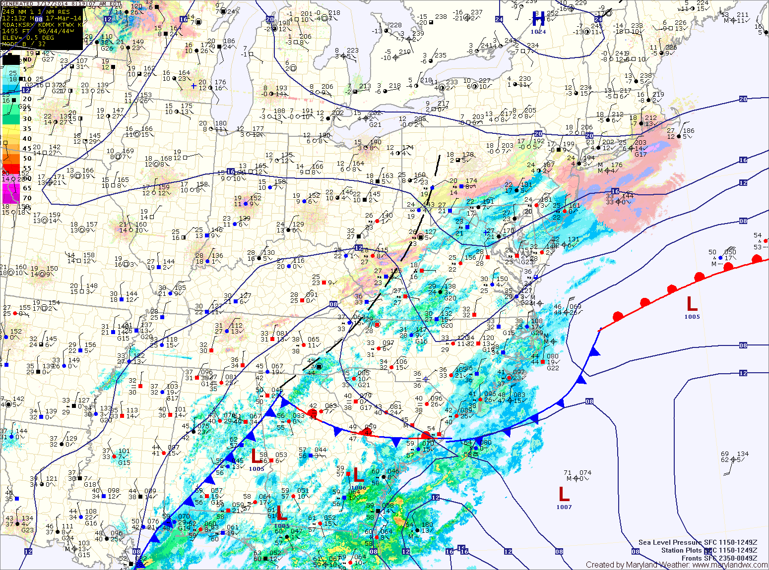
As the latest storm system pulls away from the area, expect areas of light snow or flurries to continue over the next few hours, gradually coming to an end.
The storm generally behaved as expected, except it was colder to start and the area of heavier snow set up farther north than anticipated. Bands of heavy snow set up over central Maryland, greatly increasing snow totals. In general, 5-10″ fell across central and southern Maryland, with lesser amounts to the north. It was a tricky forecast and we certainly got a lot more snow than forecast, thanks to the enhanced banding.
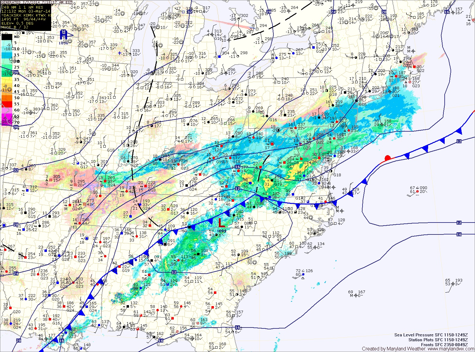
Current Surface MapA WINTER STORM WARNING remains in effect for the entire state into this evening.
Precipitation has changed over to snow as planned and is now falling heavily at times.
Snow will continue into the afternoon hours before tapering off. It will also be windy at times today with gusts to around 25mph.
As forecast, the highest snow totals will be across southern Maryland, where a foot or more is likely. Totals will taper downward as you move northward, down to about 4″ along the Mason-Dixon line.
As the storm pulls away, temperatures will continue to fall and will plummet tonight. Lows will fall into the single digits by Tuesday morning.