
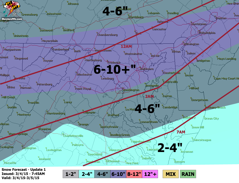
A Winter Storm Warning has been issued for:
Allegany, Anne Arundel, Baltimore, Baltimore City, Calvert, Caroline, Carroll, Cecil, Charles, Frederick, Garrett, Harford, Howard, Kent, Montgomery, Prince George’s, Queen Anne’s, Talbot and Washington counties
A Winter Storm Watch remains in effect for St. Mary’s county
The overnight and early morning model runs continue to show a significant snowfall for our area starting late tonight and lasting into tomorrow afternoon or evening. Expect rain showers to continue to develop and push through today as a cold front pushes through the area. The rain will slowly change over to sleet and then snow late tonight across the state from northwest to southeast. The snow will then continue, heavy at times through tomorrow afternoon before tapering off tomorrow evening.
The NAM and GFS have a general 6-10″ across most of the state which is in agreement with the other global models.
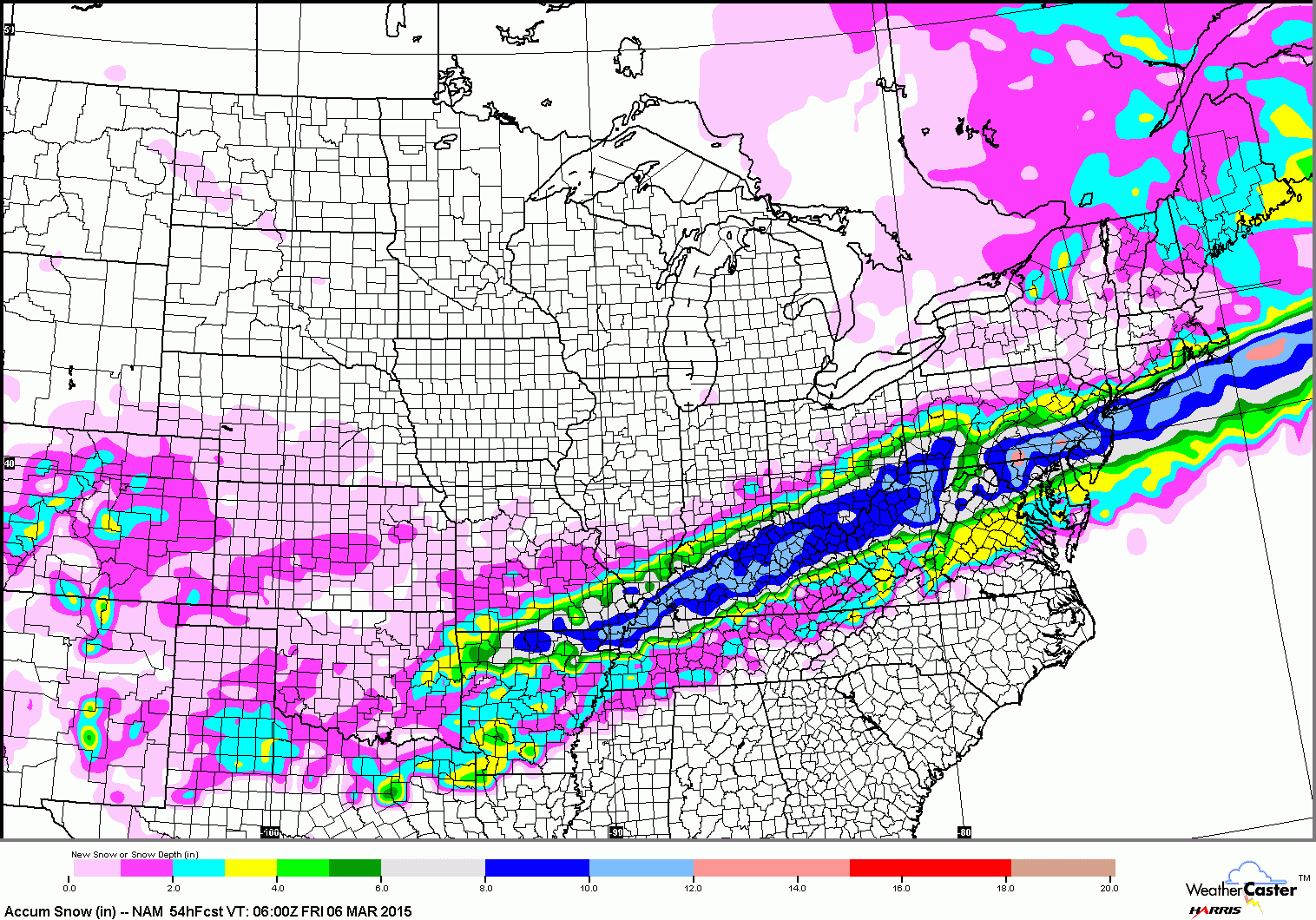
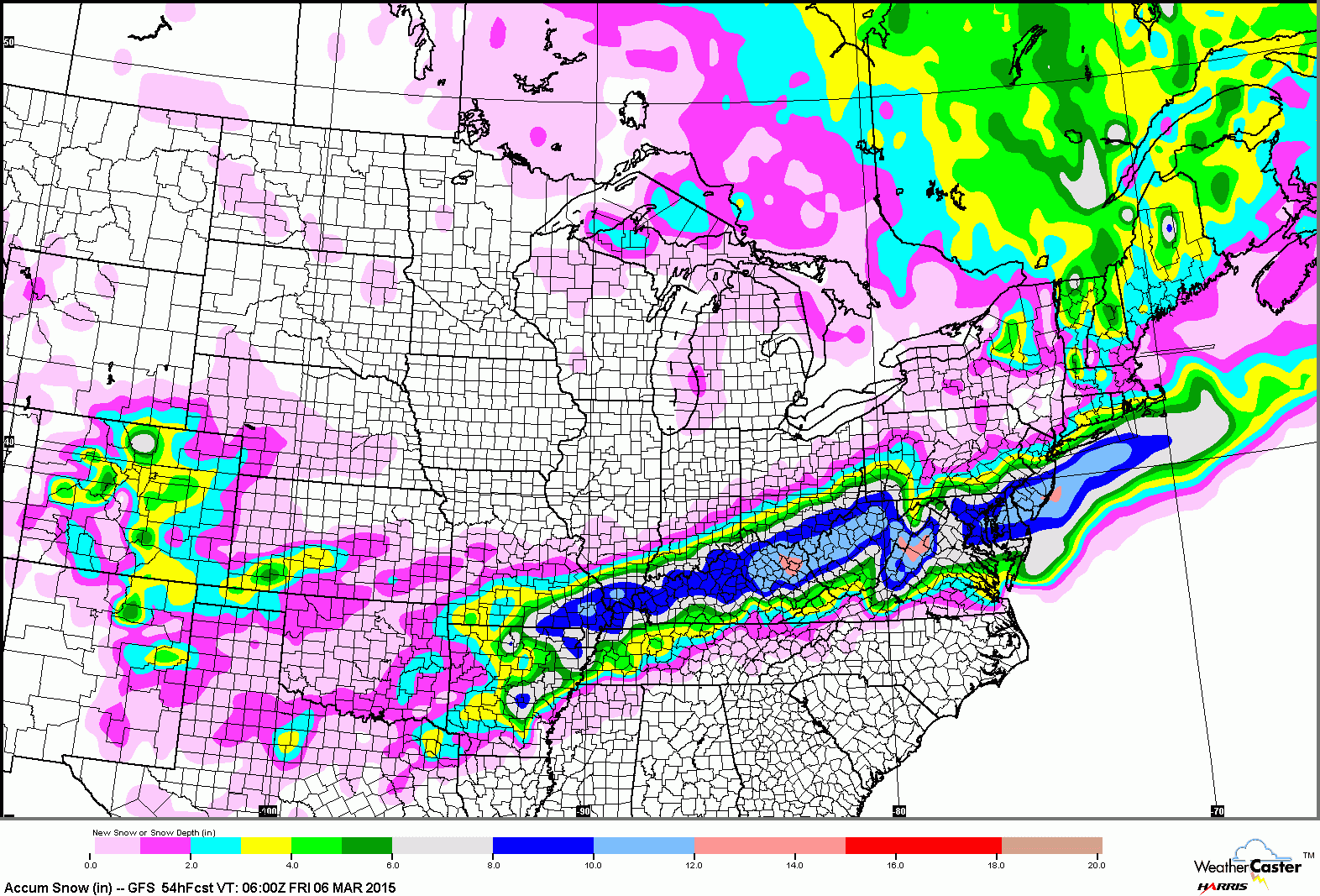
I have adjusted my forecast slightly and have slowed down the changeover from rain to snow. This will likely be a widespread, high impact snowfall across the state.
The other thing to discuss is the cold air that comes in behind the system. Lows will likely fall into the upper single digits to low 10s across the area and highs tomorrow will only reach the mid 20s.
However, this cold will be short-lived, with temperatures warming into the upper 30s for highs on Saturday, mid 40s on Sunday and near 50° by Monday.
The warmer weather looks to continue for most of next week with highs in the 50s to perhaps 60° by the end of the week.
Stay up to date with storm information on your favorite social media site!
Follow me on Twitter, Facebook and Google+!