
A Winter Weather Advisory remains in effect for: Allegany, Anne Arundel, Calvert, Caroline, Charles, Frederick, Garrett, Howard, Montgomery, Prince George’s, Queen Anne’s, St. Mary’s, Talbot and Washington counties
A Winter Storm Warning remains in effect for: Baltimore, Baltimore City, Carroll, Cecil, Harford and Kent counties
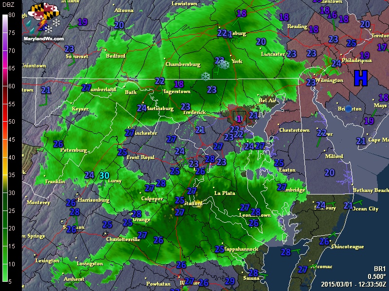
The snow will change over to sleet and then freezing rain from southeast to northwest through the afternoon hours.
Several inches of snow and sleet accumulation is possible, mainly from the I-95 corridor north and west. South and east of there, warmer air will turn the snow and sleet over to freezing rain and then plain rain quicker, limiting snow and ice accumulation.
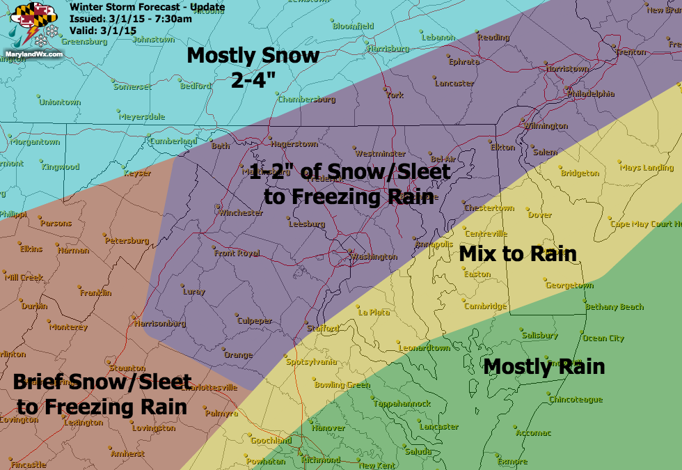
There is the possibility of significant ice accumulation, especially north and west of the cities where up to .25″ of ice is possible.
For the I-95 corridor, ice accumulation between .10″ and .25″ is possible as well.
The wintry mix and ice accumulation will make driving very difficult this afternoon and evening. Untreated surfaces will glaze over quickly, especially as the sun goes down. Be very careful when venturing out later today or tonight.
Stay up to date with storm information on your favorite social media site!
Follow me on Twitter, Facebook and Google+!