
A Winter Storm Warning has been issued from tonight through tomorrow evening for: Allegeny and Washington counties.
A Winter Weather Advisory has been issued from late tonight through tomorrow evening for: Anne Arundel, Baltimore, Baltimore City, Caroll, Frederick, Garrett, Harford, Howard, Montgomery and Prince George’s counties.
A Winter Storm Watch has been issued from tomorrow evening into Tuesday afternoon for: Anne Arundel, Baltimore, Baltimore City, Calvert, Caroline, Cecil, Harford, Kent, Queen Anne’s Somerset, St. Mary’s, Talbot, Wicomico, and Worcester counties.
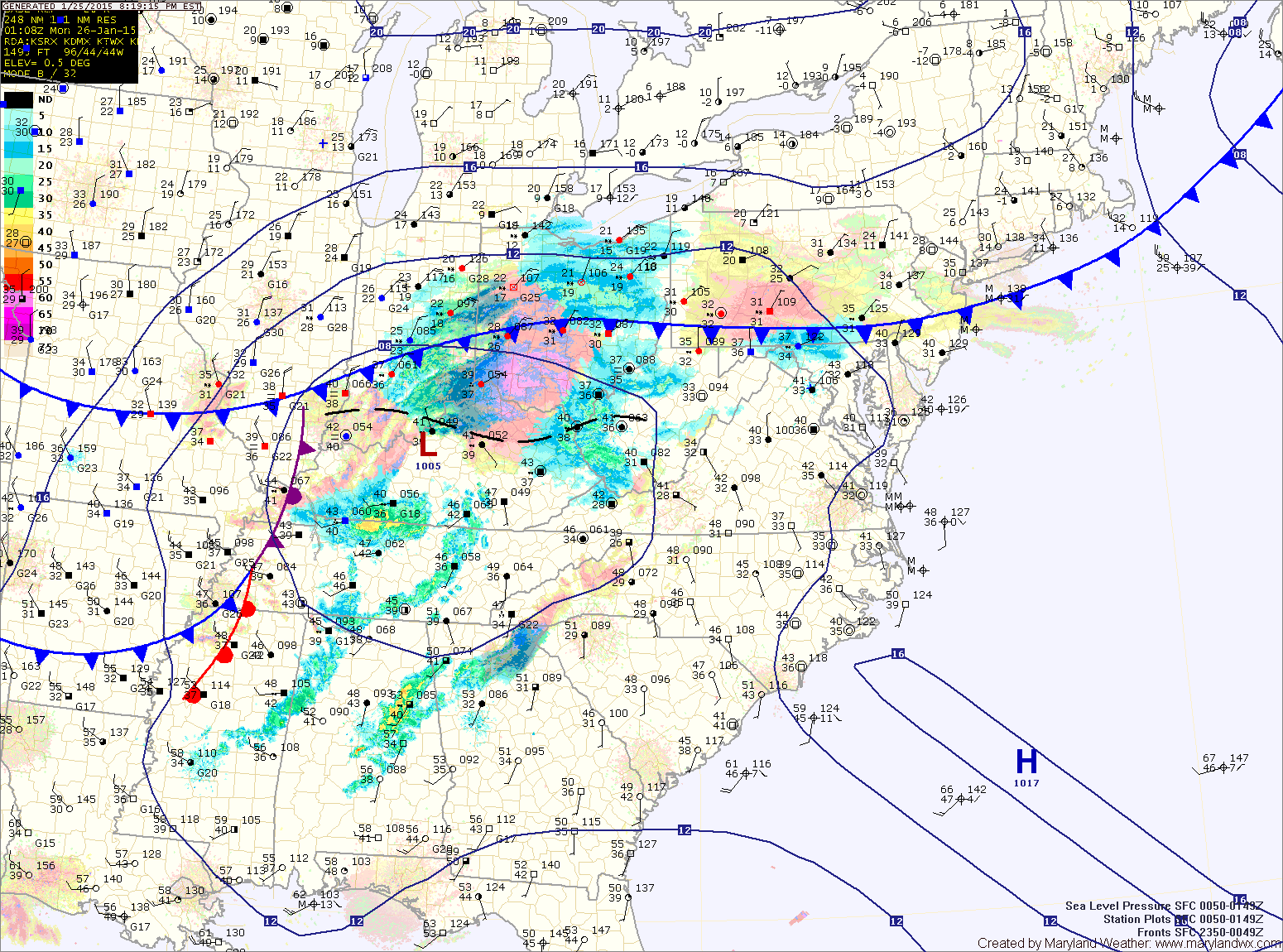
The storm will spread light rain and snow into the area tonight with the mix becoming all snow by Monday morning. The snow will continue, possibly mixing with rain at times during the late morning and early afternoon, mainly east of the mountains.
As the storm moves to the coast, it will rapidly intensify and head towards New England. As it does, another round of snow is expected, mainly along and east of I-95 tomorrow evening into Tuesday. Currently, it appears the eastern portion of the state will be on the fringe of this round of snow with little accumulation expected west of I-95.
Zone forecast:
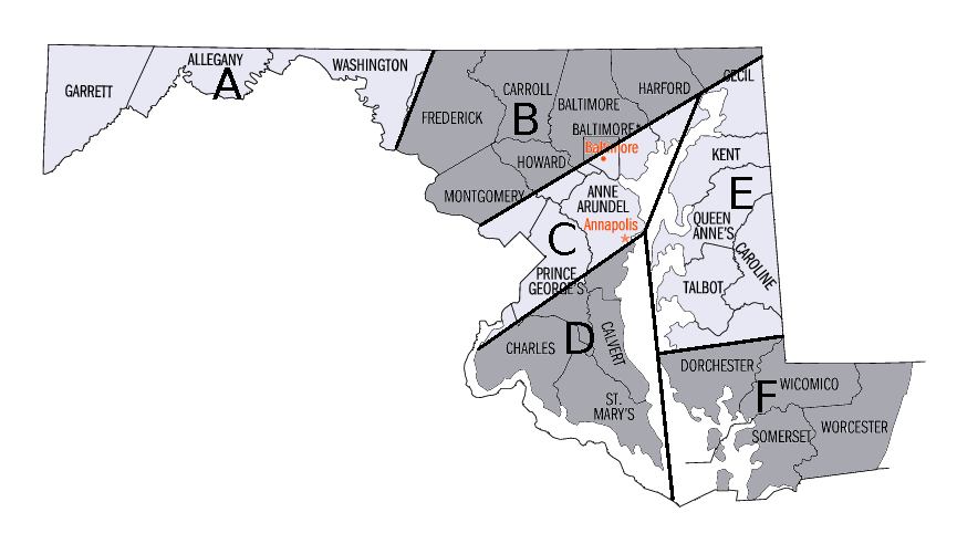
– Round 1 – Snow begins tonight, lasts into tomorrow afternoon. 3-5″ of snow is expected.
– Round 2 – Light snow is likely tomorrow evening through Tuesday morning. An additional 1-2″ is possible.
Zone B:
– Round 1 – Snow begins tonight, mixed with rain, turning to all snow by tomorrow morning. The snow will last into tomorrow afternoon. 2-4″ of snow is expected.
– Round 2 – Snow is likely tomorrow evening through Tuesday morning. An additional 1-2″ is possible in Carroll, Frederick and Montgomery counties. An additional 2-3″ is possible in Baltimore, Harford and Cecil counties.
Zone C:
– Round 1 – Rain/snow mix begins late tonight, becoming all snow by Monday morning. The snow may mix with rain at times as we head into the afternoon. Total accumulations of 1-2″.
– Round 2 – Snow is likely tomorrow evening through Tuesday morning. An additional 1-2″ is possible, mainly east of I-95.
Zone D:
– Round 1 – Rain begins late tonight, mixing with snow tomorrow morning and lasting through the afternoon. Total accumulation of about 1″ or less.
– Round 2 – Snow is likely tomorrow evening through Tuesday morning. An additional 3-5″ of snow is possible.
Zone E:
– Round 1 – Rain begins late tonight, possibly mixing with snow tomorrow morning. The rain/snow mix will taper off during the late afternoon. No accumulation is expected.
– Round 2 – Snow is likely tomorrow evening through Tuesday morning. 4-8″ of snow is possible.
Zone F:
– Round 1 – Rain begins late tonight or early tomorrow morning. The rain may change to snow late Monday with 1-2″ of snow possible before ending early Tuesday.
– Round 2 – Snow is likely tomorrow evening through Tuesday morning. 3-6″ of snow is possible.
The snowfall totals for the second round of snow are completely dependent upon the strength and track of the coastal low pressure. At this time, it appears the low will be close enough to push accumulating snowfall into our state with the highest totals across eastern portions of the state. Should the storm form and track further east, these totals will drop dramatically. Should it form and track further west, totals could increase.