
A Winter Storm Warning has been issued for: Allegeny and Washington counties.
A Winter Storm Watch has been issued for: Caroline, Cecil, Kent, Queen Anne’s and Talbot counties.
A Winter Weather Advisory has been issued for: Anne Arundel, Baltimore, Baltimore City, Caroll, Frederick, Garrett, Harford, Howard, Montgomery and Prince George’s counties.
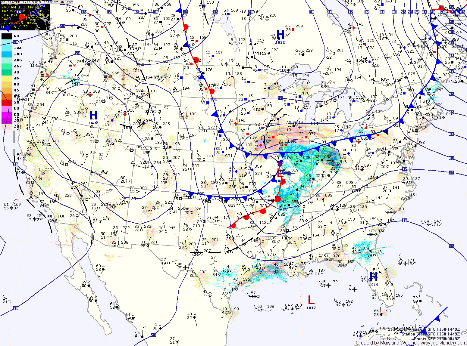
As for our area, the storm will likely strengthen too far away for us to see a major snow storm here. The eastern shore will be on the fringe of the heavy precipitation and will likely see more snowfall than areas west of the bay.
Zone forecast:
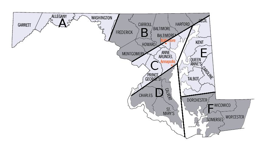
Zone B: Snow begins tonight, lasts into tomorrow afternoon. Total accumulations of 3-5″ likely.
Zone C: Snow begins tonight, lasts into tomorrow afternoon. Total accumulations of 2-4″ likely.
Zone D: Snow begins tonight, lasts into tomorrow afternoon. Total accumulations of 1-2″ likely.
Zone E: Rain begins early tomorrow morning, changing to snow tomorrow afternoon, lasting into Tuesday morning. Total accumulations of 5-10″ possible, depending on the timing of the changeover.
Zone F: Rain begins late tonight or early tomorrow morning. The rain may change to snow late Monday with 1-2″ of snow possible before ending early Tuesday.
This is a very difficult forecast and confidence is low. As things change and come into focus this afternoon, updates to this forecast may be warranted.