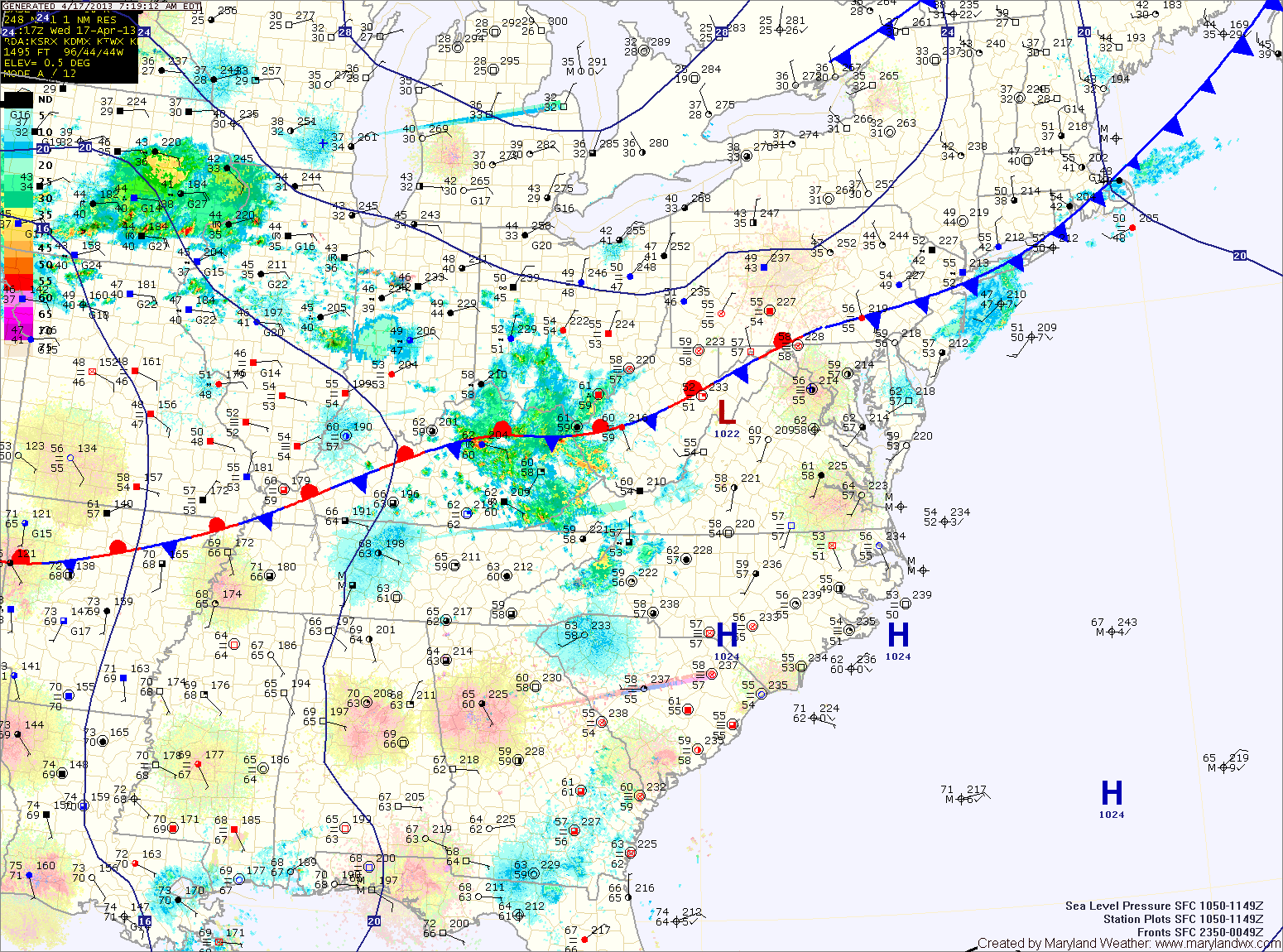
Cold Front to Bring Showers and Storms Today

Current Surface Map
Current Surface Map
A cold front currently pushing through Ohio and will approach and cross the state this afternoon and evening. Widespread showers and thunderstorms are accompanying the front and will move into the area during the afternoon hours.

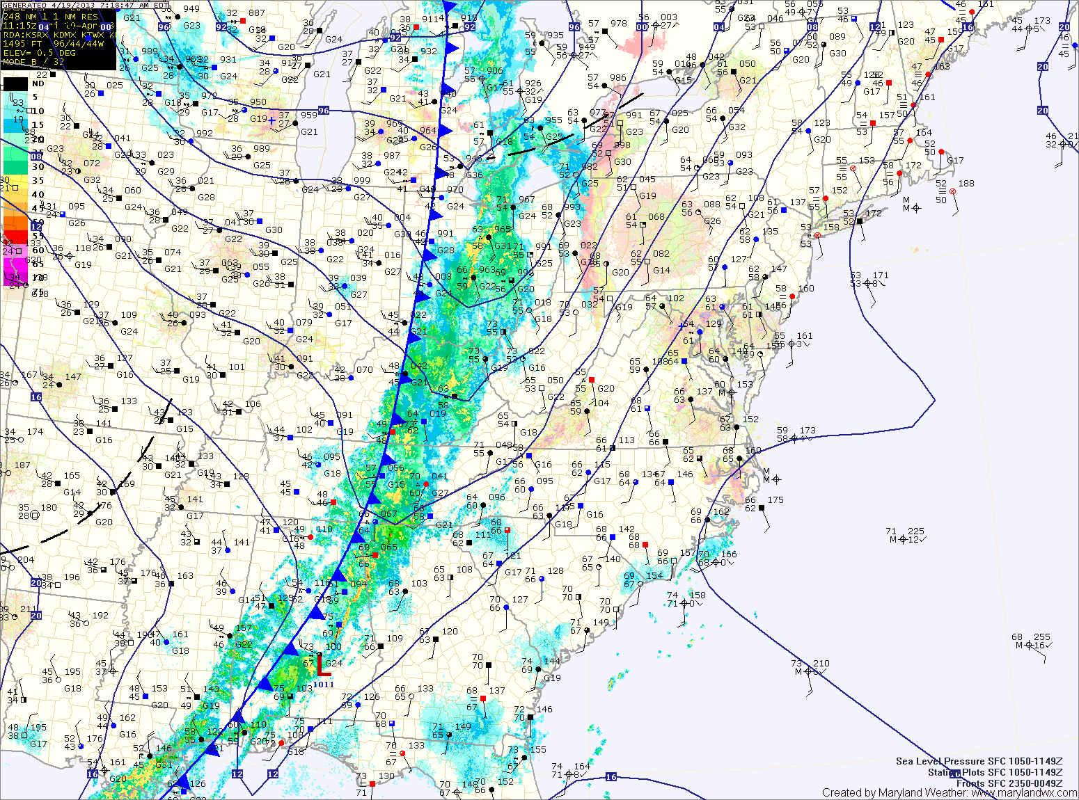
Ahead of the front, it will be warm and windy with southwest winds gusting to near 35mph. Highs today will push into the upper 70s to low 80s.

Showers and storms will move in from west to east during the late afternoon and evening, bringing locally heavy rainfall and strong, gusty winds. Flash flooding will be possible this afternoon and evening.

Partly Sunny; Seasonal Temps Today

Current Surface Map
Current Surface Map
A cold front is slowly sinking south through the state this morning and will settle south of the area this afternoon. Highs across the state will be in the upper 60s to low 70s.

Easterly flow will develop behind the front this evening, bringing in cool and moist air overnight.

Southerly flow will take over tomorrow, scouring out the cool/damp air and replacing it with warm humid air. Highs will push into the low to mid 70s.

A cold front will approach on Friday. Ahead of the front, showers and thunderstorms will develop and move into the area Friday afternoon. Some of the storms may produce gusty winds and locally heavy rain. Highs on Friday will be in the mid 70s.

Partly Sunny Today

Current Surface Map
Current Surface Map
High pressure off the coast will keep a moist, easterly flow over the region. This will maintain cloud cover and cap high temperatures in the upper 60s to around 70.

A weak cold front will sag south into the area tonight and persist through tomorrow. North of the front it will be in the mid 60s with moist, easterly flow, while south of the front, temperatures will push into the 70s. Areas near the front will also experience scattered showers and thunderstorms.

As of right now, it appears the front will slice across central Maryland, allowing southern Maryland to warm, while northern parts stay cooler. There is a slight chance of drizzle or light rain Wednesday night across the entire state as easterly flow persists.

Drizzle This Morning; Cold Front Tomorrow Night

Current Surface Map
Current Surface Map
An upper level low is bringing light rain and drizzle to the state this morning. The rain will move through and rain chances will decrease as we move into the afternoon. Highs today will be in the low 60s.

A cold front will drop southward and towards the area tomorrow, keeping clouds in the area. Despite the clouds, temperatures should climb into the low 70s for highs.

Scattered showers are possible tomorrow night as the front pushes into the area. The front is expected to stall out across the state Wednesday and Thursday. North of the front it will be cooler, while south it will be warmer. Highs Wednesday and Thursday will be dependent upon where the front stalls but will generally be in the 60s and 70s.

Mix of Sun and Clouds Today; Afternoon Shower Possible

Current Surface Map
Current Surface Map
Today will be much like the past few, with a mix of clouds and sun and a chance of an afternoon shower. Although, the cloudiness, shower chances and winds will be less than in previous days. Highs will top out in the mid to upper 50s.

High pressure builds in tomorrow, providing abundant sunshine and calmer winds. Highs will be in the upper 50s.

Clouds will increase tomorrow night and Sunday morning as a cold front approaches from the west. The front will spread showers over the state from west to east during the late morning into the afternoon and evening. Highs will be in the upper 50s.

Rain/Snow Mix Developing

Current Surface Map
Current Surface Map
Light rain/snow/sleet is moving across the area this morning. The mix will continue into the afternoon before changing to rain in most places.

The exception is far western Maryland, where a Winter Storm Warning is in effect for several inches of snow. Further east, accumulations are not expected. Highs today will top out in the mid to upper 30s.

The cold front will pass through tonight, bringing an end to the precipitation. Tomorrow will feature decreasing clouds and gusty winds. Highs will be in the low 50s.

Sunny Today; Slight Chance of Rain Tomorrow

Current Surface Map
High pressure is overhead this morning and will slide off the coast tonight. This will provide a sunny but cold day today. Highs will top out in the mid 40s.

Clouds will increase tonight and tomorrow as a weak frontal boundary sets up in our area. Warmer air flowing northward may cause light showers to break out later tomorrow. Highs will be around 50 degrees under cloudy skies.

The front should push northward Saturday as southerly flow strengthens. This will allow for more sunshine and temperatures in the low 60s.

Warmer Weather on the Way

Current Surface Map
High pressure will continue to build into the region today and slide off the coast this weekend. This will lead to mostly sunny skies and warmer temperatures.

Expect sunny skies today with highs in the mid to upper 50s.

Sunshine continues tomorrow as highs continue to climb, topping out in the low to mid 60s.

More sunshine and even warmer temperatures are expected Sunday, as highs climb to near 70.

Showers Through Mid Day, Sunshine this Afternoon

Current Surface Map
A weak area of low pressure riding along a stationary front is providing light shower activity this morning. Showers will be likely, tapering off as we move into the afternoon. As high pressure builds in, expect the clouds to clear and allow for some sunshine this afternoon. It will be warm, with highs in the low to mid 80s.

High pressure between the current system and the next system will provide for a beautiful Friday. Highs will be in the low 80s under mostly sunny skies with low dew points.

Another cold front will approach on Saturday and move through late Saturday with another round of showers during the afternoon and evening. Highs Saturday will be in the mid 70s.

Partial Clearing Today; Warm End to Week

Current Surface Map
A frontal boundary remains draped across the state. Along and to the east of the boundary, temperatures are in the 70s while they are in the 60s to the west.

This front should push northward today, allowing for partial clearing. Temperatures should push into the mid 80s in areas that end up south of the front.

The entire system will clear the area tonight but as it does so, isolated showers are possible during the overnight.

Temperatures will continue to be warm tomorrow and Friday under mostly sunny skies. Highs both days will push into the mid 80s.