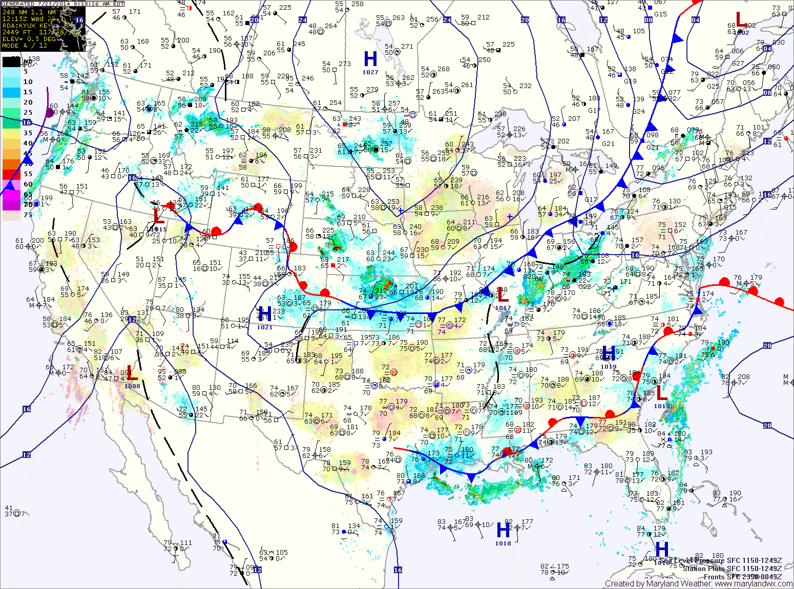
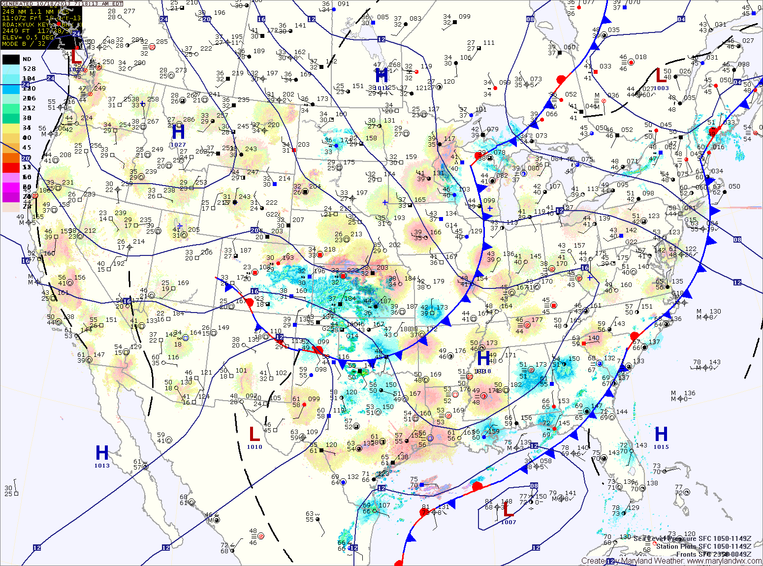
Current Surface MapA cold front is slowly moving towards the region today. As it moves closer, showers and thunderstorms will become likely late this afternoon and into tonight. Highs today will be around 90.
The front will continue its progression eastward tomorrow, keeping shower and thunderstorm chances in the forecast through the evening hours. Highs will be in the low to mid 80s.
The front will push through late tomorrow evening, ushering in high pressure and and drier air for the end of the week.
Friday will be mostly sunny with highs in the mid 80s.
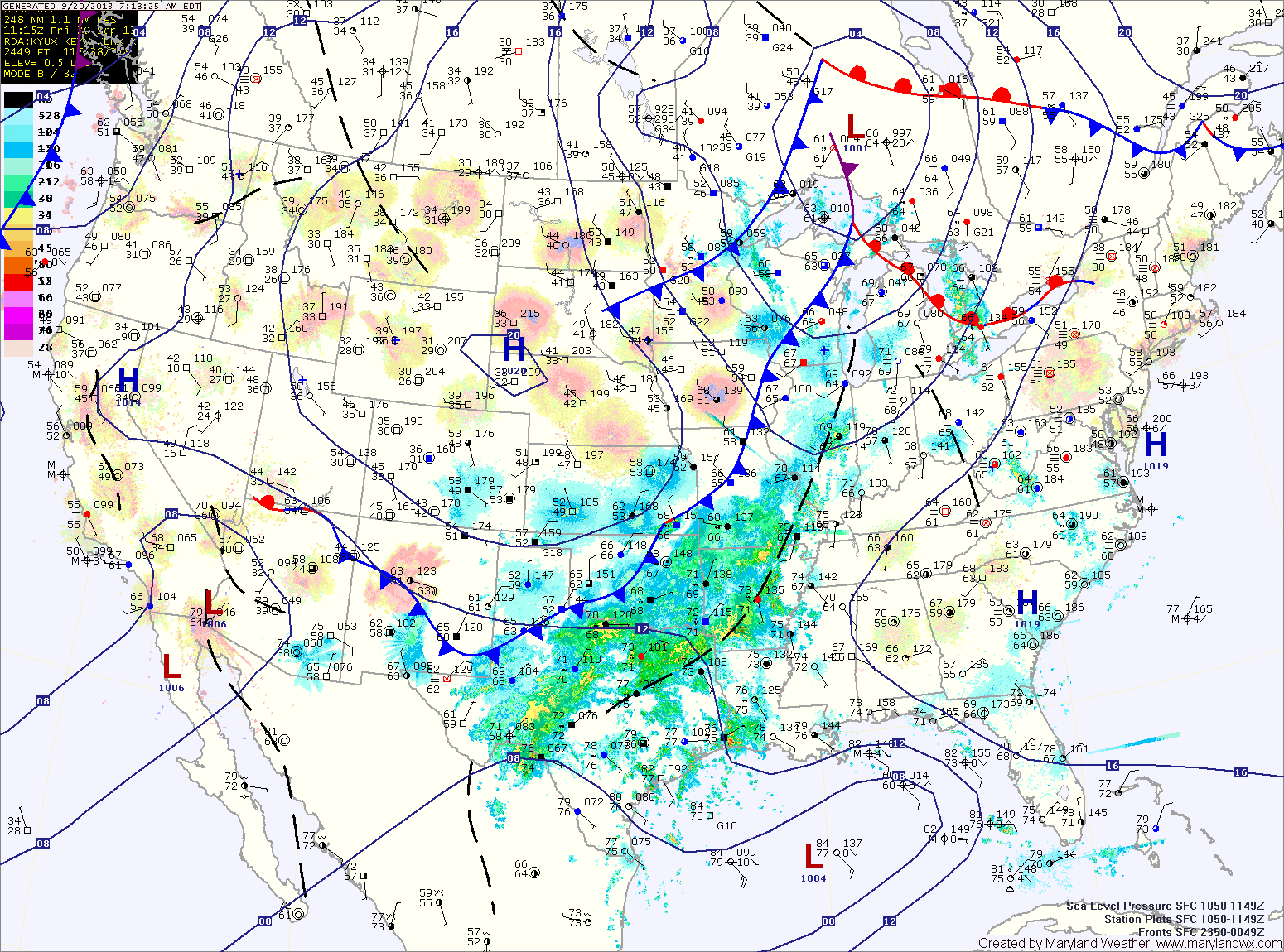
Current Surface MapHigh pressure will continue to build in from the northwest today leading to mostly sunny skies and cool temperatures. Highs today will be in the low 80s.
Another clear and cool night will be on tap tonight with lows in the upper 50s to around 60 in central Maryland, falling to the 40s in far western Maryland.
Expect another nice day tomorrow, with mostly sunny skies and highs in the mid 80s.
The high will move off of the coast this weekend and as a result, more humid air will begin to push back into the region. This will lead to an increase in clouds on Saturday with just a slight chance of isolated thunderstorms during the afternoon, mainly over the mountains. Highs will remain in the low to mid 80s.
A FLASH FLOOD WATCH is in effect for most of the state except far Western Maryland and the lower Eastern Shore.
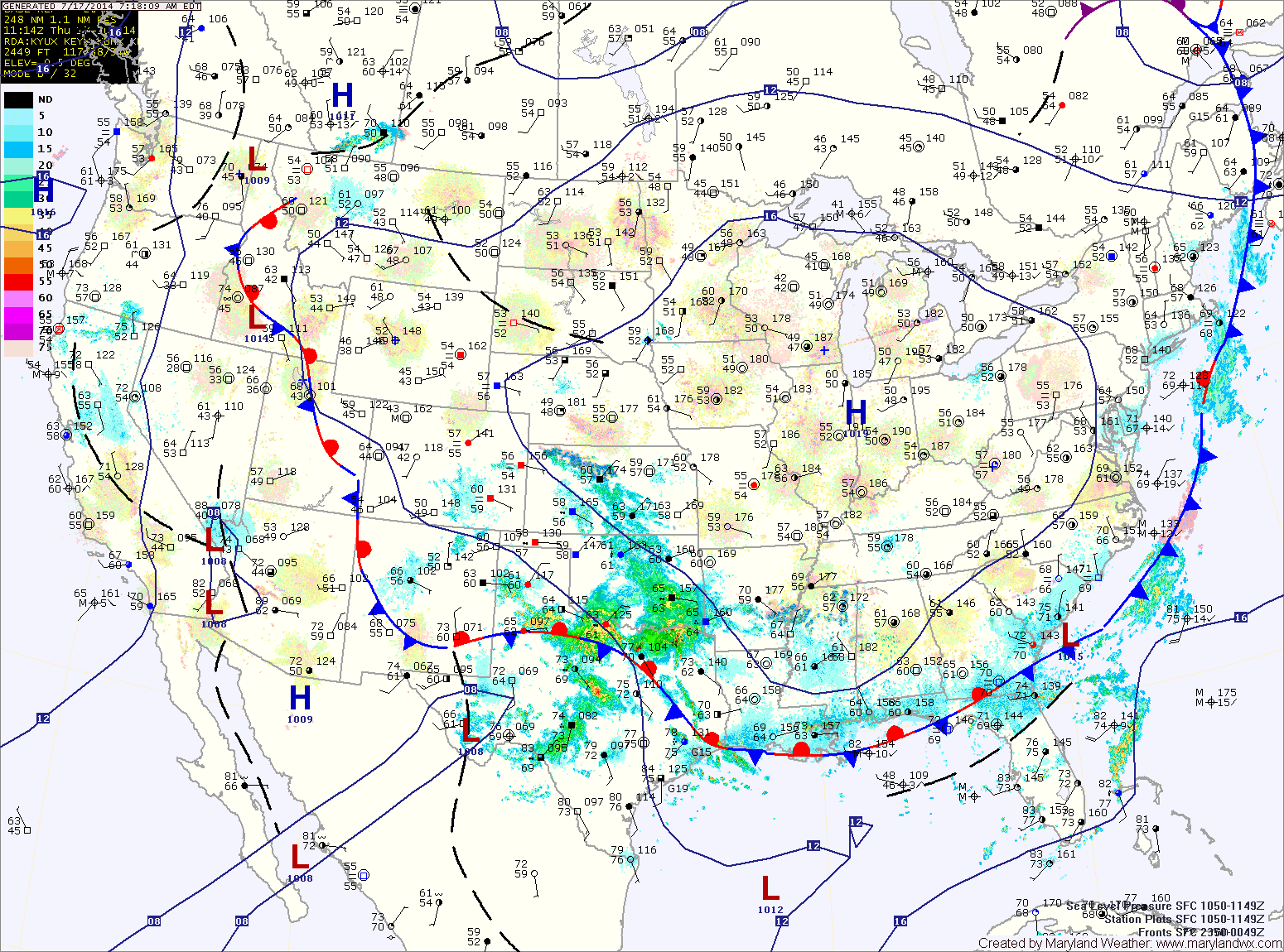
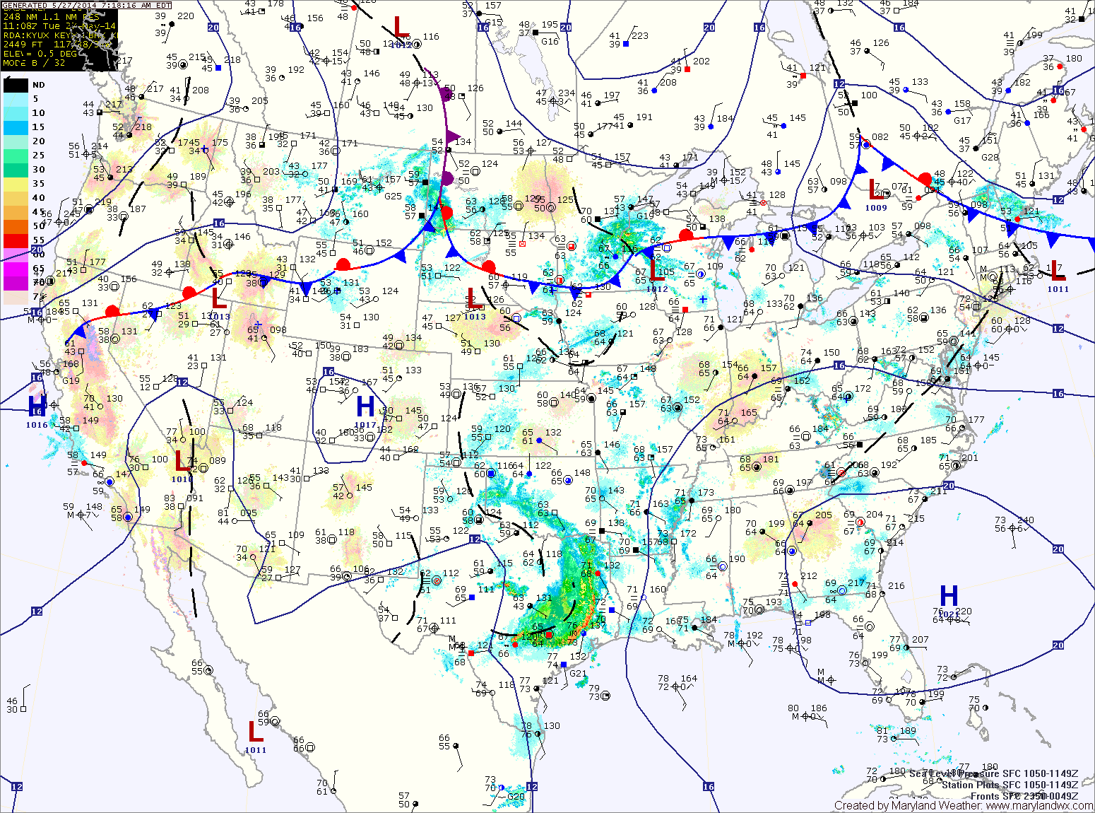
Current Surface MapA cold front will move into the area today, touching off another round of showers and thunderstorms this afternoon through tonight. It will remain hot and humid with highs in the low 90s. This airmass will continue to support strong storms with gusty winds, large hail and very heavy rainfall. Localized flash flooding is possible in any storm.
The front will push through tomorrow morning, ending the rainfall and ushering in cooler and drier air for the holiday weekend. Expect mostly sunny skies by tomorrow afternoon, with highs in the low 80s.
The front will also steer Hurricane Arthur well east of the state. By Friday afternoon, the storm should be well off the Ocean City coast, accelerating away from the area.
A HEAT ADVISORY is in effect for most of Central Maryland.
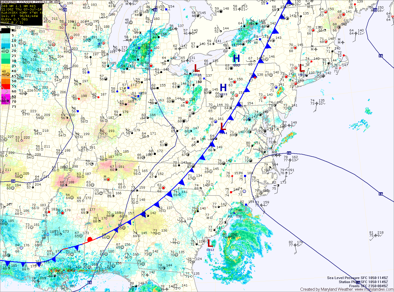
Current Surface MapWith high pressure off of the coast, southerly flow will continue to pump heat and humidity into the area. A Heat Advisory has been issued for central Maryland where highs in the mid 90s will combine with dewpoints in the low 70s to push the heat index into the low 100s.
Additionally, the heat and humidity will fuel development of late afternoon and evening thunderstorms. Some of these storms will become severe with damaging winds and large hail as the main threat. Any storm will also be capable of producing very heavy rainfall, leading to localized flash flooding.
Thunderstorms chances will continue tonight and activity will increase again tomorrow afternoon as a cold front approaches from the west. Just like today, these storms will be capable of producing very heavy rainfall, damaging winds and large hail. Highs tomorrow will be in the upper 80s.
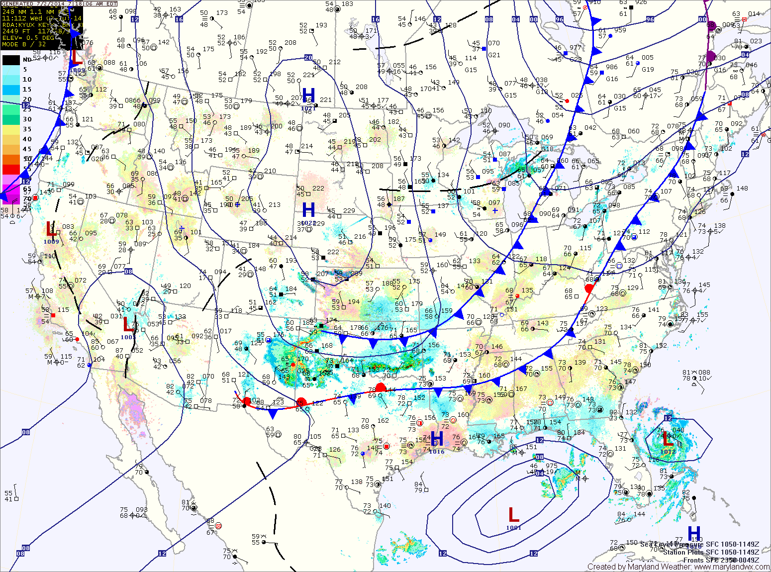
Current Surface MapHigh pressure off of the south east coast will continue to pump warm and humid air into the region. This will develop showers and thunderstorms across the state today. Some of the storms could become severe, with large hail being the primary threat. Highs today will be in the upper 80s.
A backdoor cold front will approach tomorrow, adding another mechanism for shower and thunderstorm development. Showers and storms are likely tomorrow as well, especially in the afternoon. Highs will be around 80.
The front will push through the state Wednesday night into Thursday morning. Showers will remain likely Thursday morning, tapering off during the afternoon as the front pushes south. It will be much cooler as well, with highs likely topping out in the mid to upper 60s.
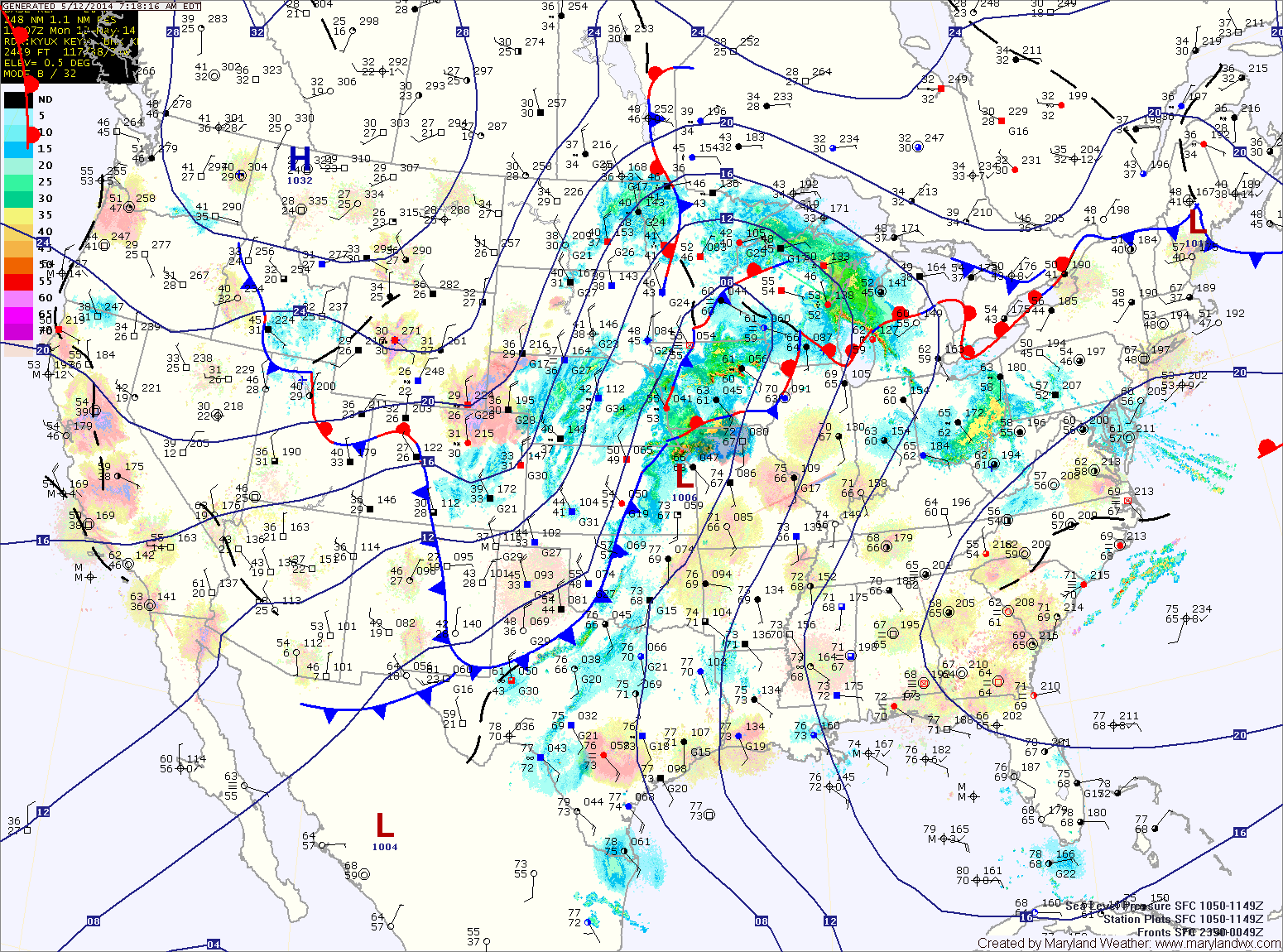
Current Surface MapHigh pressure to our south and a cold front to our west will create southerly flow and pump warm, humid air into the region. This will allow isolated thunderstorms to pop up this afternoon. Highs today will be in the upper 80s to around 90.
Tomorrow will be similar to today, continued hot and humid with scattered afternoon and evening thunderstorms. Highs will be around 90.
High pressure will develop to our northeast Tuesday night and Wednesday. This will turn winds back to the east and set up on shore flow. This will cool temperatures back to around 80 for highs on Wednesday. There will be ample cloud cover and isolated to scattered showers are possible.
Current Surface MapA FREEZE WARNING has been issued for all of central and eastern Maryland.
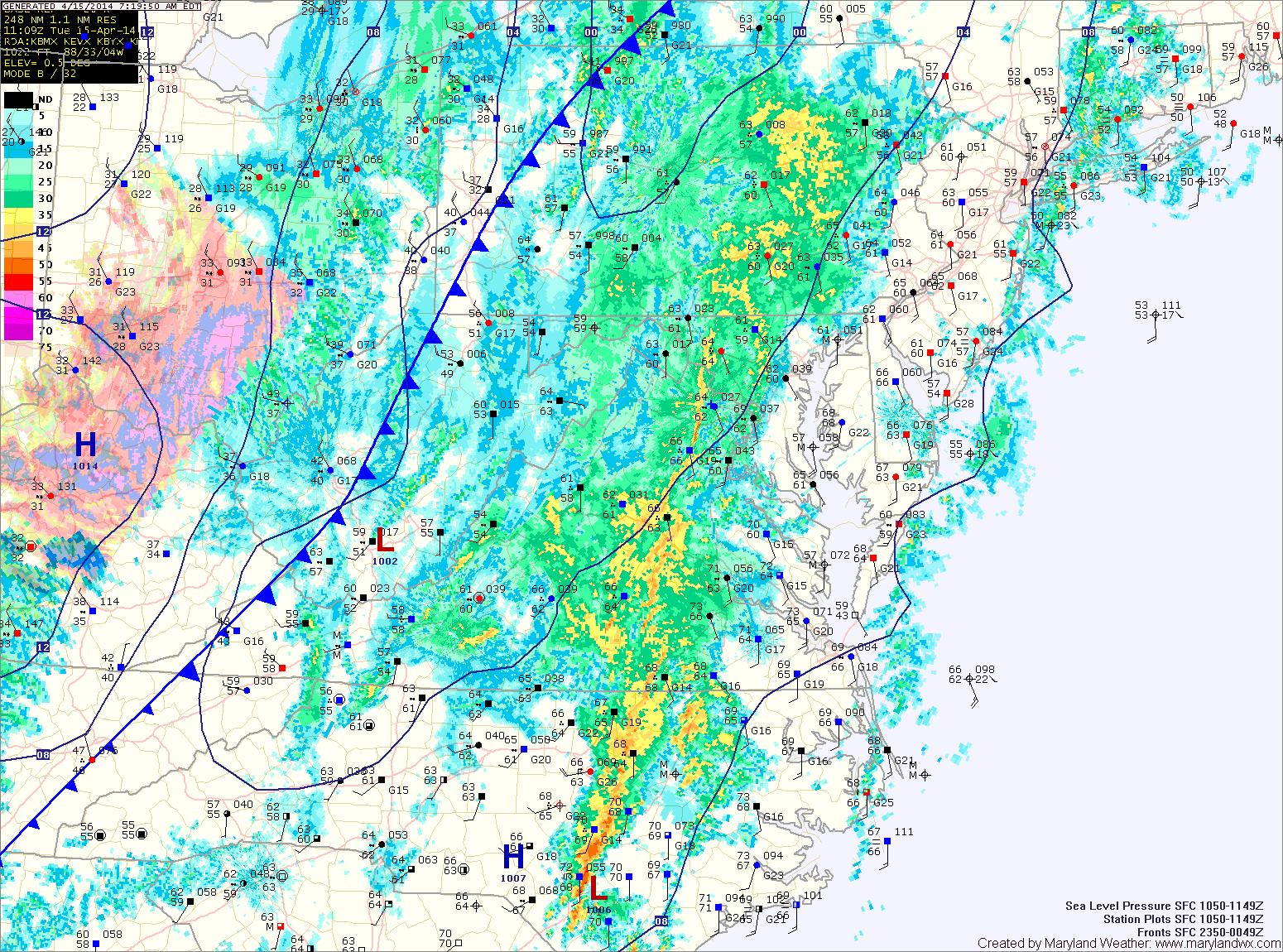
A strong cold front is moving through, spreading showers and thunderstorms into the area. The showers and storms will continue into this evening before tapering off after dark. As colder air moves in behind the front, the rain may end as a brief period of snow, mainly north and west of the cities. Highs today will reach the mid to upper 60s before falling this afternoon.
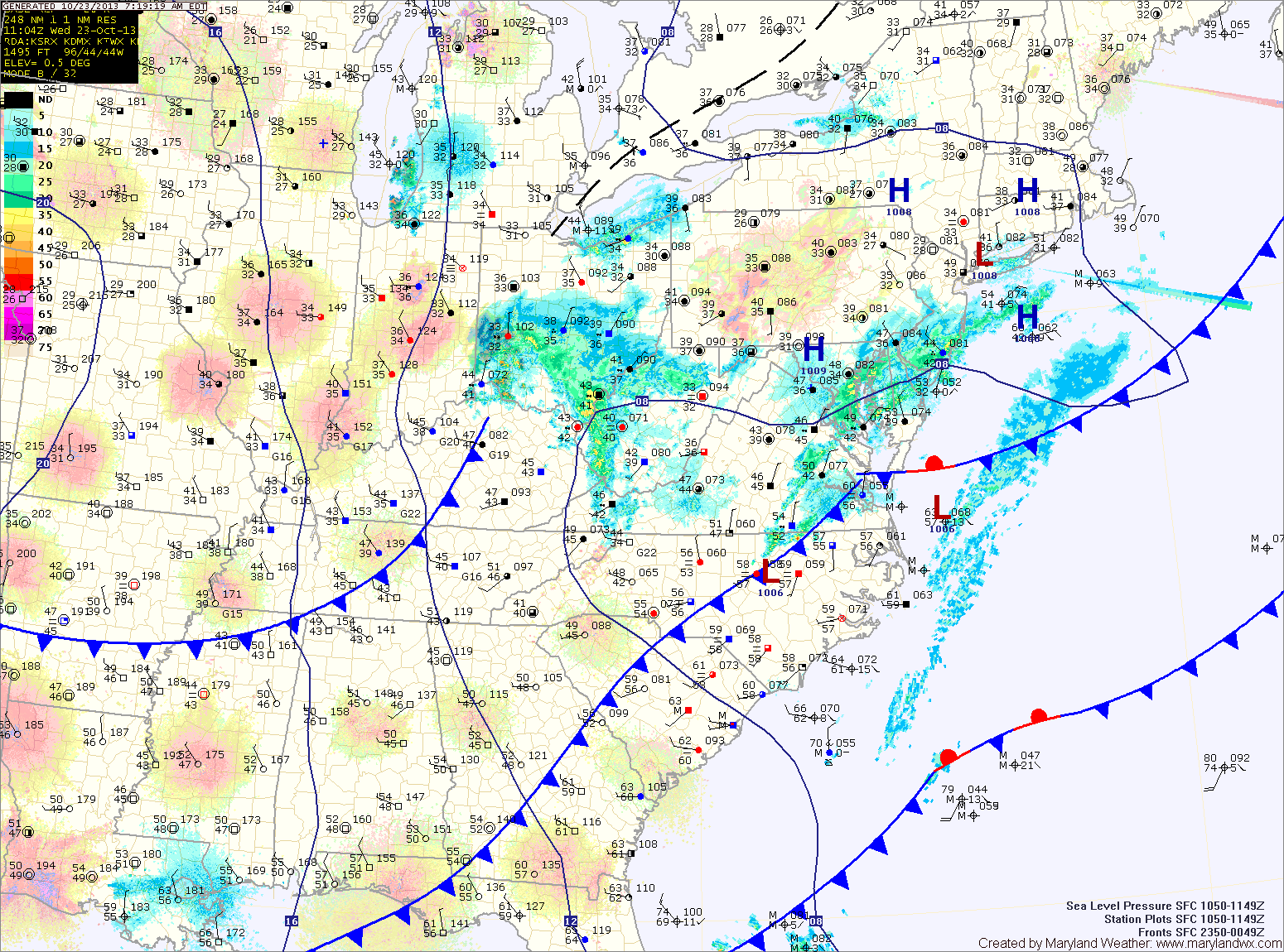
Current Surface MapAn area of low pressure is moving northeast and away from the area this morning. The low has brought light rain, mainly to the southern and eastern portions of the state. Expect decreasing clouds today and highs in the mid 50s.
Cooler air will flow into the region tonight and tomorrow. Upslope rain and snow showers are likely in the mountains and lows in the mid 30s are expected across central and eastern portions of the state tonight.
Tomorrow will be mostly sunny with highs in the low to mid 50s.
A reinforcing shot of colder air will move in tomorrow, and highs on Friday will be in the low 50s with overnight lows dropping to near freezing Friday night.
Current Surface MapExpect another nice day today with mostly sunny skies and highs around 80 degrees.
A cold front will approach the area tomorrow. Ahead of and along the front, numerous showers and thunderstorms will develop.
Some of the showers and storms could produce locally heavy rainfall and gusty winds. Highs will be in the upper 70s to low 80s under mostly cloudy skies.
Rain chances will continue through tomorrow night into early Sunday morning before the front clears the area.