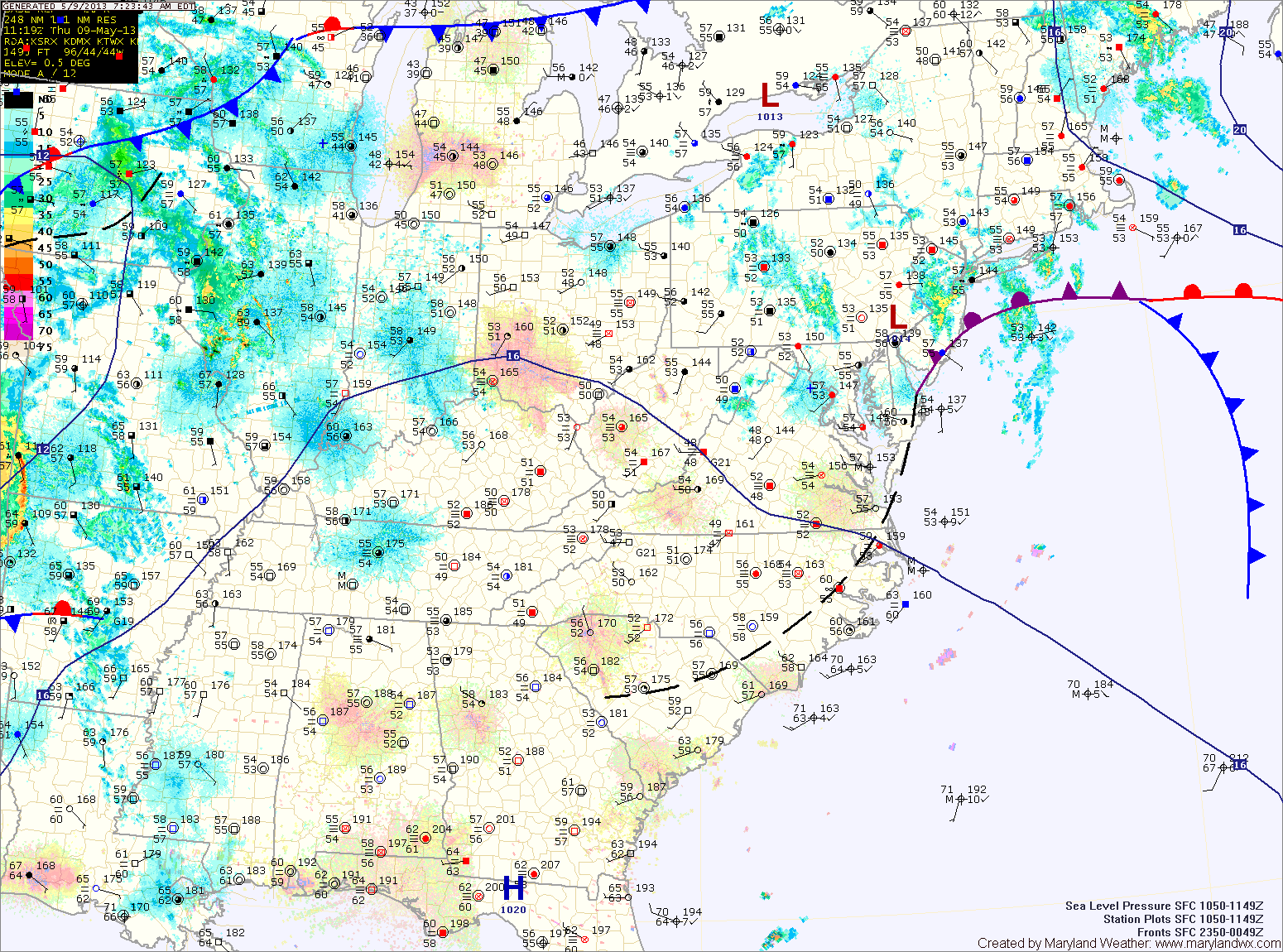
Current Surface MapThe cold front that brought numerous showers and thunderstorms to the state yesterday has pushed off shore. Behind the front, cooler and drier air is working into the region and will last through the weekend.
Expect early morning clouds to give way to more sunshine this afternoon. Highs will be in the mid 70s.
Tomorrow will be even cooler and will feature far less clouds. Expect mostly sunny skies with highs in the low 70s.
Sunday will see more sunshine and temperatures climbing back up into the mid to upper 70s during the afternoon.
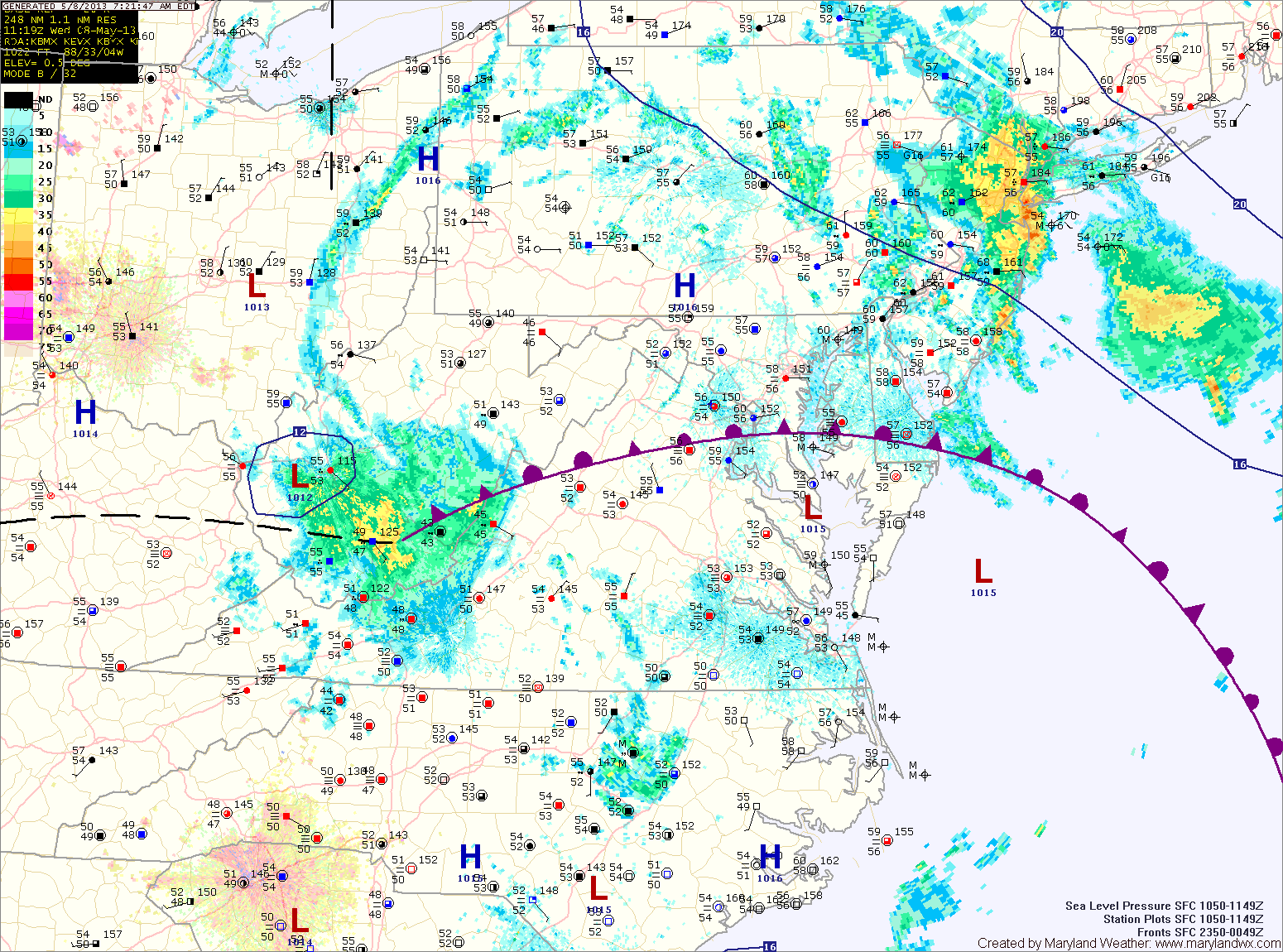
Current Surface MapA cold front will approach the area today, moving through this afternoon and evening. Ahead of the front, scattered showers and thunderstorms are expected to break out and move through as well. It will continue to be hot and humid, with highs around 90.
Canadian high pressure begins to move into the region tomorrow. Expect decreasing clouds and highs in the mid 70s.
This weekend will feature plenty of sunshine comfortable high temperatures and chilly morning lows. Highs on Saturday will be in the low 70s under sunny skies.
Current Surface MapWith high pressure remaining off of the coast, hot and humid conditions will continue today. Expect afternoon highs a few degrees warmer than yesterday, into the mid 90s under mostly sunny skies.
A cold front will approach tomorrow and move through during the late afternoon or evening. Scattered showers and thunderstorms will accompany the front as it moves through. It will continue to be hot, with highs in the low 90s.
Behind the front, Canadian High pressure will begin to move in bringing cooler and drier air. Friday will be partly sunny with highs in the mid 70s.
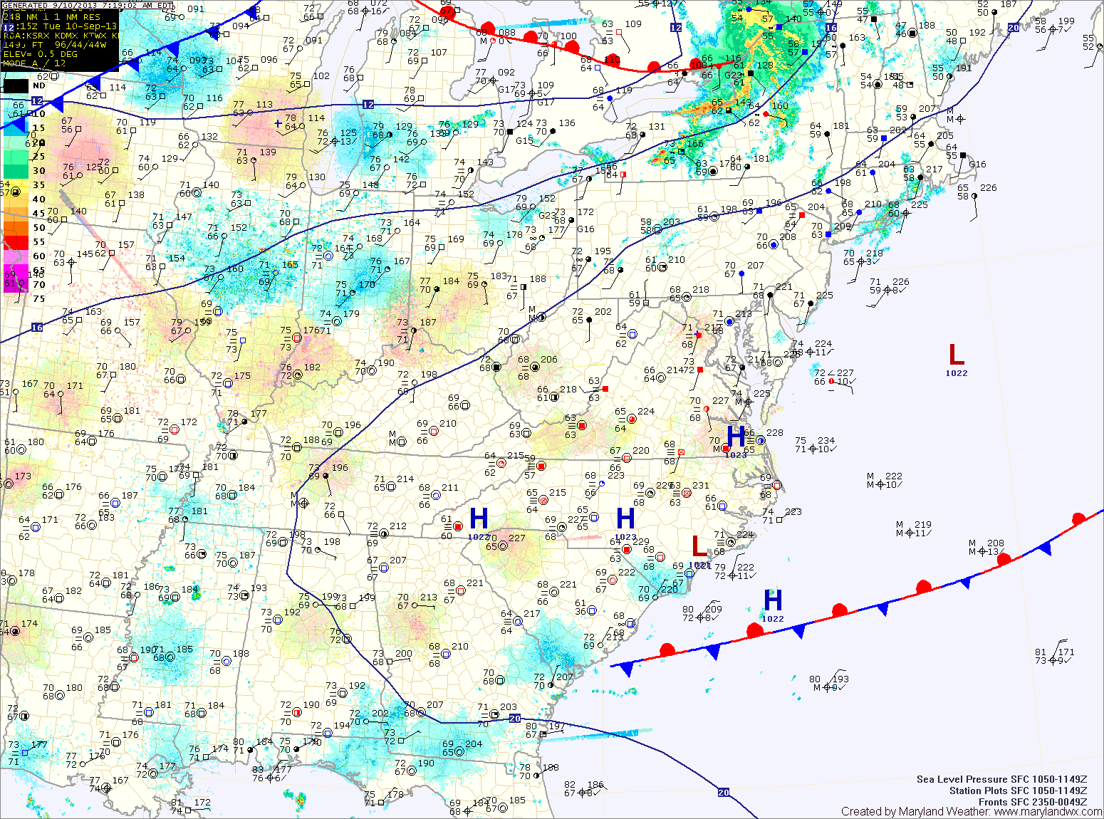
Current Surface MapHigh pressure off the coast will usher in hot and humid air for the next few days. Highs today will top out around 90 degrees under mostly sunny skies.
Tomorrow will be a few degrees warmer than today with highs in the low 90s.
Expect more heat and humidity on Thursday as a cold front approaches the area. Highs will be around 90.
The front will move into the state during the afternoon, setting off scattered showers and thunderstorms before moving through late Thursday evening.
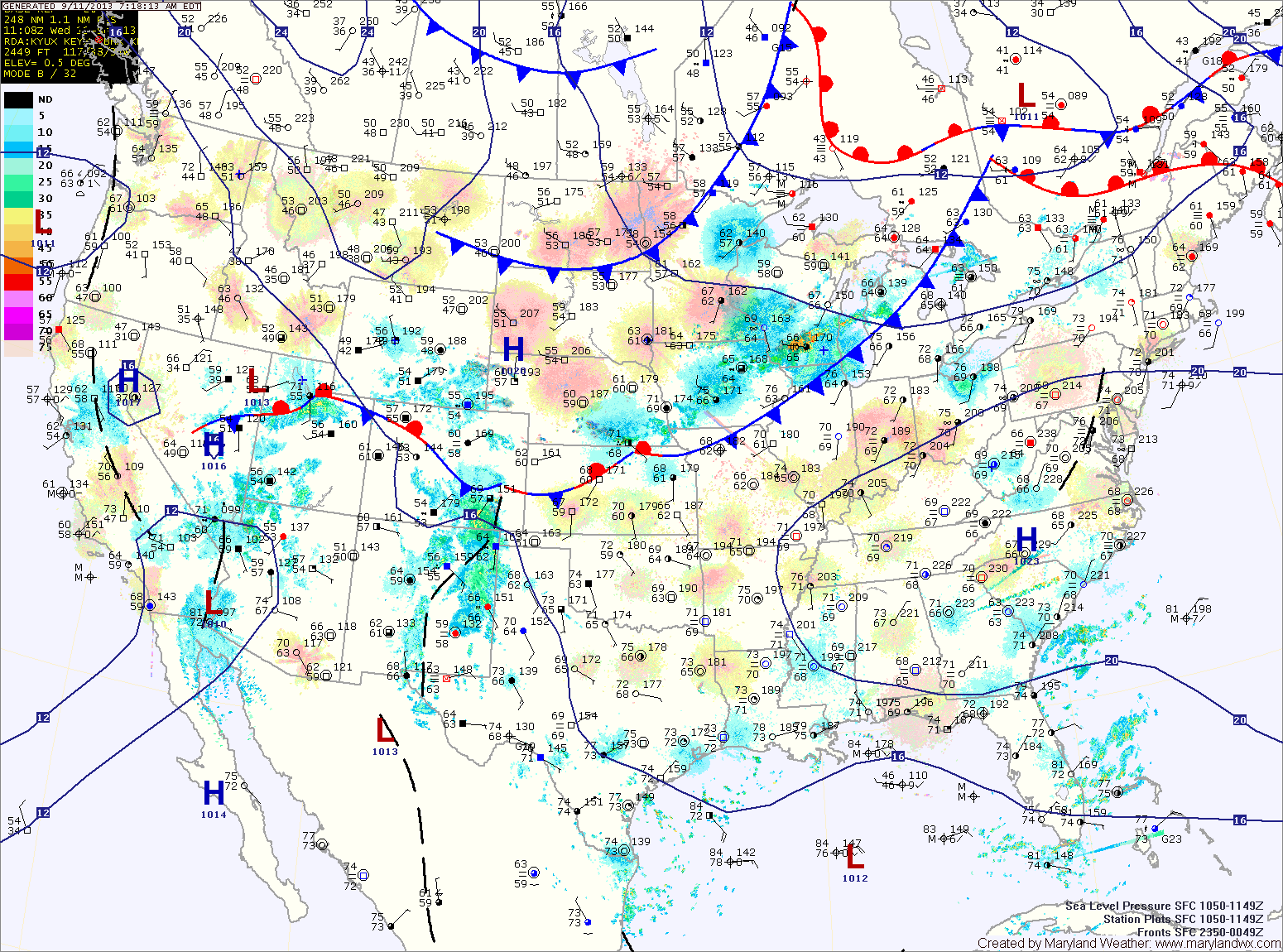
Current Surface MapAs a cold front slips through the state today, partly sunny skies will dominate the day with just a slight chance of an isolated afternoon thunderstorm. Highs will be in the mid 80s.
The cold front will usher in much drier air and set up a Thursday that will feature below normal temperatures. Highs will top out around 80 degrees with dew points in the 50s.
Clouds will still be prevalent on Friday, as an area of low pressure moves along the front, just off shore. The low should be far enough away to keep the area dry, despite the clouds. Highs will rebound a bit and push into the low to mid 80s.
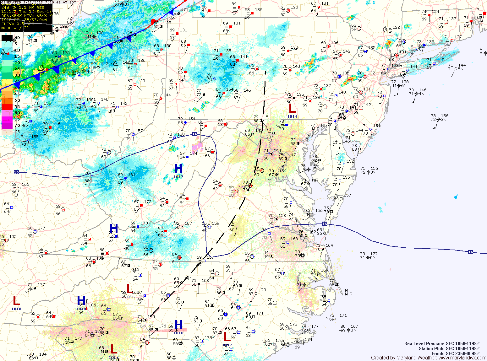
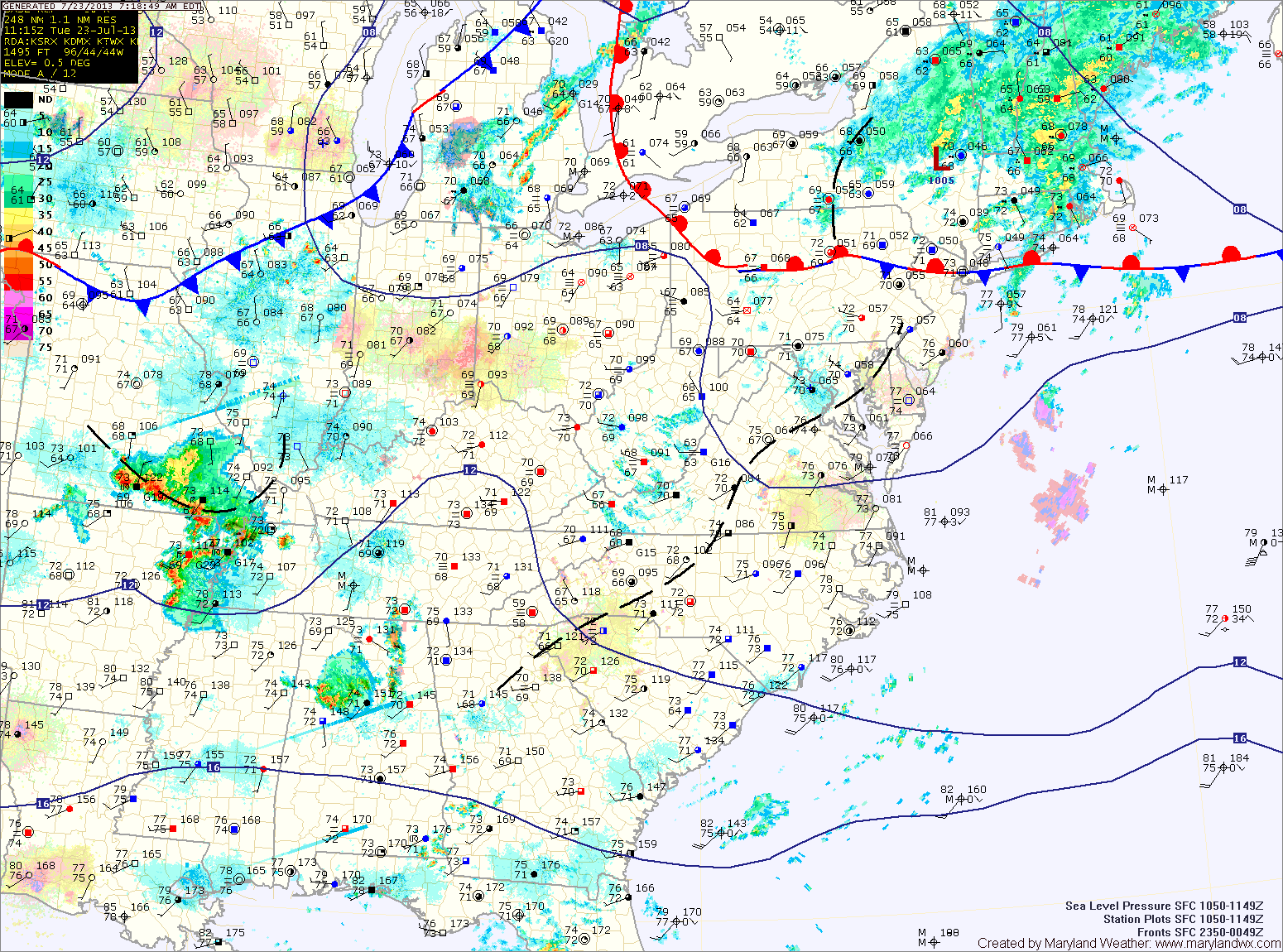
Current Surface MapToday will be much like yesterday with highs in the upper 80s and scattered afternoon and evening thunderstorms.
A cold front will push southward tomorrow bringing another slight chance of storms but also cooler and drier air for the remainder of the work week. Highs tomorrow will be in the mid 80s.
Thursday looks mostly sunny and dry, with low humidity and highs in the low 80s.
Friday will be similar to Thursday, mostly sunny with highs in the low to mid 80s.
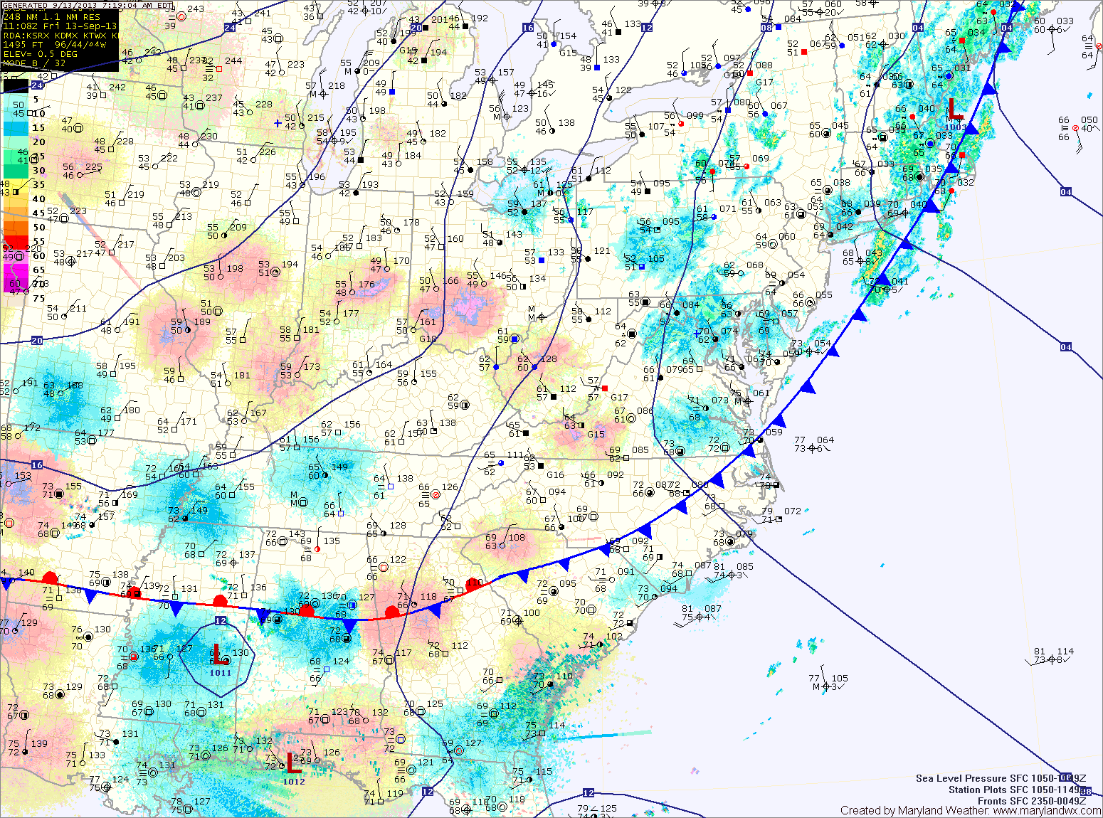
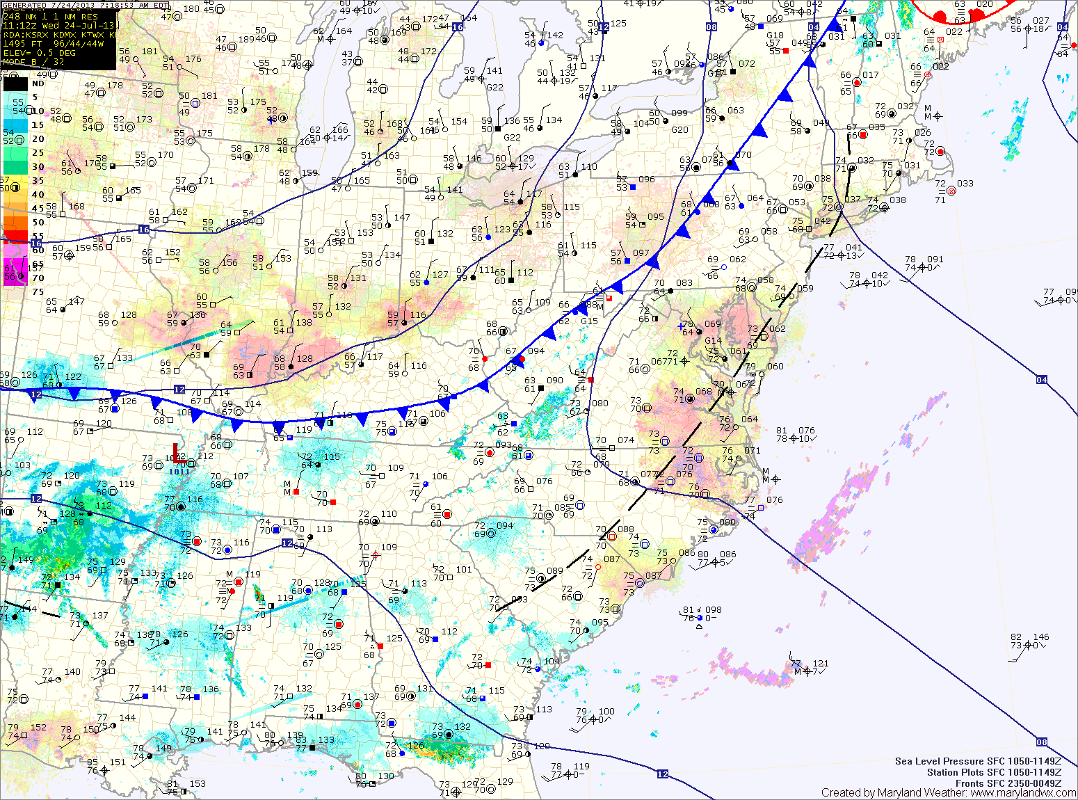
Current Surface MapThe cold front has pushed off the coast and much cooler and drier air has begun to move into the region.
Highs today will be in the upper 70s under mostly sunny skies.
It will remain mostly sunny tomorrow, with highs around 80 degrees.
Scattered showers and thunderstorms return to the forecast on Thursday, with rain chances increasing Thursday night and Friday. Highs on Thursday will be in the upper 70s to around 80.
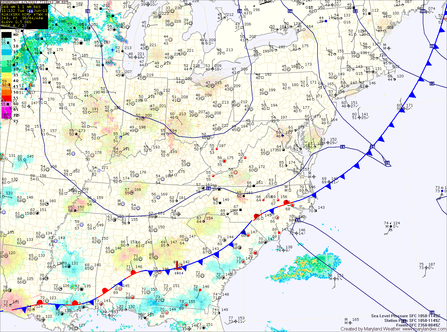
Current Surface MapHigh pressure will bring warm and humid conditions to the area as it builds in and then off the coast. Meanwhile, a cold front will approach from the west.
The combination of the two will kick off scattered showers and thunderstorms this afternoon and evening. Some of the storms may become severe with damaging winds, heavy rainfall and large hail, especially across western Maryland. Highs today will be in the low to mid 80s.
Thunderstorm activity will diminish tonight with the loss of daylight, but showers will remain possible through the overnight.
Current Surface MapDense fog will continue to lift this morning, leaving cloudy conditions. As we warm this afternoon, scattered showers and thunderstorms will develop again. Some of the storms could produce locally heavy rainfall. Highs today will push into the mid to upper 70s.
High pressure builds in tonight and into tomorrow, before the next weather maker begins to affect us tomorrow afternoon. A cold front to the west will provide forcing to help shower and thunderstorm development during the afternoon and evening. Some of the storms could become strong to severe with gusty winds and hail. Highs tomorrow will push into the 80s.
The shower and storm threat will continue Friday night and Saturday as the front continues to march into the area. The storms Saturday afternoon and evening could once again turn severe. Highs will be in the mid to upper 70s.
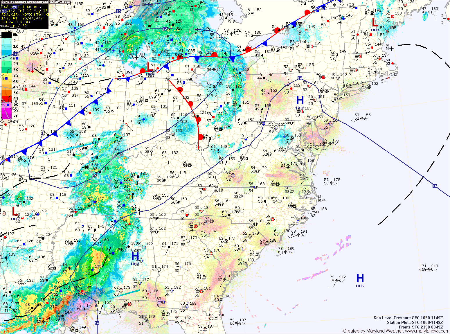
Current Surface MapAn area of low pressure remains to our south as it slowly moves northeastward. Expect showers and possibly thunderstorms to redevelop as we move into the afternoon hours. The showers and storms will continue into tonight. Highs today will be in the upper 60s to low 70s.
The low will continue to move to the northeast, and slowly pull away from the area tomorrow. Shower chances will decrease through the day tomorrow, but isolated showers will be possible through the afternoon and evening. Highs will be in low to mid 70s.
As we get rid of one system, another will approach from the west in the form of a cold front. With warm and humid air in place, pop up showers and thunderstorms are possible Friday afternoon. Highs on Friday will be near 80 degrees.