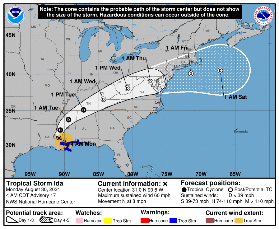
Remnants of Ida to Bring Flooding Rains to Our Area
Hurricane Ida made landfall in Louisiana yesterday as a Category 4 storm and has since moved inland and weakened to a tropical storm. The system will continue to weaken as…

Everything you need to know about the weather in Maryland
The Vane has two good articles that I recommend reading that outlined what happened as well as the results with pictures from around the area.
The cold front responsible for the heavy rainfall and flooding has pushed east of the state, ushering in drier air. Expect mostly sunny skies today and highs in the low 80s.
The front will push through later tonight, bringing an end to the rainfall.
Behind the front, expect decreasing clouds and slightly drier air tomorrow. Expect highs in the mid to upper 80s.
Temperatures will remain in the mid to upper 80s Friday and through the weekend. Isolated thunderstorms are possible Saturday and Sunday afternoon. Fairly typical weather for June in the mid-atlantic.