
Good morning! There’s quite a bit to get through this morning as Isaias continues to move up the coast, towards our area.
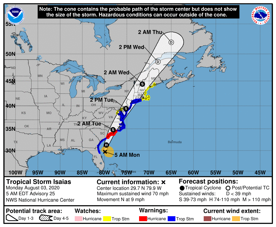
First, the latest track from the NOAA NWS National Hurricane Center has Isaias as a strong tropical storm, with 70 mph winds, moving North at 9 mph. Some slight strengthening to hurricane strength is expected before it makes landfall in the Carolinas tonight. The storm will weaken to a tropical storm after landfall, and then move into our area tomorrow morning.
Heavy rainfall will move into our area tonight and last through most of the day tomorrow. A Flash Flood Watch is in effect for most of the state. Rainfall totals of 4-6″+ are expected, with the highest amounts along the I-95 corridor.
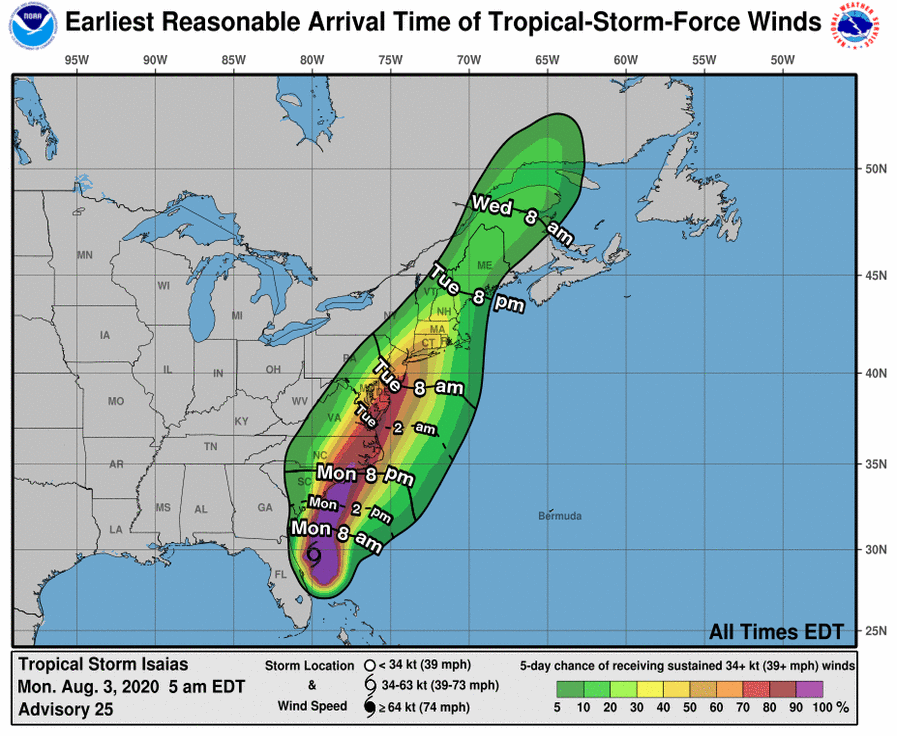
Winds associated with the system will begin to impact our area early tomorrow morning. The greatest chances of Tropical Storm force winds will be across southern Maryland and across the Eastern Shore. These areas are now under a Tropical Storm Warning, while the I-95 corridor remains under a Tropical Storm Watch.

Take some time today to prepare for the impacts from this system. Gusty winds may bring down trees and power lines, and very heavy rainfall will likely flood low lying areas, as well as local waterways.