
Summary: A strong area of low pressure will track over our area tomorrow into Sunday. Behind the system, Arctic air will flow into the system on gusty northwest winds.
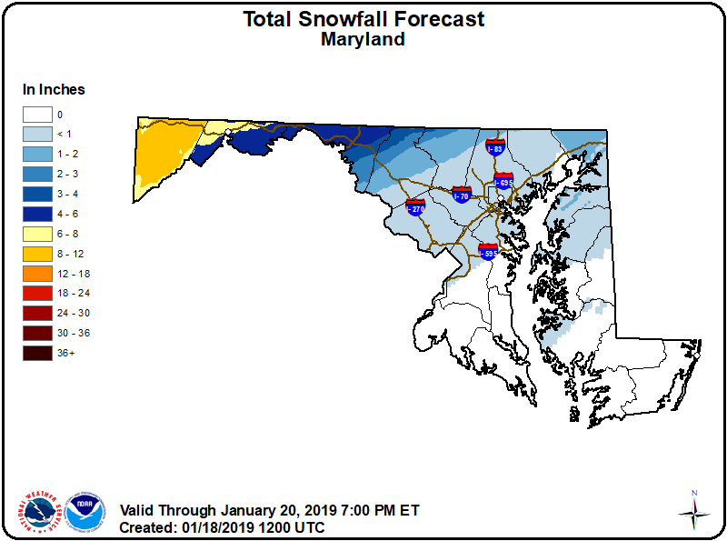
Precipitation will overspread the state from west to east during the late morning or early afternoon hours. With cold air in place at the onset, most areas will see light snow or a wintry mix.
For areas along and south and east of I-95, the wintry mix should changeover to plain rain by Saturday night. The rain will become heavy at times, with over an inch of rainfall expected by Sunday morning. Heavy rainfall, combined with remnant snowpack could lead to some flooding issues Sunday.
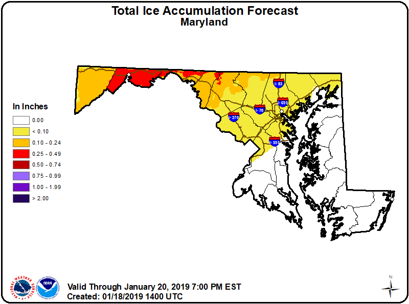
Further north and west, the colder air will hang around longer, as it tends to do. Areas north and west of I-95 (especially west of the Blue Ridge) will see a longer period of frozen precipitation, with several inches of snow likely in the mountains before transitioning a wintry mix. Some areas of the mountains may not go above freezing for the duration of the event, leading to localized significant ice accumulations.
Here is the National Weather Service snow and ice accumulation forecast:
The system will move to our north on Sunday and very cold arctic air will flow into the region. Temperatures will plummet Sunday afternoon and evening, falling into the single digits to low 10s by Monday morning, with windchills well below zero.
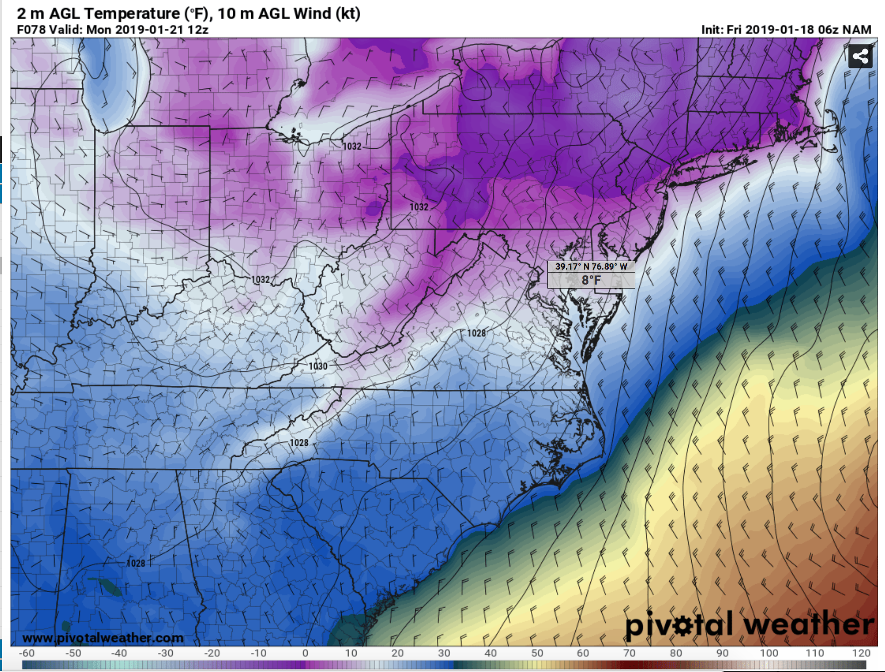
Temperatures will struggle to reach the teens and 20s on Monday, but will begin to moderate on Tuesday and Wednesday as high pressure moves off the coast.
Want the latest blog posts emailed to you?