Cold Again Today; Light Snow Tonight, again Friday

Current Surface Map
Current Surface Map
After a Tuesday in which we didn’t break the mid 20s, a cold Wednesday will follow. Expect similar temperatures to yesterday, with less wind. Highs today will be in the mid 20s.

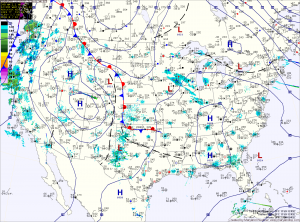
A weak Alberta Clipper will move through tonight, bringing a chance of light snow to the area. Overnight accumulations of a dusting to possibly an inch in spots is possible.

The clipper moves out tomorrow, giving way to mostly sunny skies with highs in the upper 20s to around 30.

Clouds increase again on Friday ahead of the next storm system that looks to bring light snow to the area Friday afternoon into Friday night. Highs Friday wil be in the upper 20s.

Sunny today, slight chance of rain/snow tomorrow

Current Weather Map
High pressure remains in control today, providing sunny skies and highs in the low to mid 40s. The high will move off the coast tonight as an area of low pressure moves in from the west. This system will bring a chance of light precipitation tomorrow. Light rain or snow showers are possible in the morning, but as we warm up to near 50, only rain showers are expected in the afternoon.

Light rain/snow tonight and tomorrow

Current weather map
A cold front will approach the state tonight, while a low pressure system currently over the south interacts with the front and redevelops off the south east coast. The low will track northeast, off the coast but will be close enough to bring light rain and snow to the area tonight and tomorrow. Expect light rain to develop across the state tonight, transitioning to snow from west to east as the night progresses. The rain/snow will continue through the day tomorrow, before ending tomorrow evening. An inch or two of snow is possible in the mountains, elsewhere, little to no accumulation is expected.

Light snow today

Current weather map
A weak area of low pressure is currently moving across the Ohio Valley and will bring precipitation to the state today. Currently, it looks as though areas south and east of I-95 will start out as rain and transition to snow during the afternoon and evening. In this area, expect a slushy half inch or so, mainly on grassy surfaces.

To the north and west of I-95, the precip will be primarily snow. These areas are currently under a Winter Weather Advisory for 1-2 inches of snow. Far western Maryland and areas along the Mason-Dixon line may see a little more.

Light rain and snow tomorrow

Current weather map
Following a sunny day today, a weak area of low pressure currently over Kansas will move eastward and pass just to the south of the state. This system will bring light precipitation to the state late tomorrow morning through tomorrow evening. At this time, it looks like temperatures will be cold enough for all snow in Western and Northern Maryland, while a light rain/snow mix is likely for Central and Southern Maryland, including the Baltimore/Washington metro areas.