A Winter Weather Advisory has been issued for: Dorchester, the Maryland Beaches, Somerset, St. Mary's, Wicomico and Worcester counties. A weak cold front will pass through today and high pressure…
After a very cold morning, with a low of 10.7 here in Millersville, temperatures will rebound into the mid 30s this afternoon as high pressure builds into the region. The…
A Winter Weather Advisory has been issued for Garrett county. A Wind Advisory has been issued for the entire state, except Garrett county. Low pressure continues to move eastward and…
High pressure will build into the region today, resulting in dry conditions and near normal temperatures. Expect highs to be in the low to mid 40s under partly sunny skies.…
An area of low pressure is moving by to our south, spreading rain showers into our area. Temperatures are generally near or slightly above freezing. There are still areas below…
Another cold front will pass through today, reinforcing the cold air that has been in place this week. Ahead of the front a band of light snow has broken out…
Current Surface MapA WINTER WEATHER ADVISORY is in effect for all of Maryland except for Cecil and the far western counties.
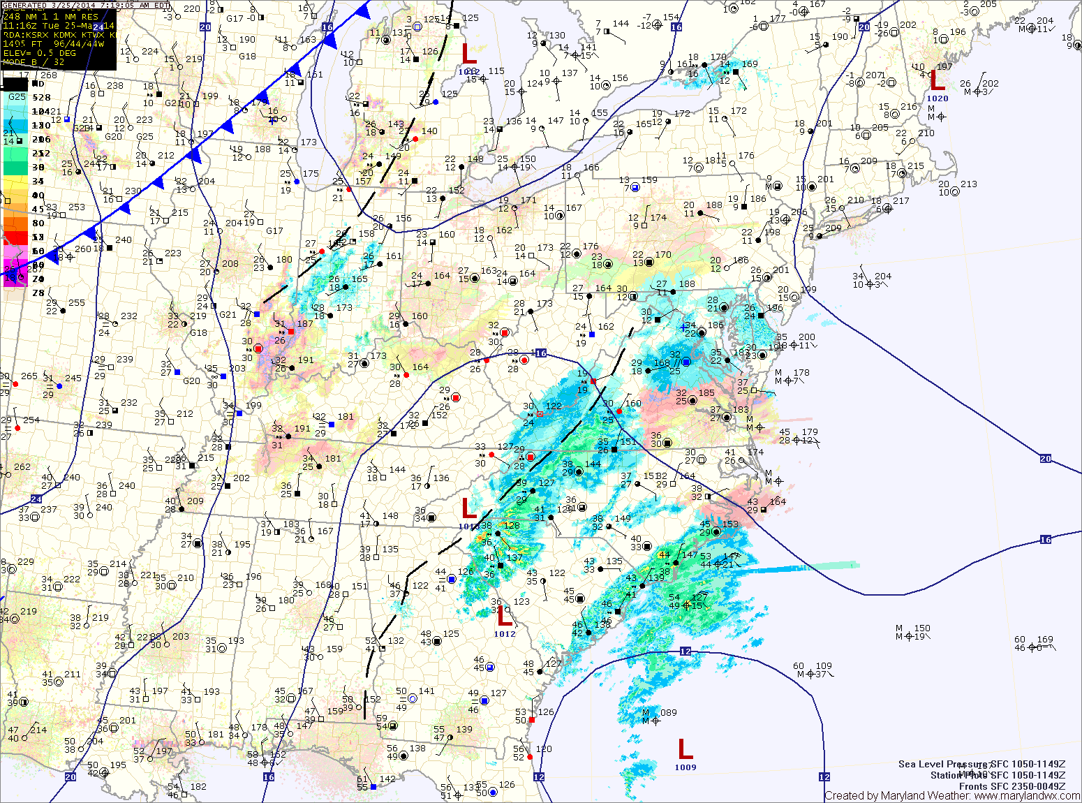
An area of low pressure developing off the southeast coast will continue to move northward while rapidly intensifying. Light snow has started to move into the area this morning and will continue this afternoon and into the evening.
The snow may be moderate at times, but accumulations will be minimal due to the late March sun angle and relatively warm surface. Expect an inch or two to accumulate, mainly on grassy surfaces. Highs today will reach the mid 30s.
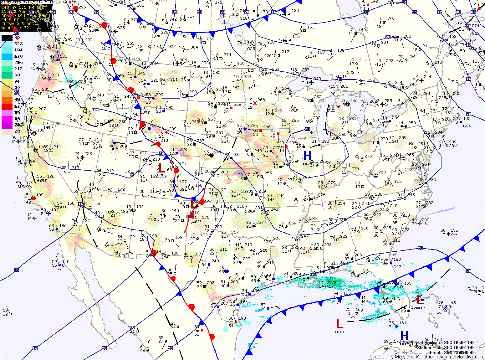
Current Surface MapHigh pressure will build into the region today, allowing for ample sunshine but also bringing colder air. Highs today will only top out around 40 degrees.
The high pressure will be replaced tomorrow as two pieces of energy phase off the Carolina coast and rapidly develop into a strong coastal storm. The storm will develop off the coast and will not impact the area.
However, as the two pieces of energy come together over our area, light precipitation is expected. It should be cold enough for mostly snow, but rain may mix in, especially along and east of I-95.
Any snow that falls will have an extremely tough time accumulating. Expect a coating to possibly a slushy inch, mainly on elevated surfaces and grassy areas. Highs tomorrow will be in the mid 30s.
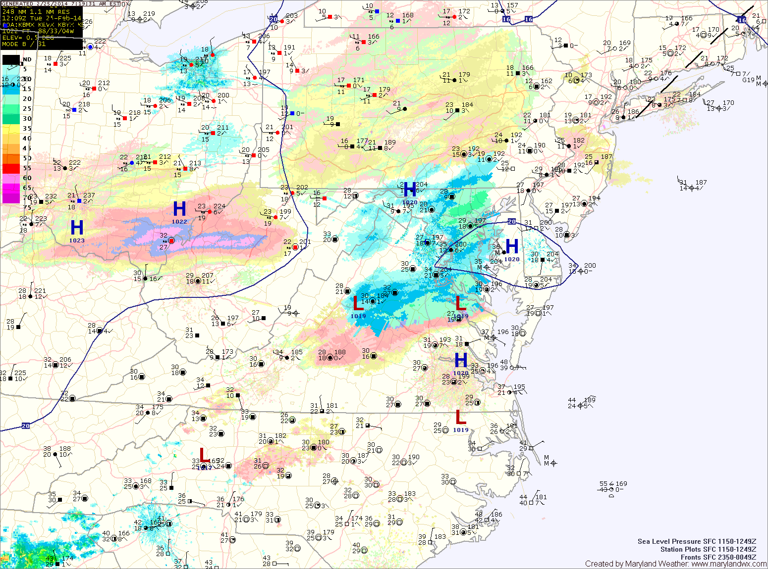
Current Surface MapAn upper level disturbance is bringing areas of light snow and flurries to the area this morning.
The snow will continue into the afternoon before tapering off. A dusting to perhaps a half inch of accumulation is possible this morning before the sun returns and temperatures warm into the mid to upper 30s.
Another disturbance will move through tonight into tomorrow, bringing another round of light snow lasting through tomorrow morning. Another half inch is possible from this system, most if not all of which will melt by tomorrow afternoon. It will also be windy and afternoon highs will be in the low to mid 30s.
Much colder air moves in tomorrow night, dropping lows into the upper teens to around 20.
Current Surface MapHigh pressure will control the weather today. Expect mostly sunny skies with highs in the low 30s.
An area of low pressure will move by to our northwest tonight, spreading light precipitation into our area later tonight. The bulk of this precip should be snow, but it may mix with or change to sleet by tomorrow morning. A general 1-2″ of snow is possible, with the highest amounts across the northern part of the state.
The snow/mix will end by mid-morning tomorrow. Skies should quickly clear and temperatures will rise into the mid to upper 40s.
Another system will slide by to our south on Wednesday. At this time, it looks to be far enough south to leave our area dry. It will be warmer, with highs will be in the low 50s under partly sunny skies.