Drier and Breezy Today; More Showers Likely Tomorrow
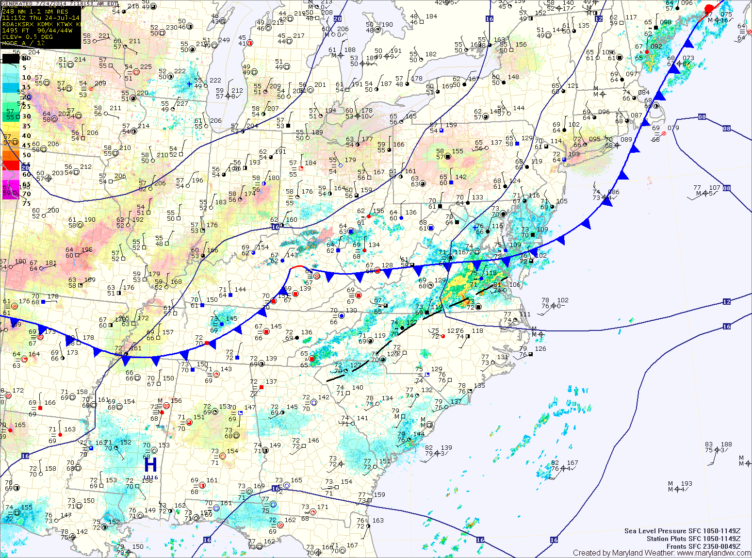
The cold front that brought showers and storms to the state yesterday and through the night is now pushing off of the coast. In its wake, drier air will move…

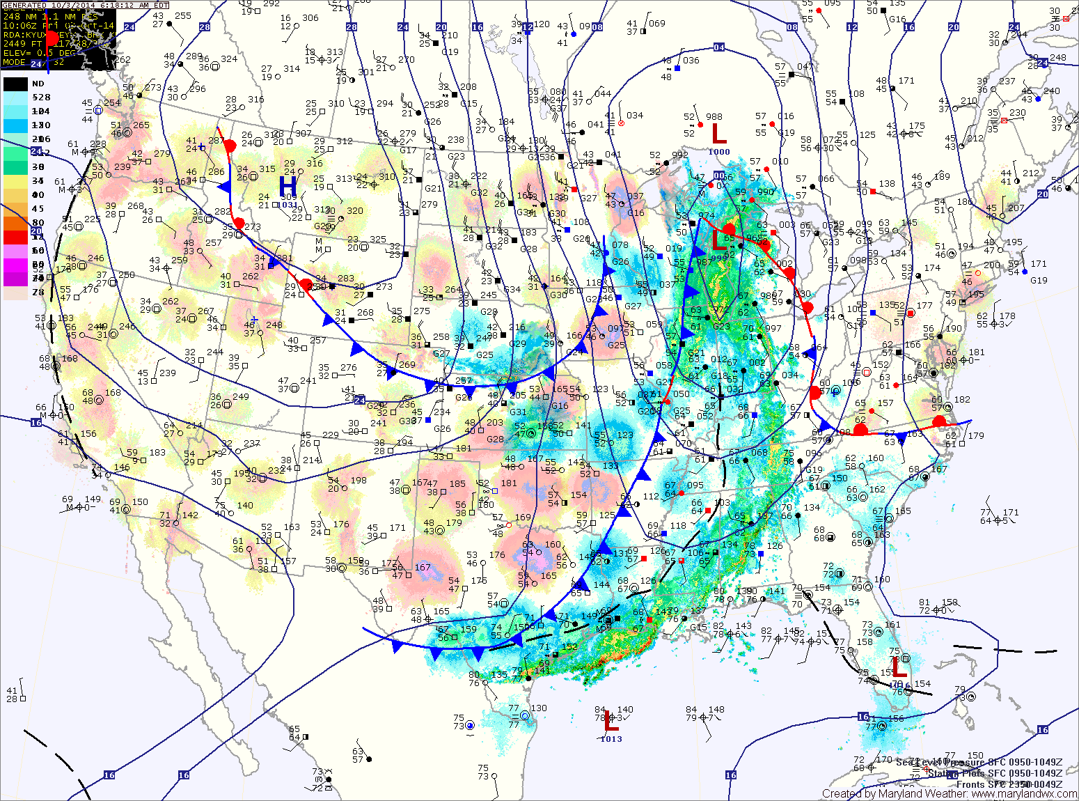
Today, ahead of the front, it will become breezy. Expect more clouds than sun and highs in the low to mid 70s.
Showers will move in from west to east this evening, reaching central Maryland after dark.
The rain will taper off from west to east during the morning hours tomorrow. Skies will partially clear as cooler and drier air move in on gusty northwest winds. Highs will top out in the mid to upper 60s.
Highs today will be in the low 70s under mostly sunny skies.
Tomorrow will be sunny with highs around 70.
Wednesday will be mostly sunny with highs in the low 70s.
An area of low pressure may form off of the Carolina coastline Thursday into Friday. This low may bring showers to the state during that timeframe.
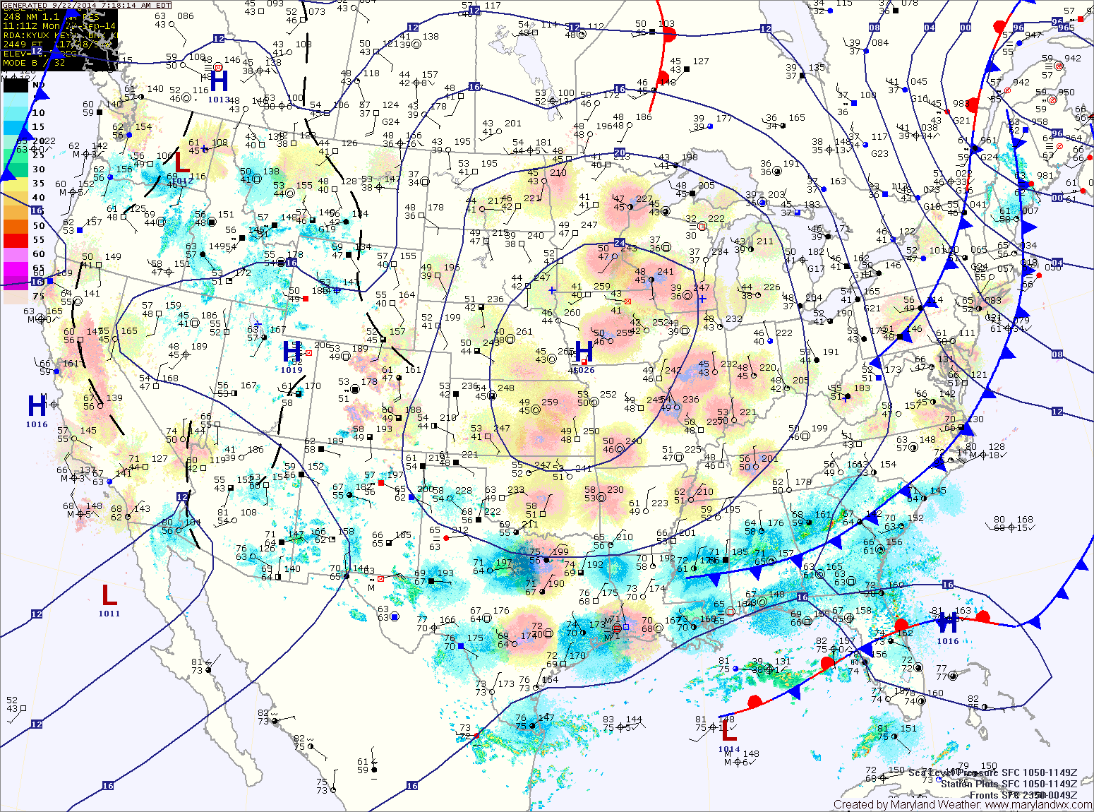
Expect more of the same tomorrow with highs once again reach the mid 80s under mostly sunny skies. Clouds will increase during the evening and into the overnight as an area of low pressure moves towards the area.
The low pressure will move west to east, just south of the state Saturday into Sunday. At this time, it appears light showers may affect most of the state Saturday. The low will continue to move eastward Saturday night into Sunday.
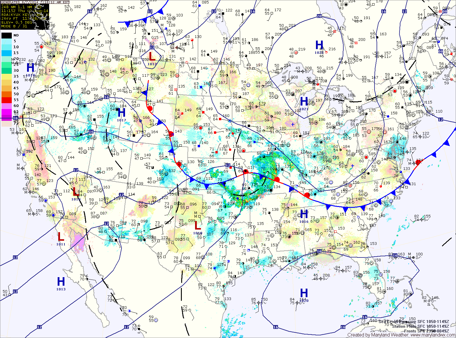
The front will push south of the area tonight and high pressure will begin to build into the region. Expect cooler and drier air to move in tonight and provide for a nice day tomorrow. Highs will be in the low 80s with low humidity under mostly sunny skies.
The high pressure will remain in control Friday, providing another day of mostly sunny skies and highs in the low to mid 80s.
An area of low pressure will form and move by to our south on Saturday. As a result, there will be more clouds and showers and thunderstorms will be possible, especially across the southern portion of the state. Highs will be in the low 80s.
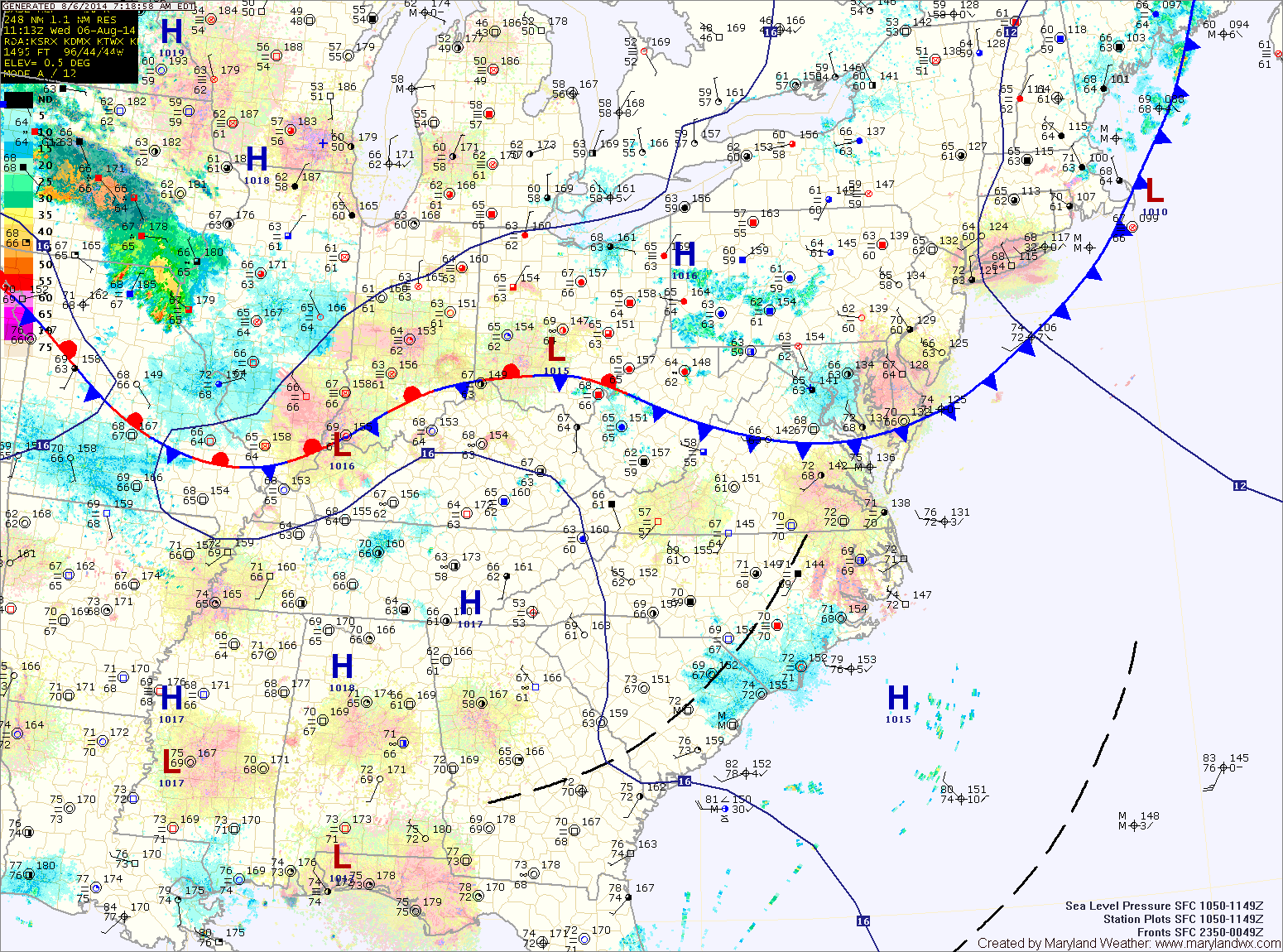
High pressure will build into the area tomorrow, leading to a nice day with highs in the low 80s, lower humidity and mostly sunny skies.
The high will shift off of the coast tomorrow night into Saturday. As a result warmer and more humid air will return. Highs on Saturday will be around 90 with a slight chance of an afternoon thunderstorm.