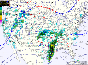
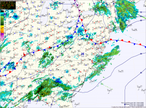
Wintry Mix Transitioning to Rain

Current Surface Map
Current Surface Map
Areas of sleet and freezing rain will continue to change to plain rain as we move through this morning. Temperatures across Central Maryland are around freezing at this time and will continue to rise. North and west of the cities, temperatures are a bit colder and will take a little longer to warm up.

All areas east of the mountains should be safely above freezing by noon.

Shower chances will continue this afternoon and into tonight.

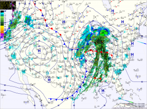
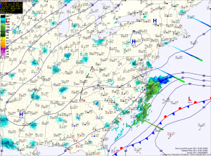
Tomorrow we will be between storm systems as a warm front slowly pushes north of the state. Temperatures will warm into the low 50s under partly sunny skies.

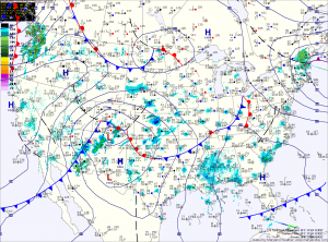
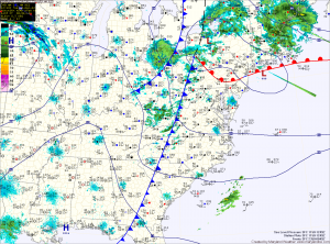
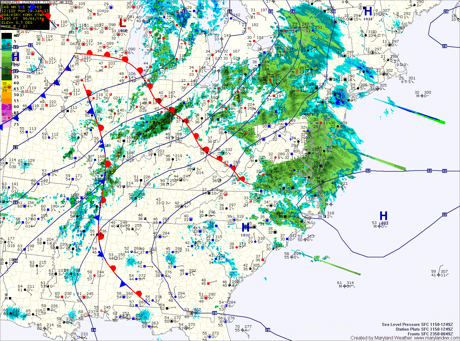
A strong cold front will approach on Wednesday. Out ahead of it, temperatures will approach 60 degrees in most areas. The front will bring rain and even thunderstorms to the area Wednesday into Wednesday night. Some of the storms could be strong to severe, with damaging winds the main threat.

Heavy Snow South

Current Surface Map
Current Surface Map
As mentioned yesterday, the low pressure that will bring snow to the area today and tonight will have a sharp dropoff of precipitation on the northern edge. As such, some areas will see flurries while others receive several inches of snow over a relatively short distance.

It appears that dividing line will setup across central Maryland today. Areas north of Baltimore will see little to no accumulation while in the counties to the south of the city, a Winter Weather Advisory is in effect for 1-3 inches of snow with the highest amounts the further south you go.

Continued Mild; Chance of Showers Tomorrow

Current Surface Map
Current Surface Map
Today will be partly sunny with highs in the low 50s.

An area of low pressure will bring a chance of showers late tomorrow into tomorrow night. Highs will be in the low 50s.

Warmer conditions are expected this weekend with highs on Saturday around 60 and well into the 60s on Sunday.

A series of low pressure systems and associated cold fronts will move through the region early next week.

Currently, rain appears likely Monday with another round on Tuesday.

Strong Cold Front Brings Rain and Wind

Current Surface Map
Current Surface Map
An intense area of low pressure continues to strengthen over the midwest while it drags a cold front across the country. The front will approach the area this afternoon spreading rain into the area by sunset.

The rain will be heavy at times, accompanied with strong gusty winds. A thunderstorm is possible during the overnight as well.

Winter begins at 6:12 tomorrow morning and the front will be pushing through around that time. Expect wind gusts to near 40mph tomorrow, as temperatures fall from the low 40s into the 30s during the day.

Sunny Today; Cold Front Passes Tomorrow Night

Current Surface Map
Current Surface Map
High pressure will control the weather today, providing sunny skies. It will be breezy, with highs in the mid 50s.

A strong storm system that will bring heavy snow to the midwest will begin to spread clouds into our area tonight. The clouds will thicken tomorrow as the storm brings a strong cold front through the region.

Rain will develop out ahead of the front and will spread into the area during the late afternoon. Highs will be in the mid to upper 40s.

The rain will continue tomorrow night and into Friday morning. In the mountains of far Western Maryland, it will be cold enough for snow. Winter Storm Watches have been issued for Garrett and Allegany counties where near blizzard conditions are expected into Saturday.

Decreasing Clouds; Cold Front Thursday Night

Current Surface Map
Current Surface Map
The system that brought the showers and foggy conditions to area continues to move away.

A cold front will push through this morning, clearing the leftover clouds and sprinkles. Highs today will be in the mid 50s.

Tomorrow will feature sunny skies as high pressure builds overhead. Highs will be in the ow 50s.

Clouds will increase on Thursday as a strong cold front approaches from the west. Showers associated with the front will move in late in the day and last through the overnight.

Showers Redevelop Today

Current Surface Map
Current Surface Map
After a foggy start to the day, another round of showers will develop this afternoon and last into tomorrow morning as another area of low pressure moves through the region.

Highs today will push into the mid 50s.

Showers will continue tonight and last through the morning tomorrow followed by partial clearing. Highs will be in the mid to upper 50s.

Wednesday looks to be the nicest day of the week, with mostly sunny skies and highs in the low 50s.

A strong cold front will approach on Thursday, spreading clouds and eventually showers into the area during the day. Highs will be in the low 50s.

Sunny Today and Tomorrow; Rain Chances Increase this Weekend

Current Surface Map
Current Surface Map
Today and tomorrow will feature plenty of sunshine and near normal temperatures.

Highs today will be in the mid to upper 40s, warming into the low 50s tomorrow.

Saturday will be a transition day with clouds increasing through the day. Highs will be in the low 50s.

As an area of low pressure moves into the region, there is a slight chance of showers Saturday night and a better chance on Sunday. Highs will be around 50.

Foggy Start; Cold Front Passes Tonight

Current Surface Map
Light easterly flow has brought moisture into the area resulting in locally dense fog this morning. The fog will gradually clear as a warm front moves through the area this afternoon. Meanwhile, a cold front will continue to move towards the area from the west.

These two features will allow showers to develop this afternoon and into tonight. Highs today will push into the mid 60s ahead of the front.

The front clears the area late tonight, bringing an end to the showers.

Scattered Showers Through the Weekend

Current Surface Map
Warmer air moving in aloft combined with a light easterly flow at the surface has developed showers over most of the state today. Scattered showers are expected to continue through the day. Highs will be around 50 degrees.

Rain chances continue tonight and into tomorrow morning before moving northward and out of the area. Clouds will slowly decrease tomorrow afternoon as temperatures push into the low 60s.

During the overnight Saturday, a backdoor cold front will push into the region bringing another round of clouds and showers for Sunday. Highs will be in the low to mid 50s.