
Two relatively weak waves of low pressure riding along a stationary boundary to our south will bring periods of wintry precipitation to our area tomorrow evening into Friday. With cold air in place, and a strong high pressure to our north, most, if not all of the precipitation should fall as light snow. Snow should overspread the state from west to east during the late afternoon or early evening hours tomorrow, with periods of light snow lasting overnight, and winding down during the morning hours on Thursday.
There will then likely be a lull, as the second wave moves towards the area. The second round of steadier snowfall should move in Thursday evening, and last through the overnight into Friday morning.
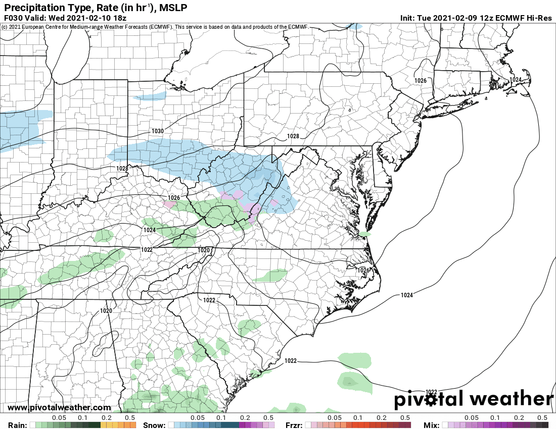
Here is today’s 12z run of the European model, depicting the timing of the snowfall, entering the state tomorrow evening and ending Friday morning:
For several runs yesterday, the European model focused both waves in the same general location, with higher moisture content. This led to the possibility of a total snowfall of 6-12+ inches for most areas. Today, the general consensus is that there will be less moisture, and the focus of each wave of low pressure will affect slightly different areas. Additionally, the European is trending south with the heaviest precipitation, due to the strength of the cold high pressure to our north.
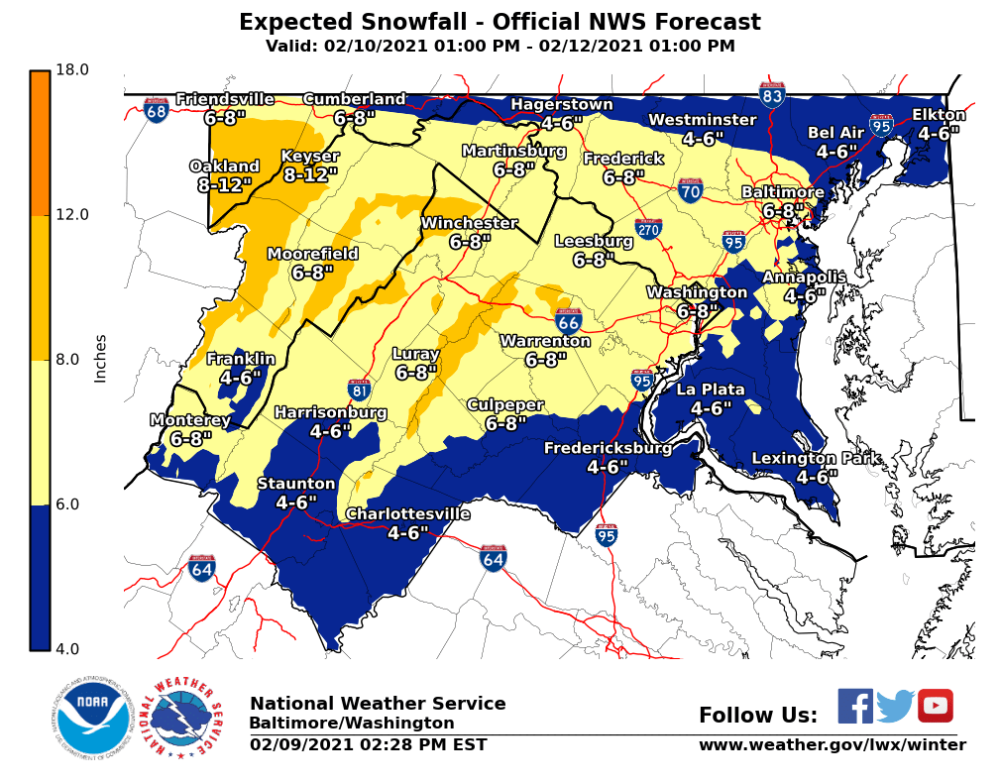
As a result, overall snowfall totals are looking a little lower across the board for our area, with the heaviest axis of precipitation trending to our south. This trend could continue this evening, pushing the heaviest precip even further south, reducing snowfall totals again, but event totals still point to a moderate snowfall for most areas as illustrated by the NWS:
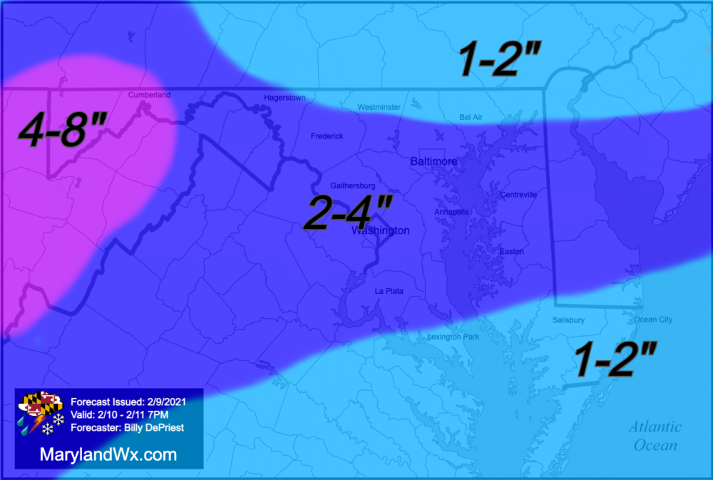
Meanwhile, here is my first call for snowfall for the first wave, from tomorrow evening through 7PM Thursday:
Another round of snowfall will fall after this time, and I’ll have an updated forecast for the second round tomorrow afternoon.