
As cold air settles in over the Eastern US, two waves of low pressure will likely bring a prolonged period of wintry precipitation to our area Wednesday through early Friday. It is too early to determine precipitation type, and how much snow will fall (especially given the recent model struggles), but trends are colder, and confidence is growing that we will see another round measurable snowfall over the latter half of this week.
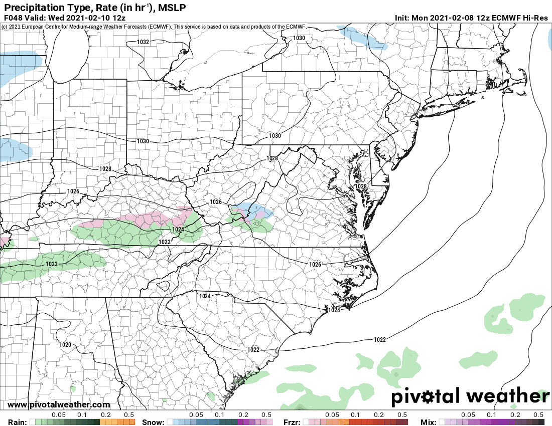
To give a sense of the setup and timing, here is today’s European model output:
Zoomed in to our area:
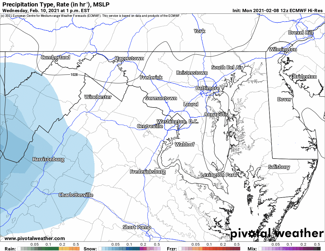
This solution brings light snow into the area Wednesday evening, with snow continuing, moderate at times into Thursday with a period of lighter snow late Thursday, picking up again in intensity Thursday night through Friday morning as the second wave of low pressure moves through. In this scenario, our temperatures remain cold, with temperatures remaining below freezing for most of the state throughout the duration of the event. This would result in a fairly significant snowfall for our area, with widespread amounts over 6 inches:
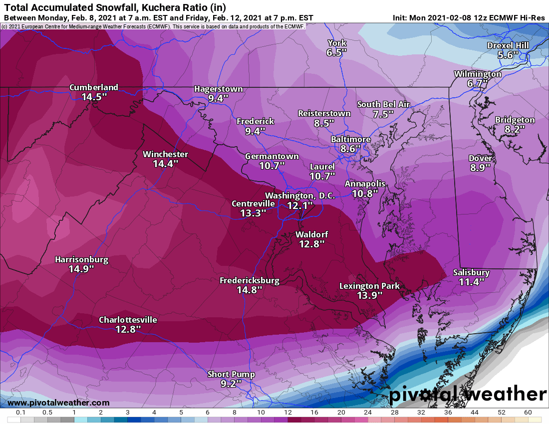
Please remember, this is *not* a forecast, and is simply the output from one run of one model. The reason I show this is to provide some context and to set expectations for the possible severity of the event.
I’ll have much more information on this threat tomorrow, including my first call snow forecast.