
Here is my updated forecast for the first wave of snowfall that will move through our area tonight into tomorrow:
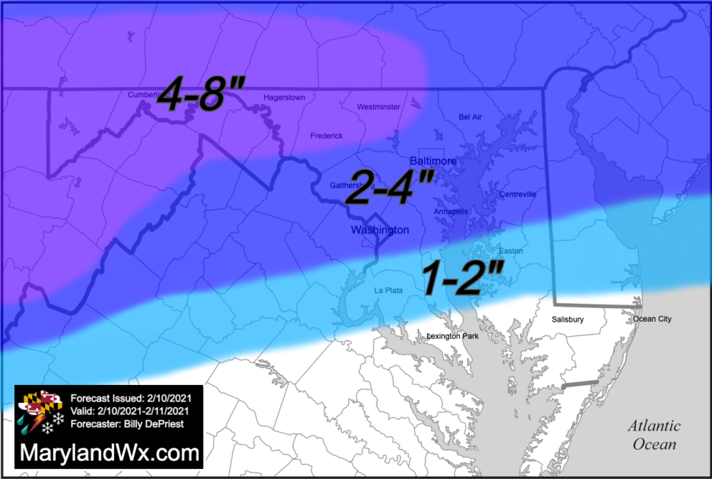
The latest trends have pushed this wave further north, bringing the highest totals north with it. Additionally, warmer air will advance further north as well, likely causing a mix of precipitation from DC and areas south and east. As a result, snow totals are likely to be minimal across southern Maryland from this wave, while further north, 2-4″ to 4-8″ are now expected.
Looking out a bit it now looks like the second wave will be suppressed well to our south, bringing minimal snowfall to our state. I’ll have an update on the potential impacts from that system tomorrow.