
The latest model data has come in a bit drier with less intense precipitation rates, which is problematic for two reasons: obviously less moisture means less precipitation overall, but also, with marginal surface temperatures, we need heavier snowfall for it to accumulate efficiently. Simply put, light snow like we saw last week won’t accumulate much, if at all, with surfaces temperatures above freezing, which will likely be the case for a lot of areas.
The other complicating factor is the likelihood of banding over our state. Under heavy bands, snow will accumulate quickly, but outside of those bands, rates will be much lighter and lead to much lower totals. Where those bands set up, totals will likely hit the upper end of my ranges, but outside of those bands, totals will likely be much lower, and on the lower end of my ranges.
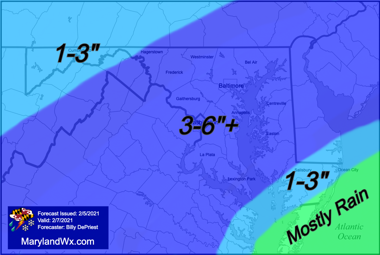
While I anticipate slightly lower totals, I don’t think it has changed enough to warrant any changes in my forecast. I still see 1-3 inches as likely for most areas, with 3 to perhaps 6 inches possible along and northwest of I-95, where heavier rates are most likely.
In terms of timing, the storm still looks like a quick hitter, with snow overspreading and beginning during the early morning hours, between 4-6AM for most, and winding down and ending by early afternoon.
Winter Storm Warnings and Winter Weather Advisories go into effect for most of the state late tonight.

After the snow winds down, temperatures will likely rise into the mid to upper 30s, before plummeting tomorrow night. Lows will range from the single digits in the mountains to upper teens to around 20 elsewhere.