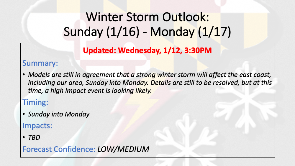
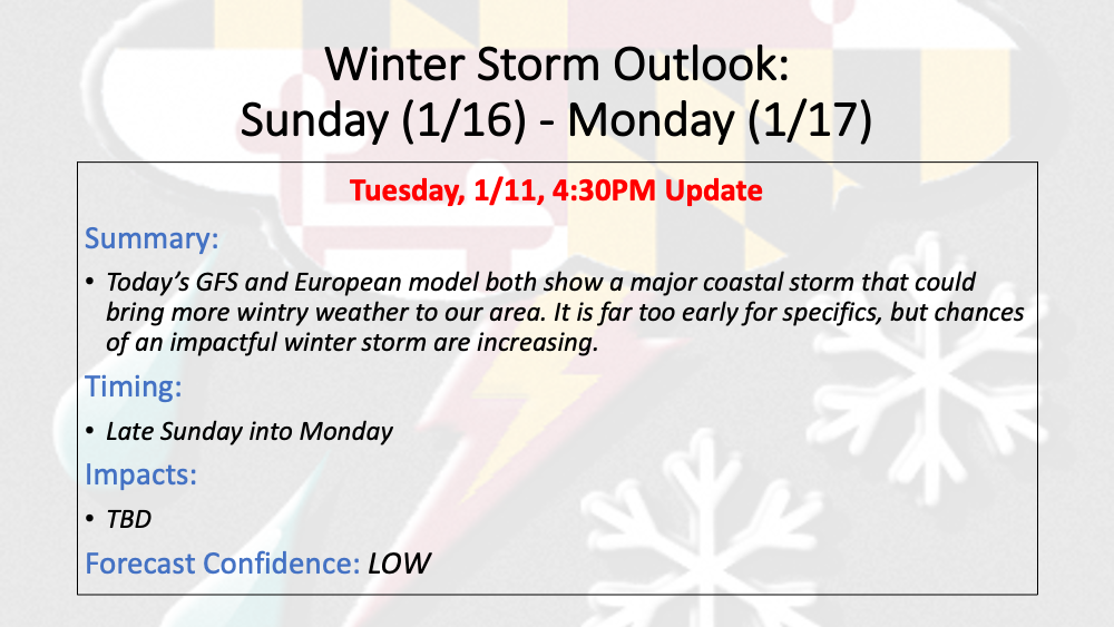
1/12 Update: 1/16-1/17 Winter Storm Outlook
12z European Model Depiction of the System Today's 12z European model run shows snow moving into the state Sunday afternoon/evening and becoming heavy. The snow then mixes and changes over…

As cold air settles in over the Eastern US, two waves of low pressure will likely bring a prolonged period of wintry precipitation to our area Wednesday through early Friday. It is too early to determine precipitation type, and how much snow will fall (especially given the recent model struggles), but trends are colder, and confidence is growing that we will see another round measurable snowfall over the latter half of this week.