
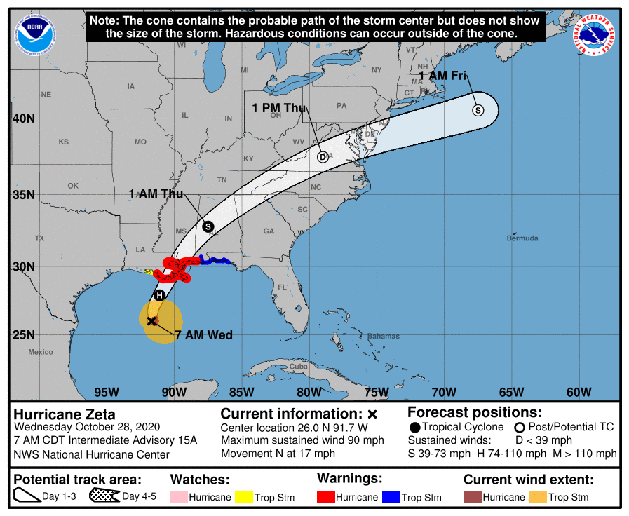
Hurricane Zeta, currently in the northern Gulf of Mexico, is expected to make landfall later today in Louisiana, as a Category 2 storm with winds near 100 mph. The storm will quickly move northeastward, and interact with an upper level low over the deep south, spreading rainfall up into our area tonight into tomorrow morning.
Rainfall, heavy at times will continue through the day tomorrow. Winds will also increase as the remnants move through, gusting to 15-20 mph at times.
The larger upper level low will bring a cold front through on Friday, as surface low pressure develops and intensifies off the coast. As a result, our rain should come to an end, but northwest winds will turn gusty during the afternoon, before calming Friday night.
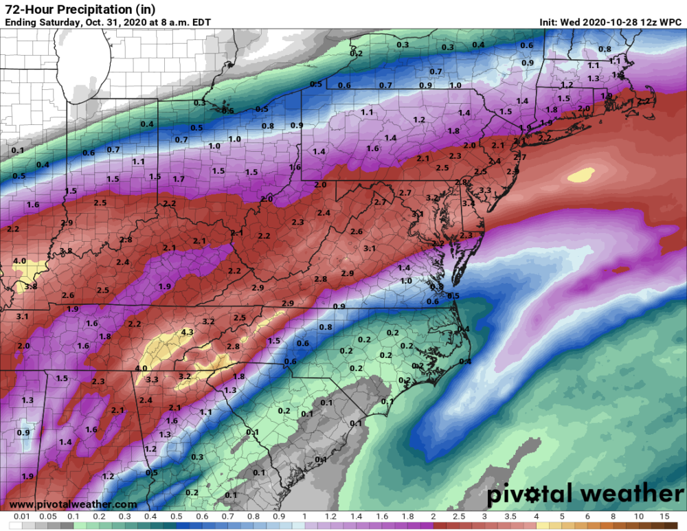
When all is said and done, 2-3″ of rainfall are likely across the state.
The coldest air of the season thus far is expected to settle in this weekend. After highs in the upper 40s to low 50s on Friday, lows Friday night/Saturday morning will range from the low to mid 20s in the mountains, to mid 30s along and east of I-95. Frost advisories and freeze warnings will likely be issued for this timeframe.
Saturday will be sunny but cold, with highs likely topping out in the 40s.