
A cold front and gusty northwest winds have brought a cold air mass into our region, setting the stage for some wintry weather tomorrow.
A strong storm system will move by to our northwest tomorrow, putting us on the warm side of the system. Initially, it will be cold enough at all levels of the atmosphere to support a period of snowfall during the morning hours tomorrow. Generally, an inch or less of snow is likely as this band of snow moves through.
After it moves through, we will likely see a break into the afternoon, before another round of precipitation moves in. By this time, the atmosphere will have warmed, and mostly rain is expected. There is the possibility that it may start as a wintry mix, with light ice accumulation, especially north and west of I-95, but the majority of the precip will fall as rain during the afternoon and evening hours.
We should begin clearing our during the late evening hours as the system pulls away.
Here is the HRRR model output, for 1AM through 7PM, showing the approximate timing of the precipitation:
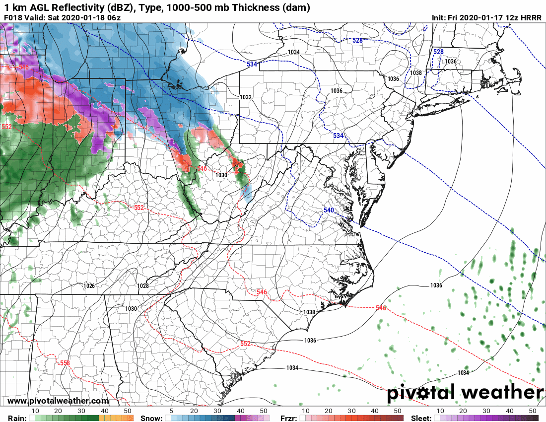
The most likely time for snow will be between 7AM and 12PM, with the second round most likely from 1PM to 7PM.
This will be a minor event, with minimal impact, but there could be slick spots tomorrow with the initial snow and possible sleet/freezing rain during the early afternoon.