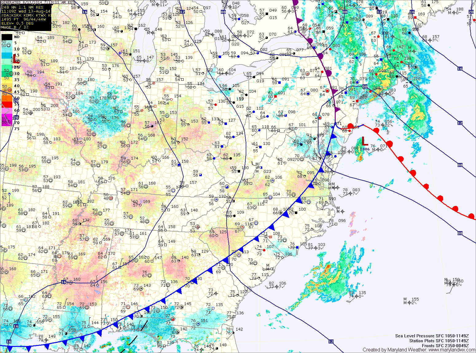
**A FLASH FLOOD WATCH has been issued for: Anne Arundel, Baltimore, Baltimore City, Carroll, Cecil, Frederick, Harford, Howard, Montgomery and Prince George's counties.** A cold front is moving into the…
Several areas of low pressure will bring rain to our area through Wednesday. High pressure will return to end the week, bringing a return to sunshine. A weak area of…
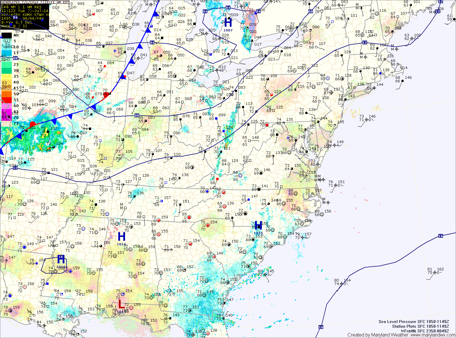
Low pressure is expected to develop off of the Virginia coast today and move northward. The developing low will spread precipitation into the area late this afternoon and tonight. The…
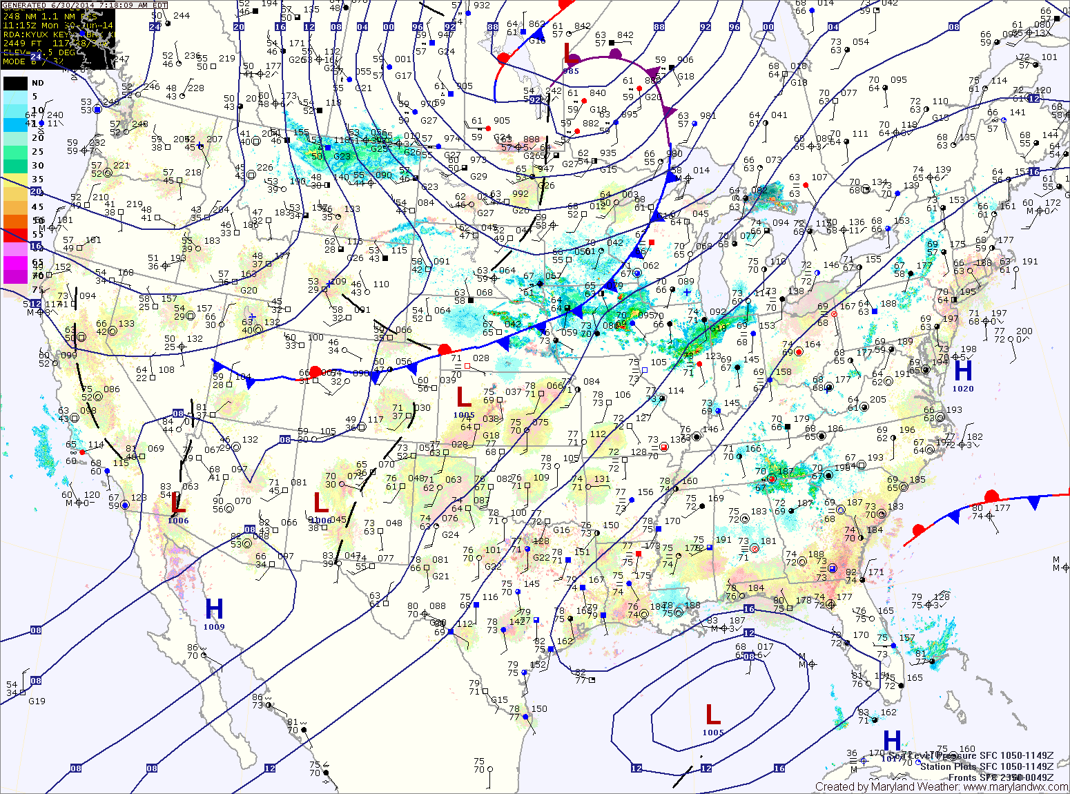
A strong cold front will approach from the west today. Ahead of the front, warm, humid and unstable air has been drawn into the region. This combination will support shower…
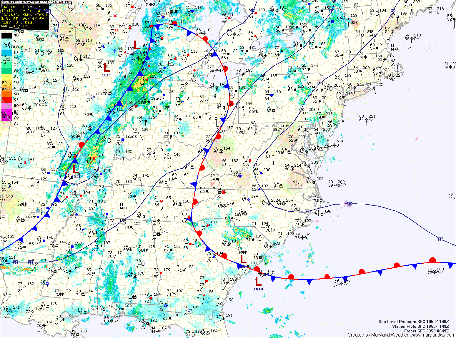
Current Surface MapTraining pockets of heavy rainfall resulted in widespread flooding yesterday but the “jackpot” area was northeastern Anne Arundel county where over a foot of rain fell! Here in Millersville, “only” 5.15″ fell. This heavy rainfall resulted in many road closures and snarled the evening commute.
The cold front responsible for the heavy rainfall and flooding has pushed east of the state, ushering in drier air. Expect mostly sunny skies today and highs in the low 80s.
Current Surface MapHigh pressure has moved into the region and as a result, expect mostly sunny skies today with highs in the low to mid 80s.
The high will slide off of the coast tonight into tomorrow. This will allow warmer, more humid air to flow back into the area. Expect highs to be in the upper 80s to around 90 under mostly sunny skies.
A disturbance will move into the area Saturday night and Sunday, bringing a chance of showers and thunderstorms. Some of the storms could be strong to severe on Sunday with damaging winds being the most likely threat. The storms will also be capable of producing heavy rainfall, leading to localized flash flooding. Highs will be in the mid to upper 80s.
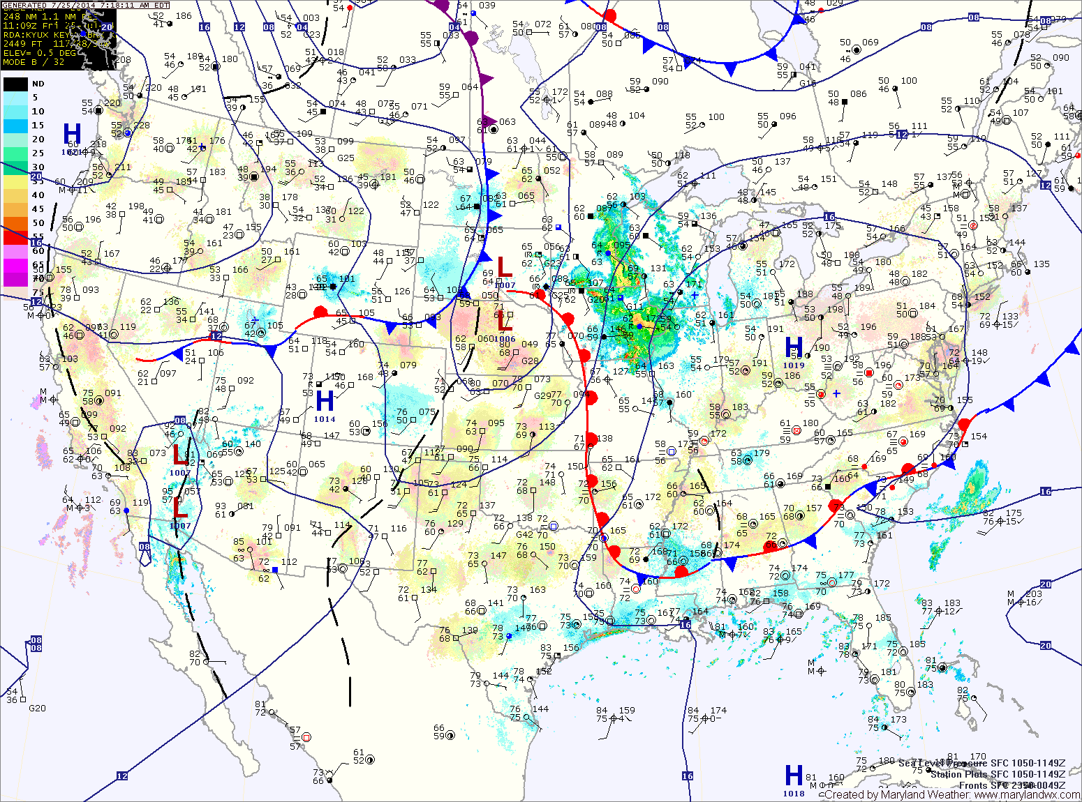
Current Surface MapWith a Bermuda high continuing to pump warm and humid air into the region and a cold front approaching from the west, the stage is set for another round of showers and thunderstorms this afternoon. Some of the storms may turn severe with damaging winds and heavy rain. Highs will be in the upper 80s to around 90.
The cold front crosses tonight into tomorrow morning bringing an end to the rainfall. Cooler and drier air will filter in tomorrow, leading to mostly sunny skies by the afternoon. Highs will be in the low 80s with low humidity.
High pressure will remain overhead Thursday, leading to another pleasant day. Highs will be in the low to mid 80s.
Current Surface MapToday will be hot and humid with isolated showers and thunderstorms possible late this afternoon and evening. Highs will be in the low 90s.
As the tropical system off of the southeast coast strengthens and a cold front approaches from the west, moisture will increase tomorrow and as a result, thunderstorms are likely tomorrow afternoon and evening. Some of the storms could become severe with damaging winds and large hail. Locally heavy rainfall is also possible. It will continue to be hot, with highs in the low to mid 90s.
Thunderstorms will remain likely tomorrow night through Thursday as the front remains to our west and the tropical system remains to our south. Another round of severe weather is possible Thursday afternoon as well. Highs will be in the upper 80s to around 90.
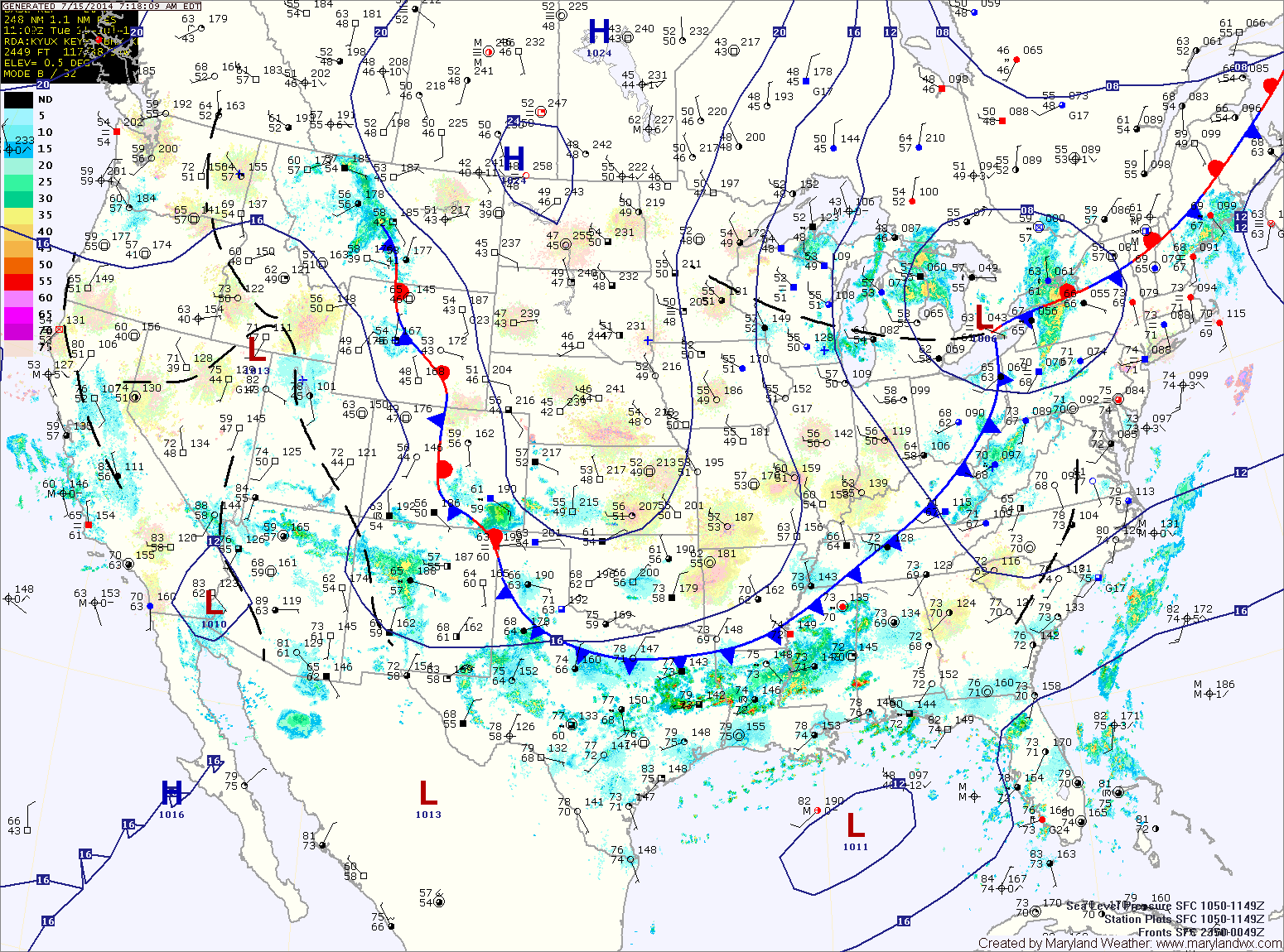
Current Surface MapSoutherly flow will sharpen today bringing heat and humidity back into the region today. The heat will continue to build through midweek.
Expect a mix of clouds and sun today with an isolated shower or thunderstorm possible. Highs will be around 90.
Tomorrow will be a few degrees warmer, with isolated thunderstorms possible in the afternoon. Highs will be in the low 90s.
A cold front will approach on Wednesday, increasing storm chances. Additionally, tropical moisture will be pulled into the area ahead of a developing system off the southeast coast. This will make isolated to scattered storms likely with locally heavy rainfall. Highs will be in the mid 90s with heat indices approaching 105.
The front will remain in the area Thursday and thunderstorm chances will continue. Localized flooding will be possible again Thursday afternoon as storms produce locally heavy rainfall. Highs will be in the upper 80s.
Current Surface MapHigh pressure off of the New England coast will keep the region mostly dry today with just a slight chance of an afternoon or evening thunderstorm. Highs will be in the mid to upper 80s.
A cold front will approach from the west tomorrow. Showers and thunderstorms are likely mainly during the late afternoon and into the night. Showers and storms will be capable of very heavy rainfall and localized flooding. Highs will be in the upper 80s to around 90.
The front should clear the area by Thursday morning. Expect mostly sunny skies and highs in the mid 80s.