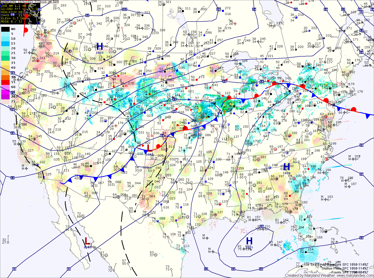
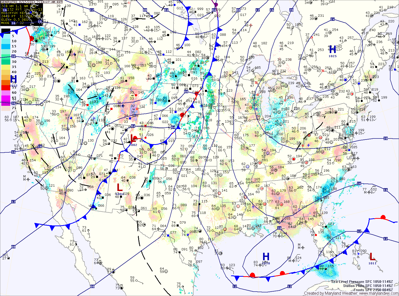
Cool and Dry Stretch into Next Week
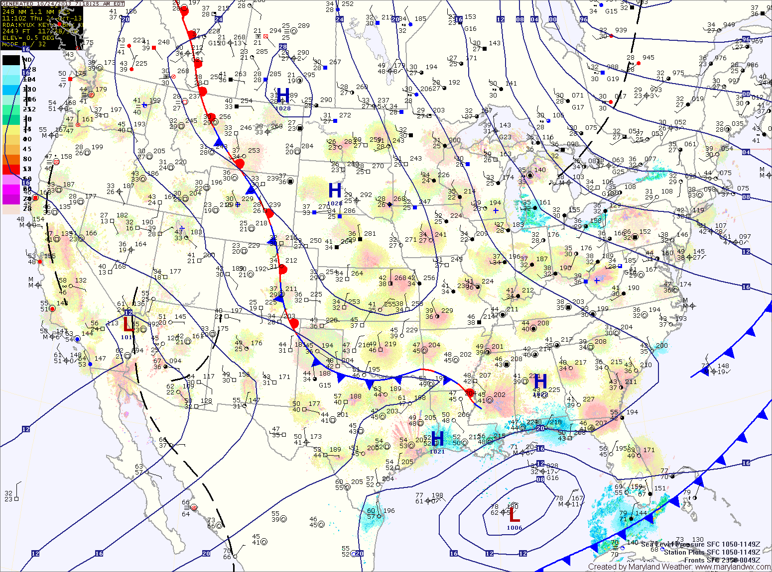
Tomorrow will be very similar to today. Mostly sunny, breezy and cool with highs in the low to mid 50s.
Lows tomorrow night will again be near freezing along and east of I-95 and below freezing to the west.

Tomorrow will be very similar to today. Mostly sunny, breezy and cool with highs in the low to mid 50s.
Lows tomorrow night will again be near freezing along and east of I-95 and below freezing to the west.
Cooler air will flow into the region tonight and tomorrow. Upslope rain and snow showers are likely in the mountains and lows in the mid 30s are expected across central and eastern portions of the state tonight.
Tomorrow will be mostly sunny with highs in the low to mid 50s.
A reinforcing shot of colder air will move in tomorrow, and highs on Friday will be in the low 50s with overnight lows dropping to near freezing Friday night.
High pressure builds in tomorrow, leading to a sunny and cooler day. Highs will be in the mid to upper 60s.
Saturday will start out partly sunny, but a weak cold front will move through during the evening and will touch off another round of scattered showers during the late afternoon. Highs will be in the upper 60s.
Clouds will decrease tomorrow with highs around 70 under mostly sunny skies.
Clouds will thicken again on Wednesday as a cold front approaches from the west. Highs will be in the low 70s.
The front will pass through Wednesday night bringing a chance of showers as it does.
Tomorrow will be mostly sunny with highs in the upper 80s.
High pressure will hang on through Sunday, providing another dry day, although clouds will increase through the day as a cold front approaches from the west. It will continue to be warm, with highs in the mid to upper 80s.
Tomorrow will be similar to today but will be about 5 degrees cooler. Expect highs in the low to mid 80s under mostly sunny skies.
It looks to remain dry and warm as we head into the weekend. Highs on Friday will be in the mid 80s under partly sunny skies.
Saturday will be mostly sunny with highs in the mid 80s.
High pressure will be in complete control tomorrow, providing sunny skies and warm temperatures. Highs will push into the mid 80s.
An area of rain will move by to our northwest on Thursday, causing an increase in clouds in our area. Highs will be in the low 80s under partly sunny skies.
Friday will be similar to Thursday, partly sunny skies and highs in the low 80s.
Tomorrow will be partly sunny and warm, with highs around 80 degrees.
Wednesday will feature even more sunshine and warmer temperatures. Highs will be in the low to mid 80s.
Expect more of the same on Thursday and Friday, mostly sunny skies and highs in the low 80s.
Expect more of the same tomorrow, with a bit more sunshine. Highs will be in the mid 70s.
Sunday will be similar, mostly sunny with highs in the mid 70s.
A weak cold front will approach and move through Monday into Monday night. It is expected to be a dry passage, with just an increase in clouds expected Monday afternoon. Highs will continue to be in the mid 70s.
High pressure will control the weather through the weekend. Tomorrow will feature a mix of clouds and sun with highs again in the mid 70s.
Saturday and Sunday will feature more sunshine and highs in the mid 70s.
A cold front will approach and move through Monday into Monday night. The front will be fairly moisture starved, and as a result, nothing more than an isolated shower is expected. Highs on Monday will be in the mid 70s.