Rain today clears out tomorrow morning
After some early morning showers, skies will gradually clear through the day tomorrow as afternoon highs reach the low 60s.
Wednesday and Thursday will be mostly sunny with highs in the low 60s.

After some early morning showers, skies will gradually clear through the day tomorrow as afternoon highs reach the low 60s.
Wednesday and Thursday will be mostly sunny with highs in the low 60s.
The front will clear the area tonight allowing drier air to move in for the weekend. Tomorrow will be mostly sunny but breezy with highs in the low 60s.
Sunday will also be mostly sunny with less wind. Highs will be around 60.
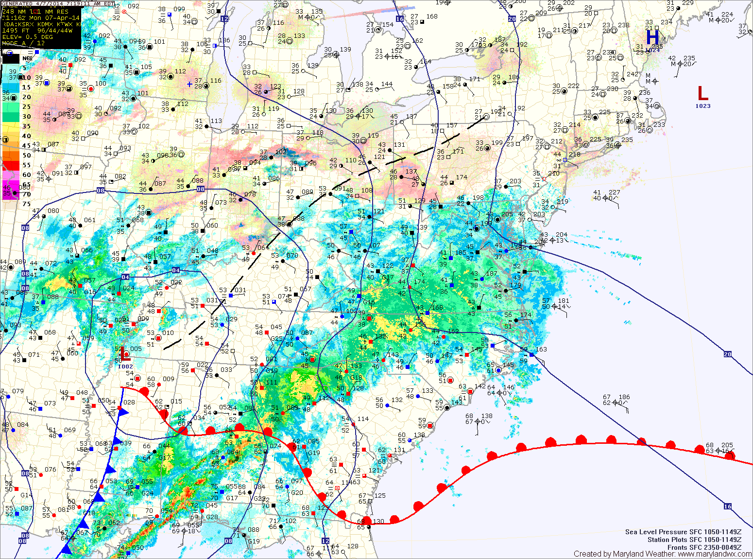
This past weekend’s storm brought over 2 inches of rain to the area and has now moved off to the northeast. The storm will still be close enough to cause breezy conditions today but otherwise, expect mostly sunny skies and highs around 60.
Tomorrow will be similar to today except winds will decrease and there will be a bit more cloudiness. Highs will be in the low 60s.
Another system will move towards the area on Wednesday causing clouds to increase. It will continue to be warm, with highs in the mid to upper 60s.
Expect partly sunny skies and highs in the mid to upper 40s.
A cold front will approach tonight and tomorrow. Expect scattered showers to increase in coverage during the morning and through the day.
It will be warmer and breezy, with highs in the upper 50s to low 60s.
The front will push through tomorrow evening, bringing a brief end to the rainfall.
Light showers are developing over the Blue Ridge. A Winter Weather Advisory for light freezing rain has been posted for that area as temperatures are near freezing. The showers will continue to develop and move eastward this morning and afternoon. Expect highs to reach the low to mid 40s.
The showers may continue into this evening and tonight before a cold front pushes through. The front will end the shower activity and clear the skies.
Tomorrow will be mostly sunny, breezy but warmer with highs pushing into the mid 50s.
The high will move overhead tomorrow, diminishing winds. It will be mostly sunny with highs in the upper 40s.
As the high moves off the coast on Thursday, southerly flow will bring in slightly warmer air and a few more clouds. Highs on Thursday will be in the low to mid 50s under partly sunny skies.
Friday will be a few degrees warmer, with highs in the mid to upper 50s under partly sunny skies.
Another cold night is on tap tonight, with lows dipping into the mid 20s once again.
Temperatures begin to moderate tomorrow under continued sunny skies. Highs will be in the mid 50s.
As the high slides off the coast, a more southerly flow will develop. As a result, clouds will increase a bit on Friday but temperatures will continue to warm with highs expected to push into the upper 50s.
Today will be mostly sunny, breezy and cool with highs around 50 degrees.
Winds will diminish tomorrow and temperatures will warm a bit, with highs in the mid 50s.
A weak cold front will move through on Sunday, increasing winds and bringing an end to the warming trend. Highs on Sunday and Monday will be in the mid 50s, followed by highs around 50 on Tuesday.
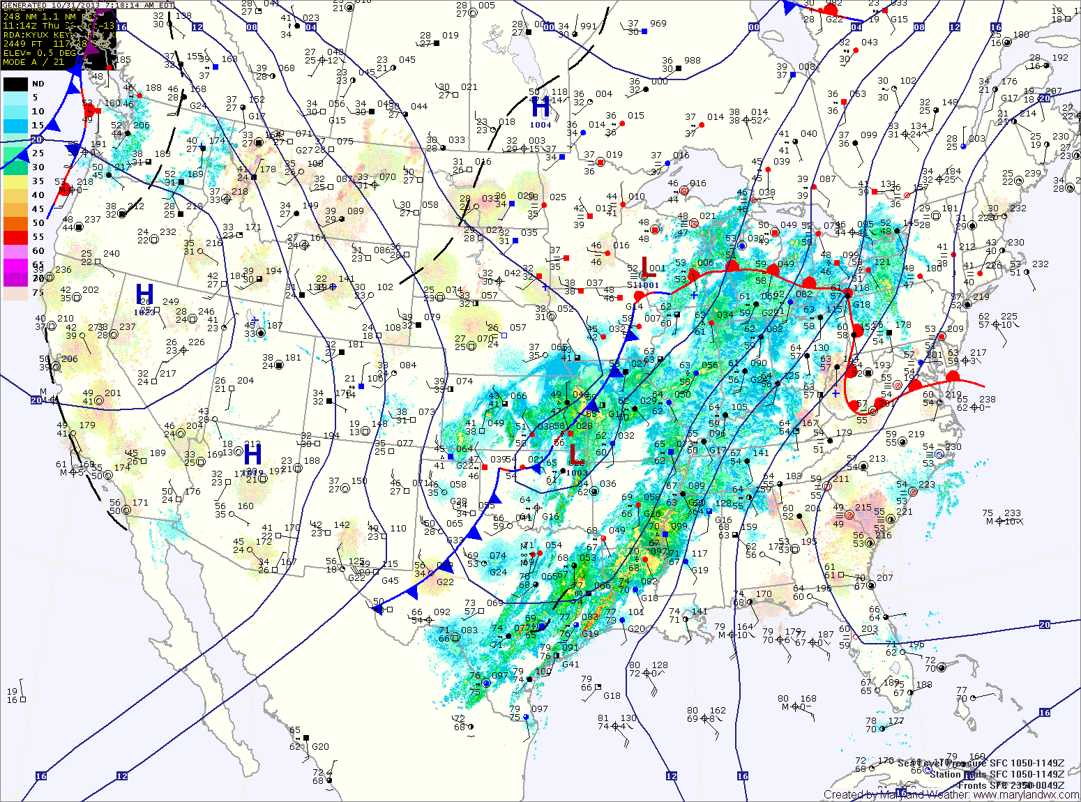
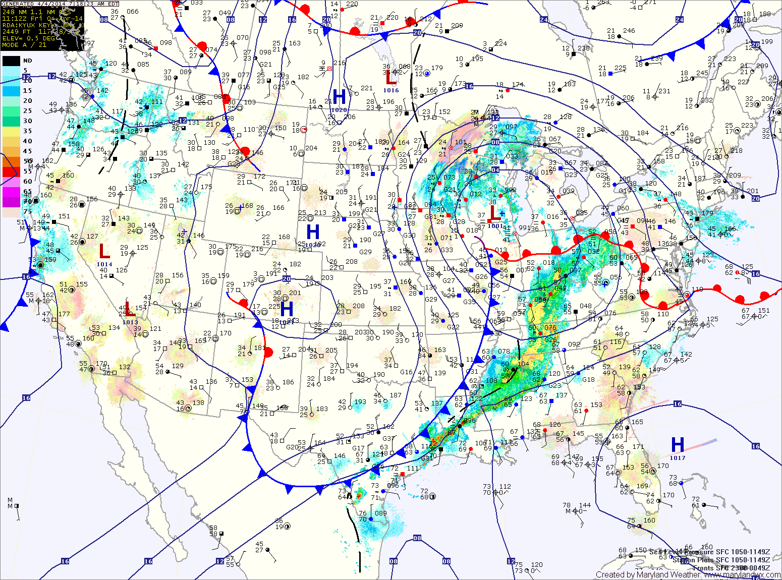
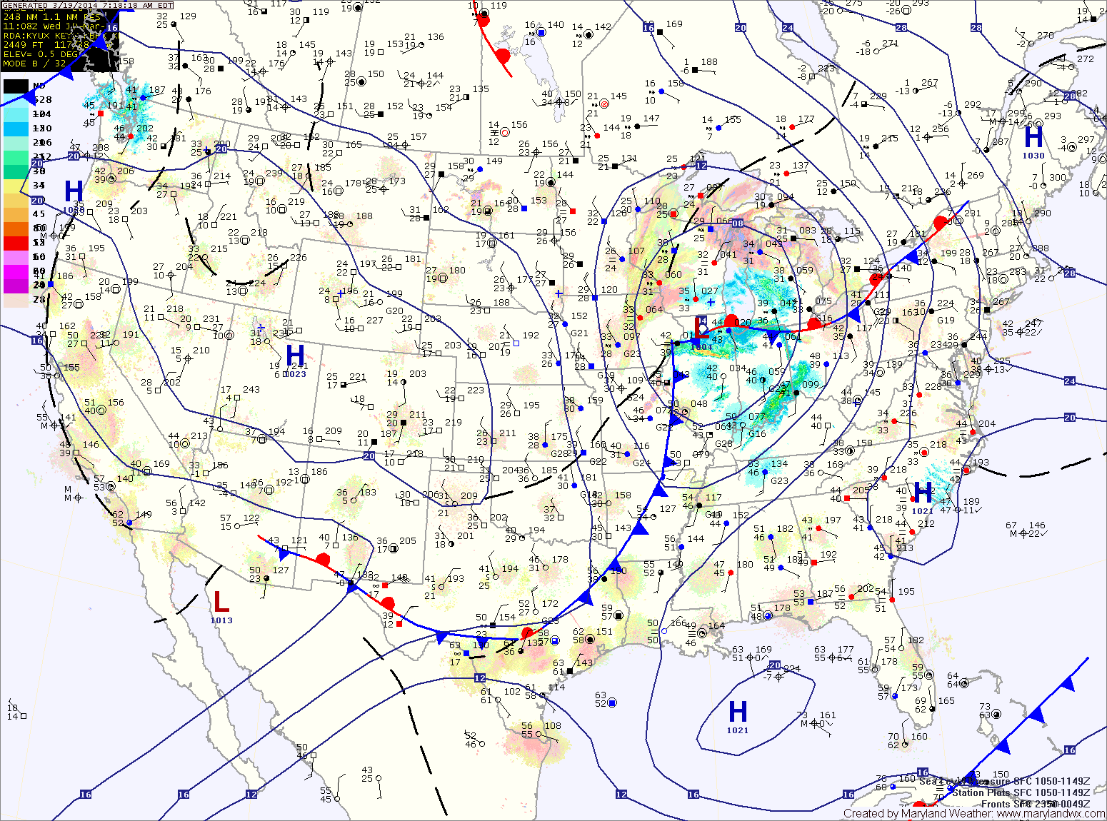
The front will spread rain showers and isolated thunderstorms into the area late tonight. Some of the showers and storms may produce locally gusty winds.
The front will continue to push showers and isolated storms through the area tomorrow The front will slow and may even stall along the bay Friday afternoon and evening. This will allow shower chances to persist into tomorrow night. Highs will be around 70 degrees.
Tomorrow will see generally cloudy skies. Southerly flow ahead of an approaching cold front will increase winds through the day, with gusts near 25 mph by tomorrow night. Highs will be around 70 degrees.
The front will spread rainfall into the area late tomorrow night or early Friday morning. Winds will continue to gust to near 25 mph through the day on Friday. Additionally, an isolated thunderstorm is possible Friday with localized strong gusty winds. Highs on Friday will be in the low 70s.