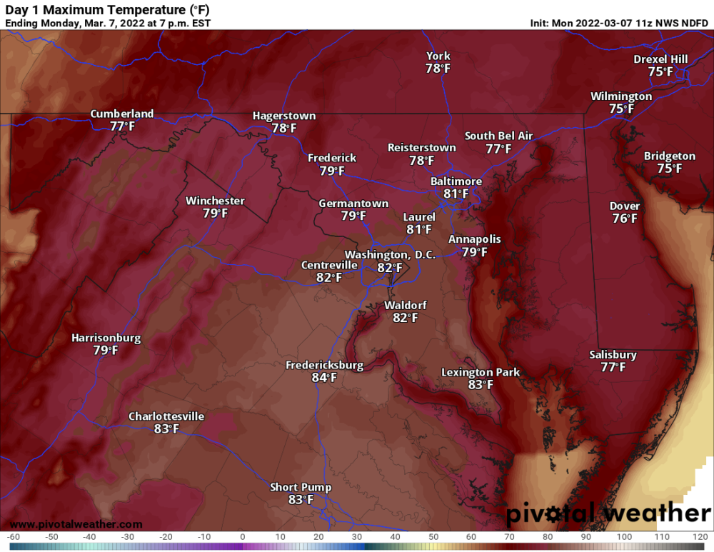
Strong southwesterly winds will continue to bring record warm air into our area today. Highs will be in the upper 70s to low 80s across most of the state, including BWI, where the record for today (76, set in 1974) will likely fall.
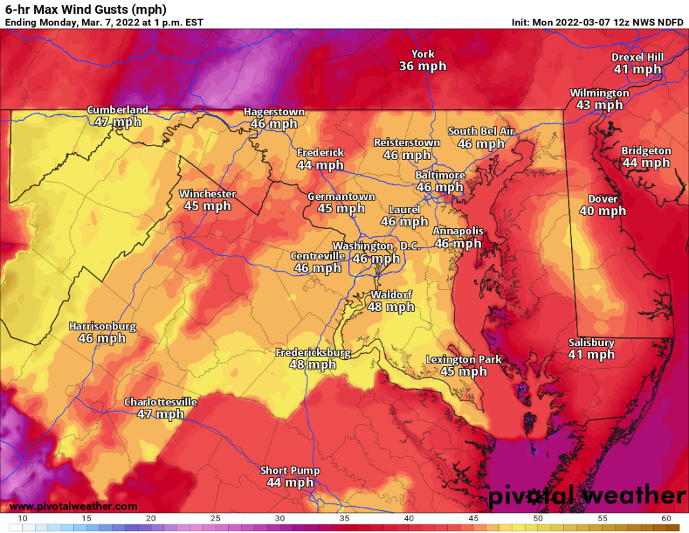
A Wind Advisory is in effect for the entire state, as the southwest winds intensify ahead of the cold front this afternoon, gusting to near 50 mph at times.
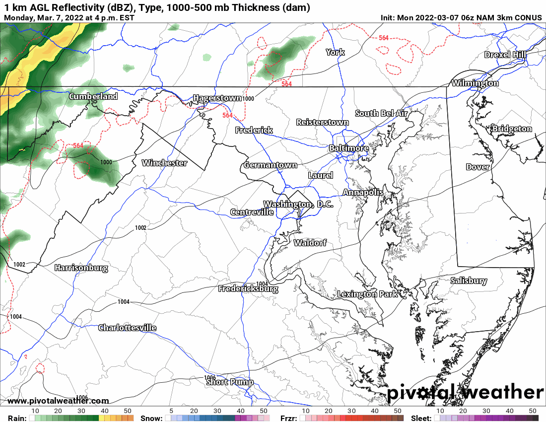
The cold front will push eastward tonight, spawning showers and thunderstorms as it does. The Storm Prediction Center has placed most of the state in a “Slight Risk” for severe storms, with the primary threat being damaging wind gusts.
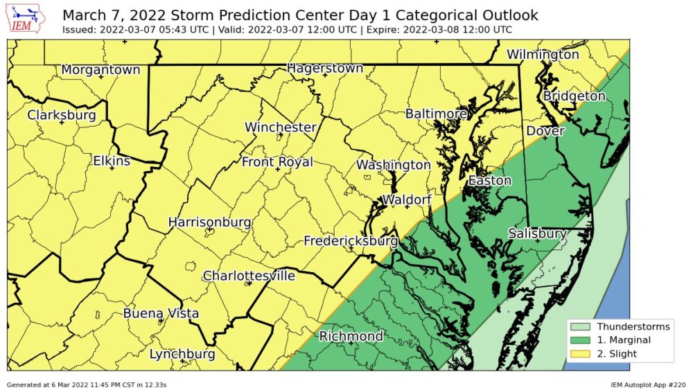
Timing wise, expect the showers and storms to enter western Maryland late this afternoon, around 4pm or so, and then press eastward, entering the central Maryland around 7pm, and crossing the bay and exiting the coast by about 10pm.
Behind the storms, and the front, winds will shift to the west bringing in much cooler and drier air. Highs tomorrow will be 25-30 degrees colder than today, topping out in the low to mid 50s.