A day after highs in the 60s and 70s, a cold front has delivered a fresh cold air mass across the region while weak low pressure approaches from the south west. This combination will lead to some wintry weather today into tomorrow with some ice accumulation likely north and west of I-95.
While occasional light snow/sleet/freezing rain/rain is likely today, the main concern for ice accumulation is later today and tonight, when steadier, more widespread precip is likely.
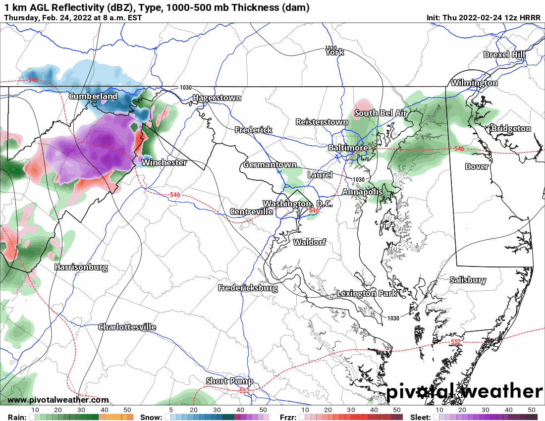
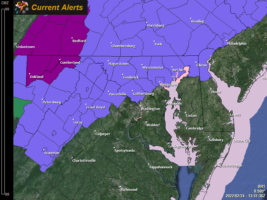
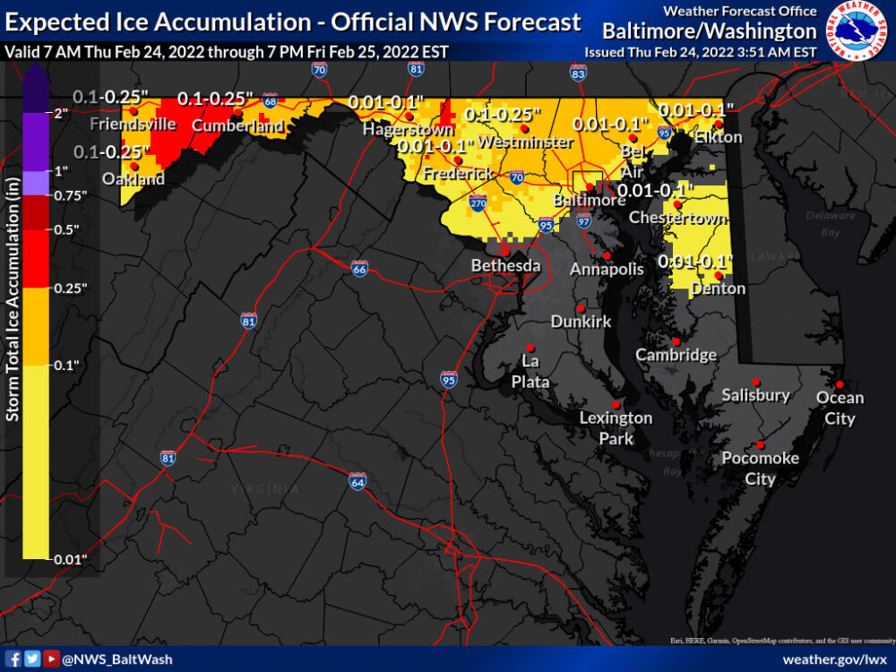
As shown above, steadier and more widespread precip is likely to move in around 10pm tonight, and fall as sleet and or freezing rain across northern and western parts of the state. The concern for ice accumulation has led the NWS to issue Winter Weather Advisories (north and west of I-95) and Ice Storm Warnings (Allegany and Garrett counties) for this evening into tomorrow morning.
Per the NWS forecast, 0.1 to localized 0.25″ of ice are possible in the advisory areas, while localized amounts up to 0.3″ of ice are possible in the warning areas.
South and east of I-95, some wintry precip is likely to mix in, but temperatures should stay above freezing and mostly rain is expected.
By 5 or 6 tomorrow morning, most if not all areas should rise above freezing, ending the ice threat and beginning melting of any accumulation.
If you are traveling tonight or early tomorrow morning, be careful, especially north and west of I-95 as ice accumulation could make for treacherous travel. Additionally, some tree damage and power outages are likely in Garrett and Allegany counties, where ice build up is expected to be highest.