Summary
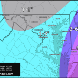
- Slight westward adjustment to the storm track has pushed slightly higher snow totals westward
- Winter Storm Warnings in effect on Eastern Shore. Blizzard Warning issued for Worcester county – including Ocean City
- Winter Weather Advisories posted for I-95 corridor
- Accumulating snow will begin this afternoon/early evening, ending west to east tomorrow morning/afternoon
Current NWS Alerts

Overnight, the models stayed fairly consistent, but have converged on a storm track that is slightly west of where we were yesterday. As a result, I have adjusted my snowfall forecast to bring slightly higher totals westward as well. The question is, will this shift even further west? There is always that possibility, especially since the storm has just started to form off the Florida coast!
Some areas are seeing some light snow showers this morning as an arctic boundary and the northern energy moves into the area, but the main event will start this afternoon and early evening.
Updated Snowfall Forecast
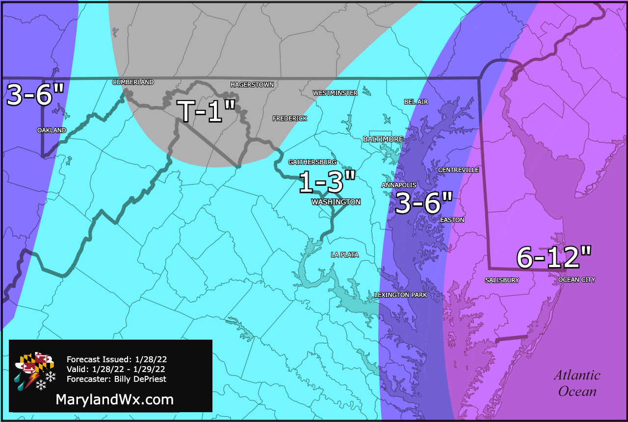
As mentioned, not much to change with the initial forecast, but I did update things slightly to account for the slight westward shift in the storm track. This will be my last official forecast, but I will provide updates should the track change enough to impact expectations.
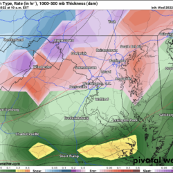
Detailed Timing
Here is the latest (12z) NAM to illustrate the timing of the snow. Generally, accumulating snow is expected to start this afternoon and last through tonight and into tomorrow morning, tapering off from west to east. The snow should clear the bay by around noon, and the Eastern Shore during the afternoon hours.

With this more westward track, the center of the storm will be closer to the coast, and as such, winds will likely be a touch higher as well. This is what will bring possible Blizzard conditions (Sustained wind or frequent gusts to 35 mph or greater; and considerable falling and/or blowing snow reducing visibility frequently to less than 1/4 mile for 3 or more hours) to Ocean City, where gusts to near 50 mph are likely.
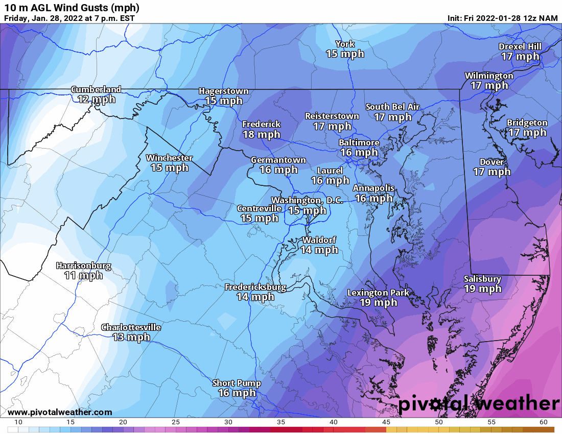
Behind the system, much colder air will flow in on the strong northerly winds. With a fresh snowpack, temperatures will plummet into the teens, and combined with the winds, feel even colder tomorrow night into Sunday morning.
This will be the last post on this system, but I will continue to provide updates on Facebook, Twitter, and Instagram as warranted. Stay safe!