A cold front pressing down from the north will provide a path for low pressure to travel along, setting the stage for possible freezing rain on Friday.
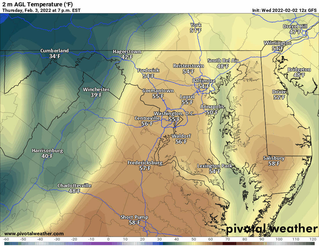
Ahead of the front, temperatures will remain mild, with 40s to low 50s expected tomorrow into tomorrow night. The front will make steady progress southward into our area late Thursday night and early Friday, with temperatures dropping sharply behind it.
As this occurs, an area of low pressure will spread moisture into the area, mostly in the form of rain, but as the temperatures drop, there is the possibility that the rain ends as a period of freezing rain and/or sleet. The models disagree on the exact amounts, but there is the possibility, especially across the northern parts of the state that some ice accumulation is possible.
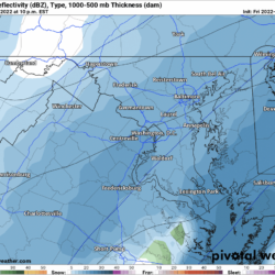
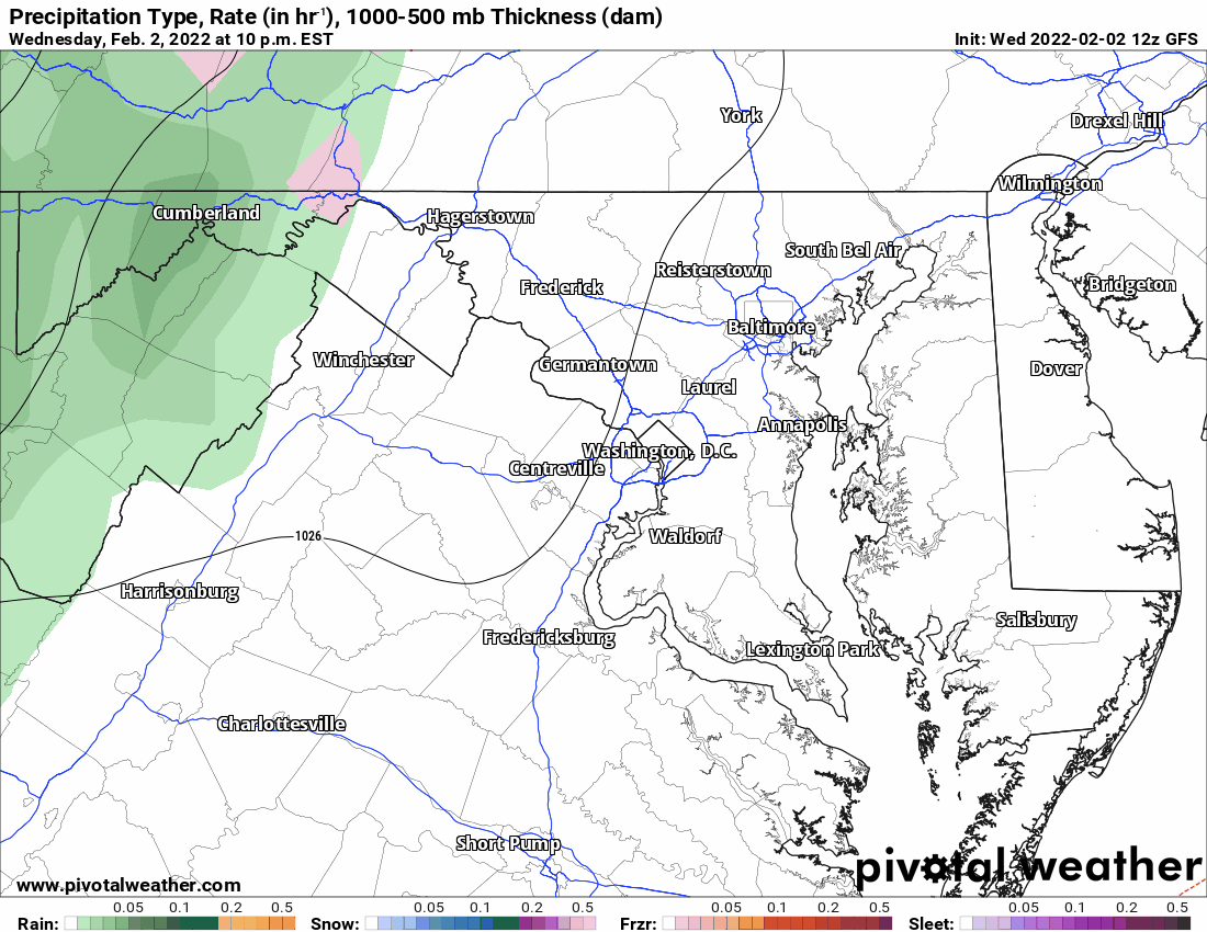
Setting the stage, here is this afternoon’s GFS model output for tomorrow at 7pm through Saturday at 7AM, illustrating the steady push of arctic air into our area:
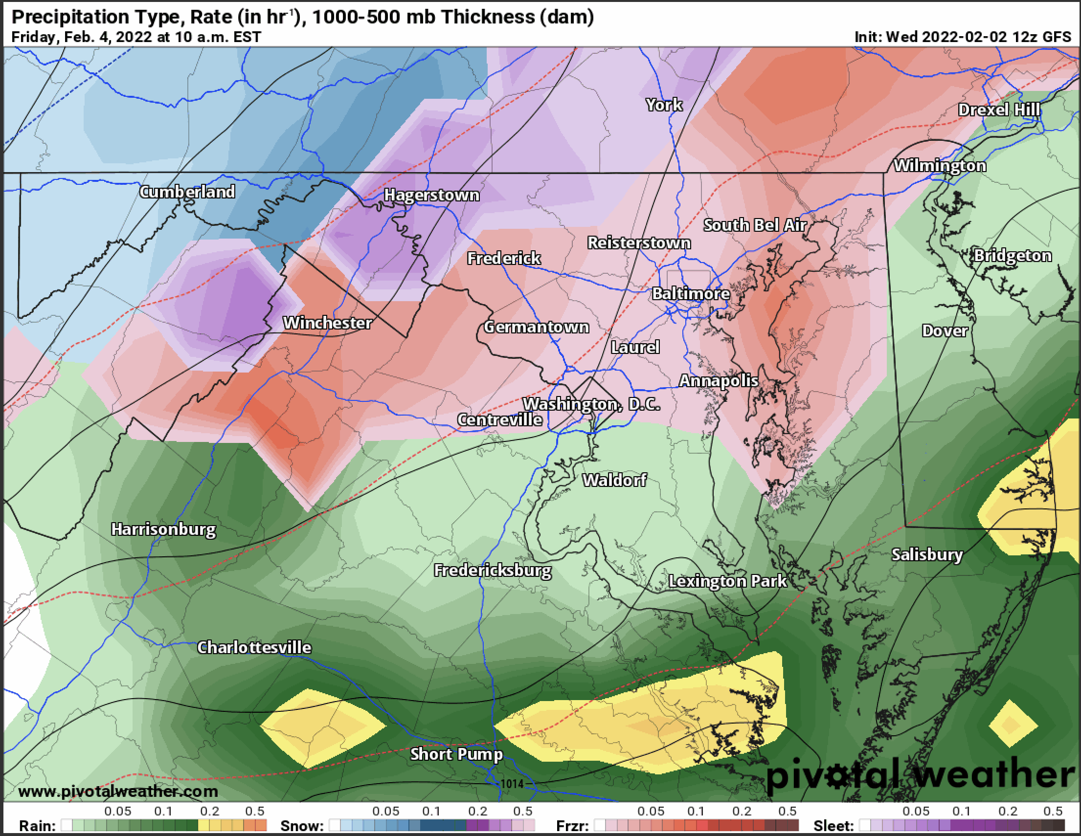
The GFS is the most aggressive with the ice threat, showing rain changing over to freezing rain and sleet Friday morning over most of northern and central parts of the state:
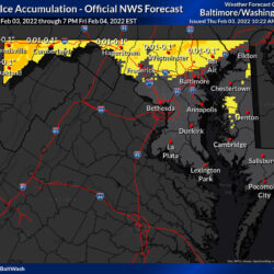
This would result in a substantial ice accumulation:

However, the GFS is sort of an outlier here, as the NAM and the European show a much lower threat for ice, and less accumulation.
Here are all three models side by side for comparison:
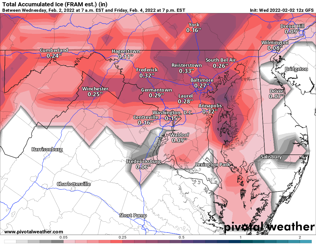
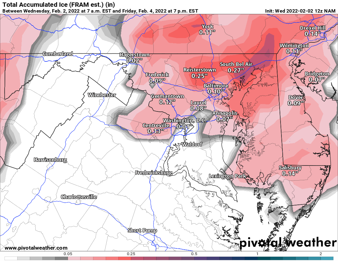
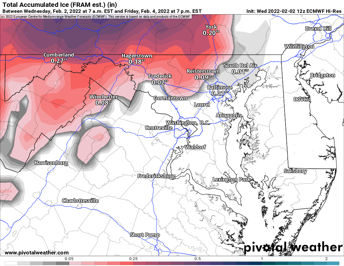
The main takeaway is that, while the NAM and European are not as aggressive with the ice, all three models show ice accumulations that could cause impacts, especially areas further north.
While this does not appear to be a crippling ice storm by any means, be prepared for possible impacts to the Friday commute should this icing threat materialize.
Should anything change, updates will be provided.