Summary
- Models in good agreement that system will develop off the coast
- Still some discrepancies in tracks – minor changes are expected and could change snow totals
- Heaviest snow will be east of the bay
- Winter Storm Watches in effect for Delmarva
After a week of following a complicated setup, where energy from the southwest interacts and combines with energy dropping out of Canada, we have arrived at a general consensus for the system that will develop along the east coast tomorrow.
We have seen how miniscule differences in the timing, position and strength of each piece causes huge swings in the projected path and strength of the combined system along the east coast. Even now, there are still some differences in the models, and as a result, some uncertainty to the forecast.
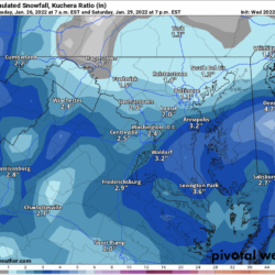
Historically, our area has rarely seen substantial snowfall statewide from patterns and systems such as this, and this nor’easter looks to mostly fit that pattern. The storm will develop and strengthen too late, and too far east to bring widespread heavy snow to our state. However, light snow is still expected, and eastern parts of the state could still see a substantial amount, with a up to a foot possible, but there will be a fairly sharp drop off in snow totals as you move westward across the bay.
Snowfall Forecast
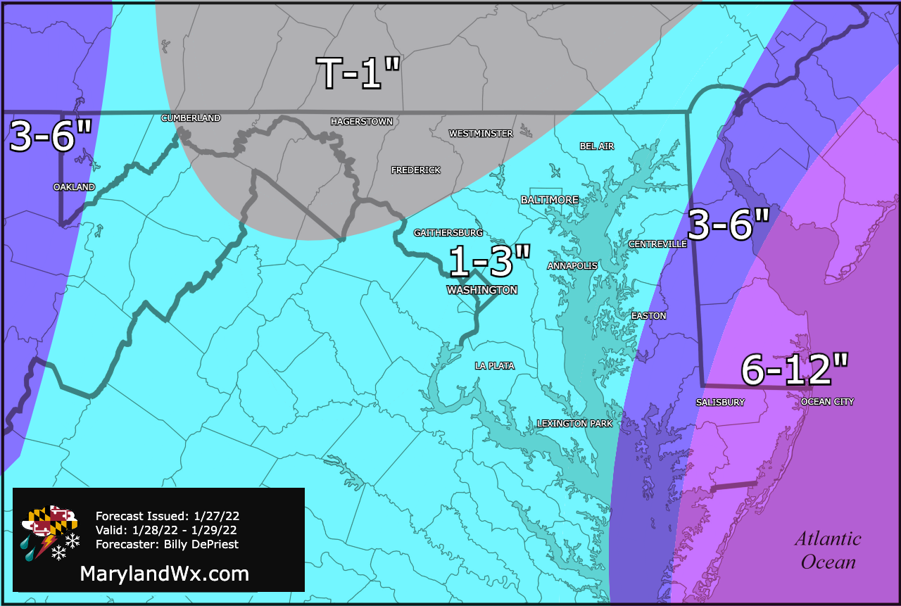
In general, most of the state should see light snow from the northern energy as it swings through and begins to develop the coastal system. Lighter amounts of less than an inch are likely in northwestern parts, with a general 1-3″ elsewhere. As mentioned, the Eastern Shore, and especially lower Delmarva will see additional, and heavier snowfall from the coastal system which will enhance totals there, with up to a foot possible.
Timing
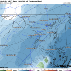
Here is this afternoon’s European model run to illustrate the timing of the the event, at a regional scale and, zoomed in to Maryland.
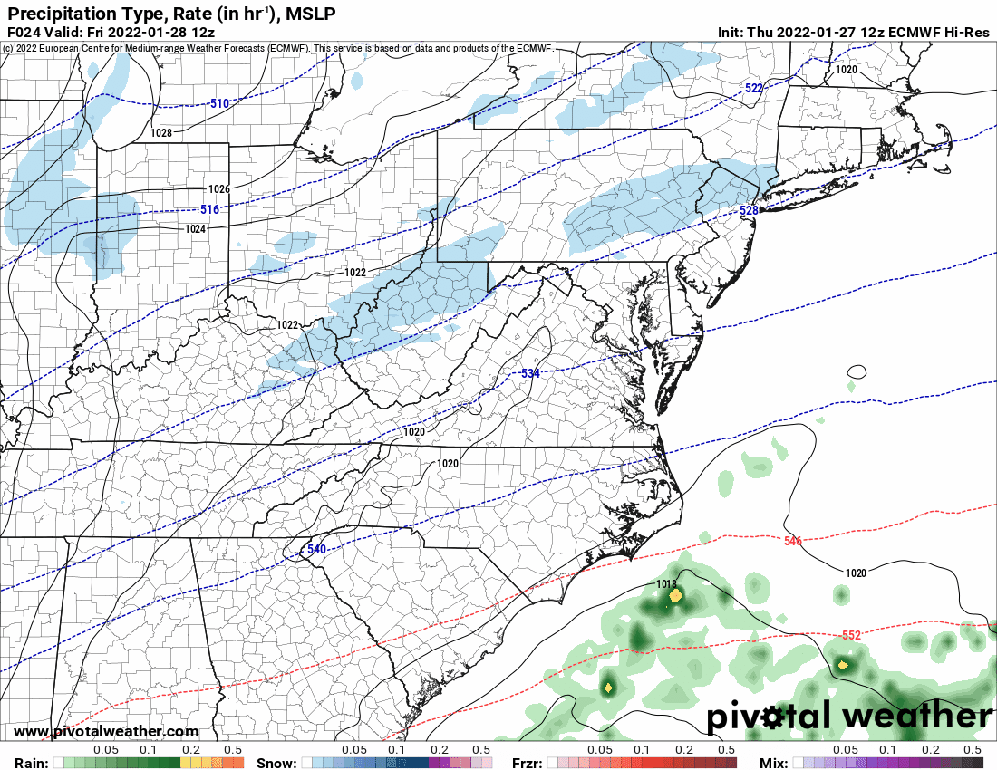
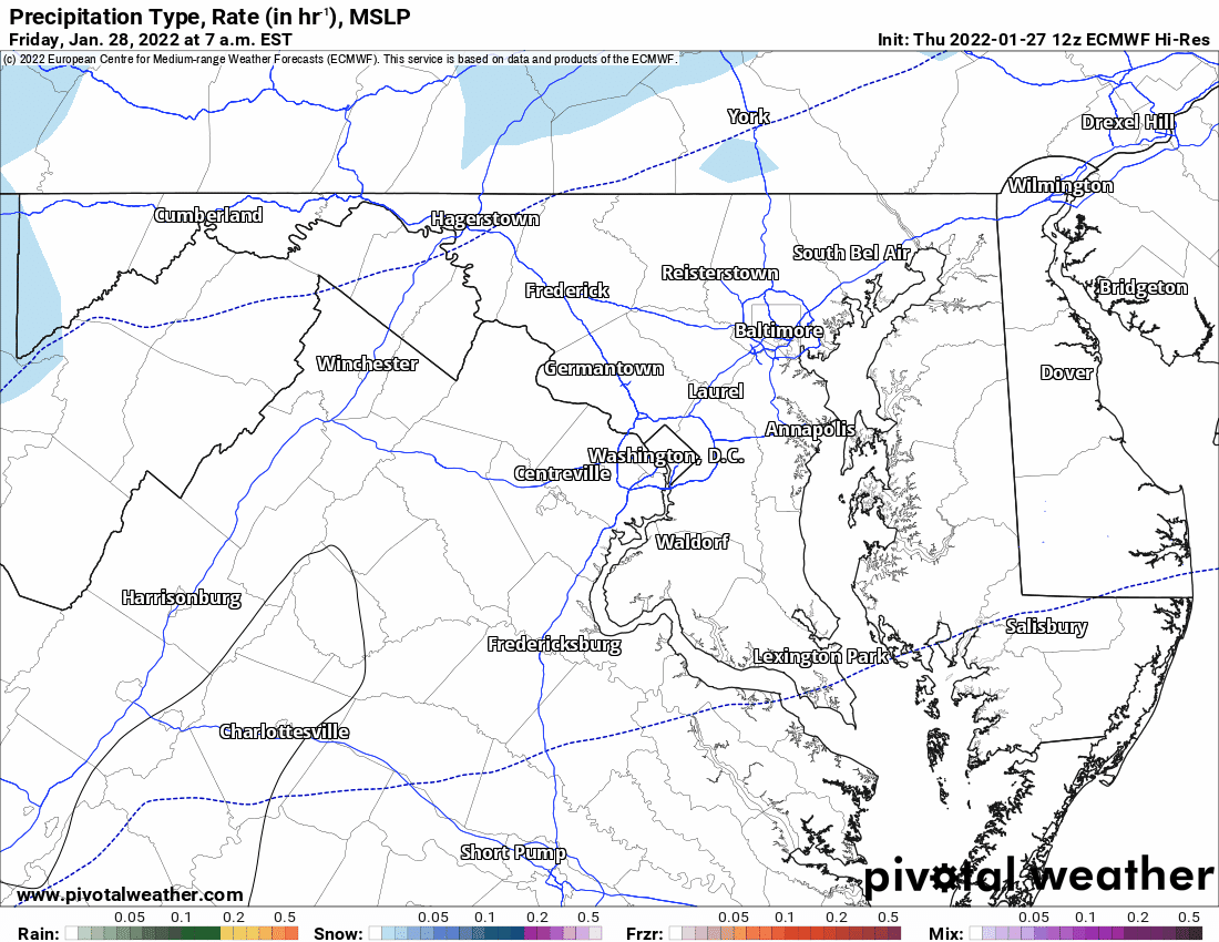
Expect light snow to develop during the afternoon hours Friday, continuing through Friday night and ending west to east after midnight and into Saturday morning.
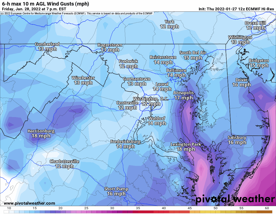
Behind the system, winds will pick up Saturday as it moves off to our north east and strengthens. Expect wind gusts to near 40mph at times through Saturday evening, before diminishing Saturday night.
This continues to be a complicated setup and difficult forecast, especially being on the southwestern fringe. In this position, any changes to the track will have possibly drastic impacts to snowfall totals here, especially west of the bay.
I’ll continue to track the latest model runs, and post an updated forecast tomorrow morning if needed.