Thursday Morning
Summary:
A cold front will push through late Wednesday into Thursday morning. Light rain Wednesday night will changeover to light snow before ending Thursday morning.
Timing:
4AM to 10AM Thursday morning
Impacts:
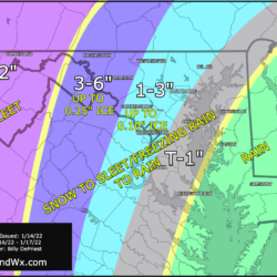
Minor impacts. 1-2” of snow is possible, falling during the AM commute. Temperatures will generally be near or above freezing, limiting accumulation and impacts.
Forecast Confidence: MED/HIGH
Friday Night – Saturday
Summary:
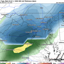
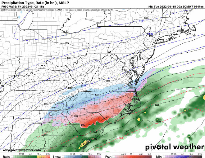
The European model develops low pressure over the southeast, moving just to our south with plenty of cold air overhead. This results in a significant snowstorm for our area.
The GFS model does *not* currently show this storm. We will look for a consensus in the coming days.
Timing:
Late Friday into Saturday
European Model Animation:
Impacts:
*Potential* for major impacts statewide.
Forecast Confidence: LOW/MED
More specifics and details in the coming days.