Summary:
Strong low pressure will spread wintry weather into our area tomorrow afternoon into Monday morning. Heavy snow, sleet, freezing rain, and rain, along with strong winds are expected across the state.
Watches and Warnings:

Timing:
Details:
1-4PM Sunday:
Areas west of the bay: Snow develops from SW to NE and becomes moderate to heavy at times
Eastern Shore: Rain develops S to N and becomes moderate to heavy at times
6-10PM Sunday:
Areas west of the bay to the Blue Ridge: Snow transitions to sleet then freezing rain, then plain rain from east to west
Eastern Shore: Rain continues, heavy at times
Western Maryland: Snow, mixing with sleet continues, heavy at times
Highest winds expected: NE winds 20-30mph, gusts to 40-50mph
12-4AM Monday:
All Areas: Main batch of precipitation ends from S to N
4-10AM Monday:
All Areas: Wraparound snow showers possible statewide
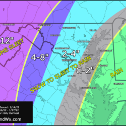
Snow/Sleet/Ice Forecast:
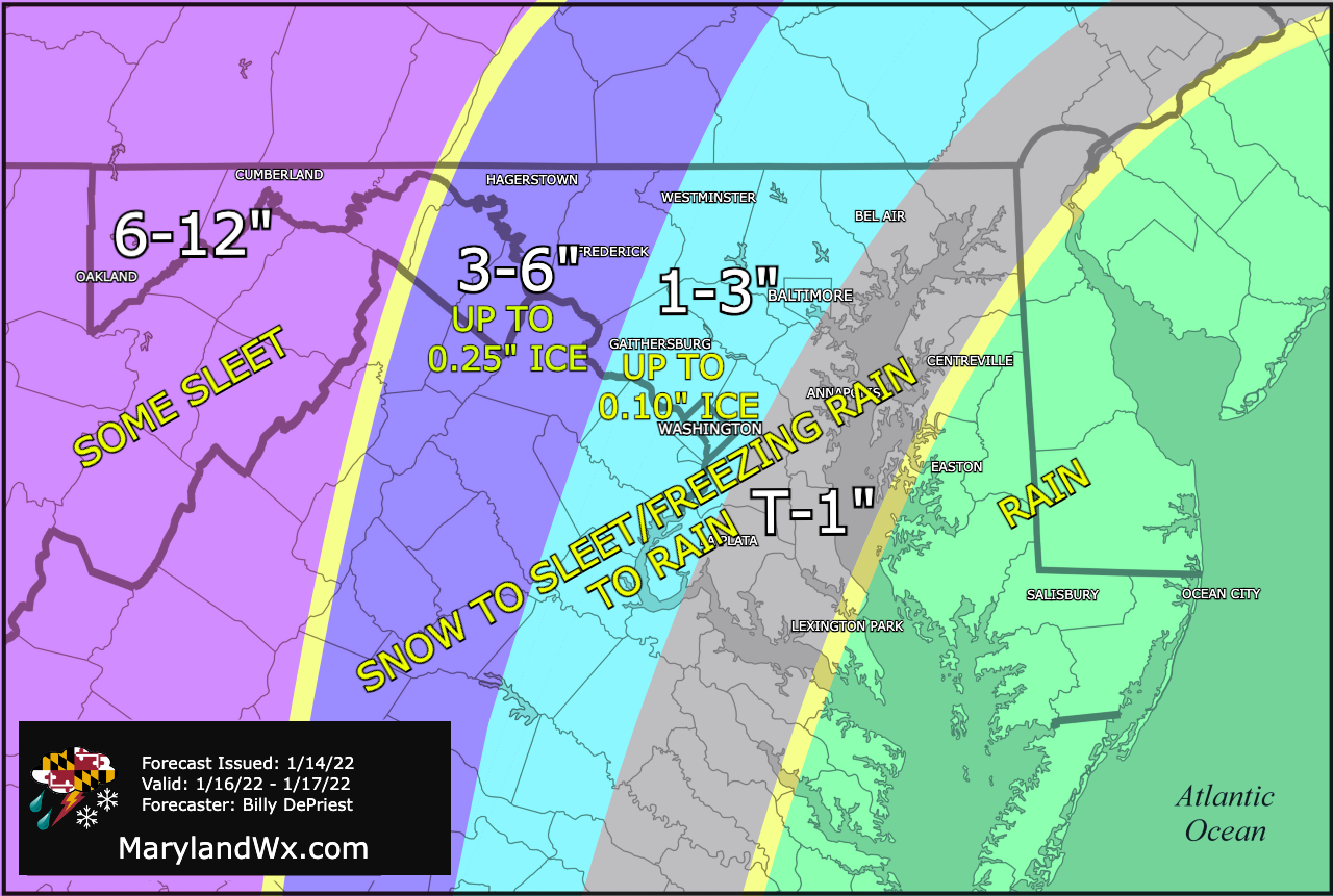
Changes from previous forecast:
- Decreased amounts slightly, especially east of the mountains where a quicker changeover is expected.
- Introduced ice accumulations in central MD
Impacts:
Significant travel impacts are likely Sunday evening through Monday morning, especially for western parts of the state where more snow is expected.
Heavy rainfall is possible over the Eastern Shore, leading to isolated flooding
Strong gusty winds could cause tree damage and isolated power outages along with coastal flooding