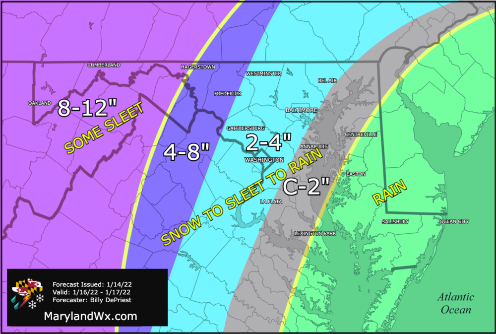
Summary:
Low pressure is expected to rapidly develop to our south and move up the coast. The current track would bring snow, sleet, freezing rain, and rain to our area Sunday afternoon into Monday morning before departing by Monday afternoon. At this time, heavy snow is expected across western parts of the state, with lesser amounts east of the mountains. Plain rain is expected across the Eastern Shore.
Timing:
- West of the Bay to about Hagerstown, snow develops Sunday afternoon from SW to NE, heavy at times into Sunday evening before changing over to sleet and plain rain from east to west. Plain rain continues Sunday night, before ending, possibly as light snow Monday morning.
- In the mountains, snow continues into Sunday night, possibly mixing with sleet at times before ending Monday morning.
- On the Eastern Shore, plain rain is expected from Sunday afternoon through Sunday night, before ending early Monday morning.
Impacts:
- Significant travel impacts are likely Sunday evening through Monday morning, especially for western parts of the state where more snow is expected.
- Heavy rainfall is possible over the Eastern Shore, leading to isolated flooding
- Gusty winds could cause isolated power outages and coastal flooding
Preliminary Snowfall Forecast: