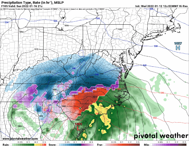
12z European Model Depiction of the System
Today’s 12z European model run shows snow moving into the state Sunday afternoon/evening and becoming heavy. The snow then mixes and changes over to a wintry mix and plain rain for areas east of the mountains, before ending on Monday.
As is usually the case, the exact track of the storm will determine the precipitation types and amounts, and cannot be nailed down until we get closer to the event.
The next update will be tomorrow afternoon.