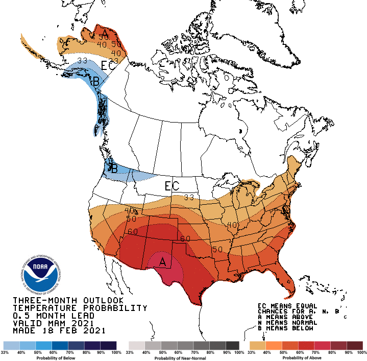
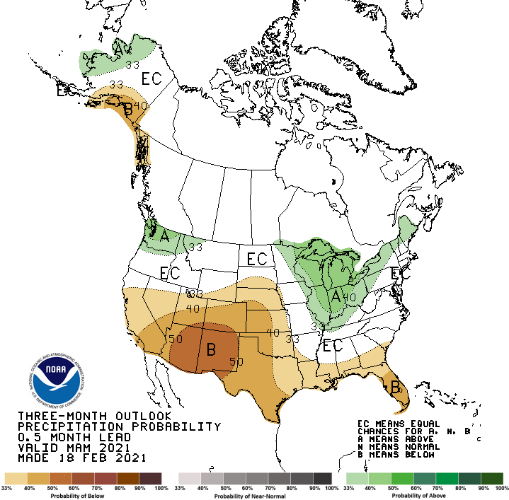
Today is March 1st, and it is the first day of Meteorological Spring! The current 3-month outlooks from the Climate Prediction Center show temperatures likely to be warmer than normal, while normal rainfall is expected.
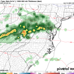
As for the near term, we will lose the rainfall this morning as a strong cold front progresses eastward, but the flood threat continues in the mountains as the combined rainfall and snowmelt makes its way through the various tributaries. Flood Warnings remain active in many areas.
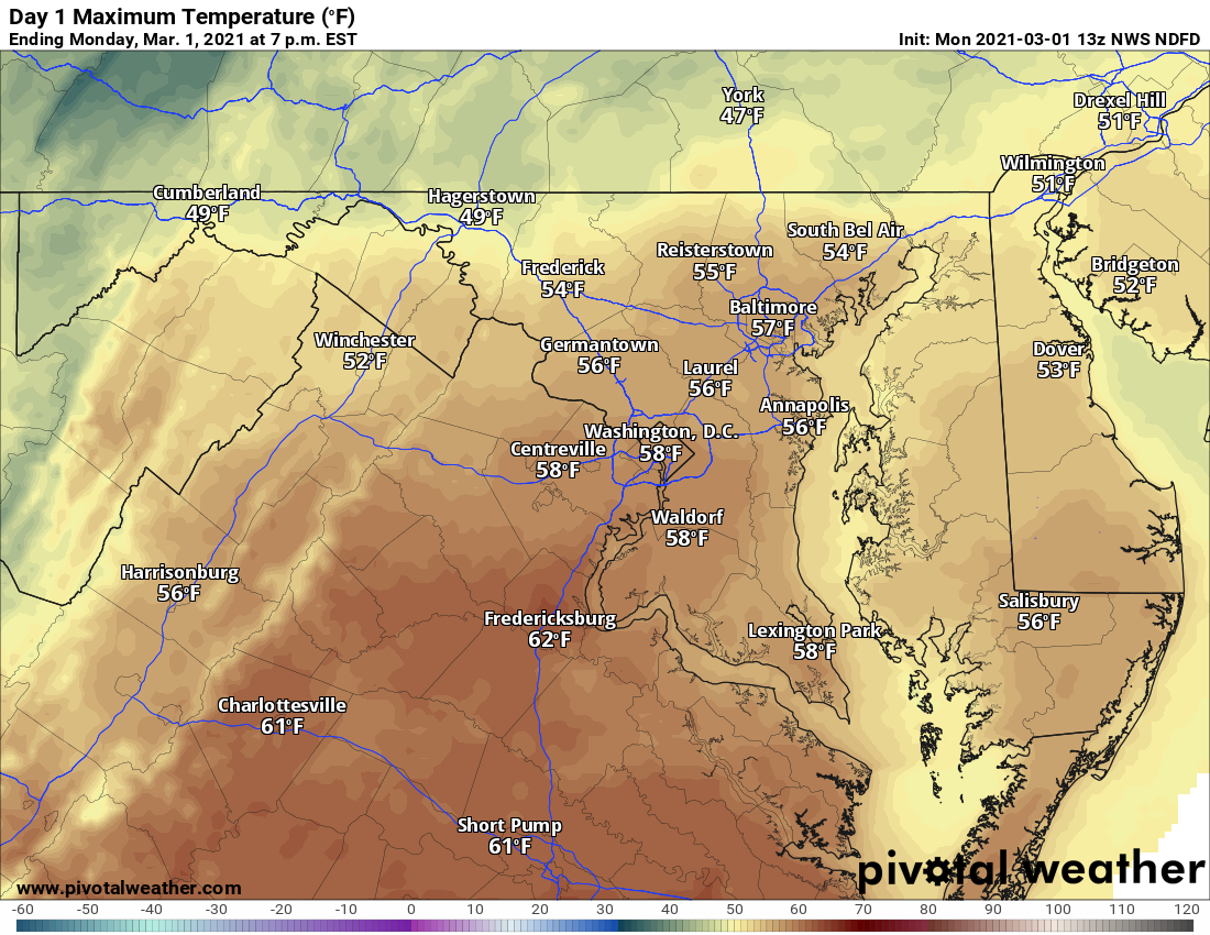
It will be mild today, with 40s and 50s expected statewide.
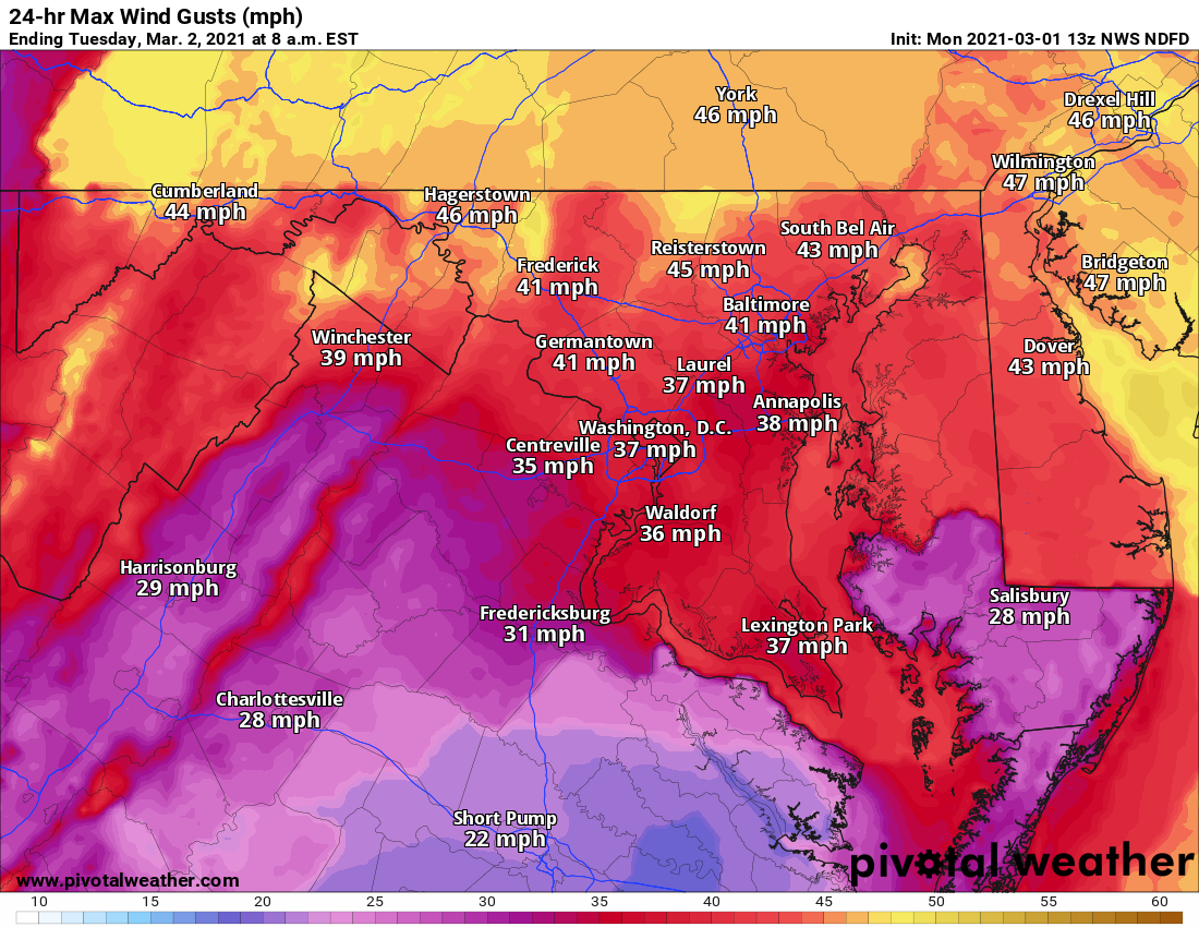
As the front pushes through, gusty northwest winds will develop. Wind gusts to near 50mph are possible, especially across northern areas, where a Wind Advisory is in effect.
After a cold and windy night, tomorrow will be sunny, but breezy with highs generally in the mid 40s. It will remain chilly, breezy, and mostly dry for the rest of the week and into the weekend.