
With surface temperatures expected to be in the upper 20s to low 30s, another system approaching from the southwest will bring the threat of more wintry weather late tomorrow into Sunday. Right now, minimal snow is expected, as temperatures will warm aloft, increasing the chances for sleet and freezing rain, and possible significant ice accumulations.
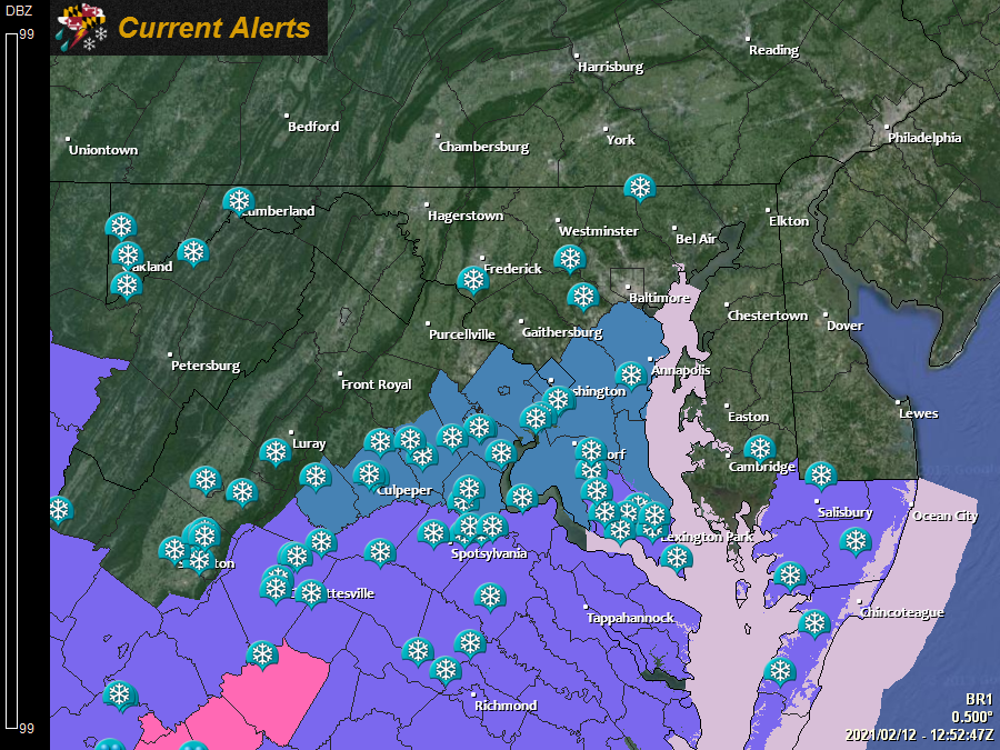
The greatest threat of ice accumulation is along and east of I-95, where Winter Storm Watches have been posted:
The models have struggled a lot recently, so it is hard to put much stock in their output at this time, but the most recent trends have less precipitation, and a lower ice threat. Nonetheless, the threat remains, and significant icing is possible in and around the areas currently under the Winter Storm Watch.
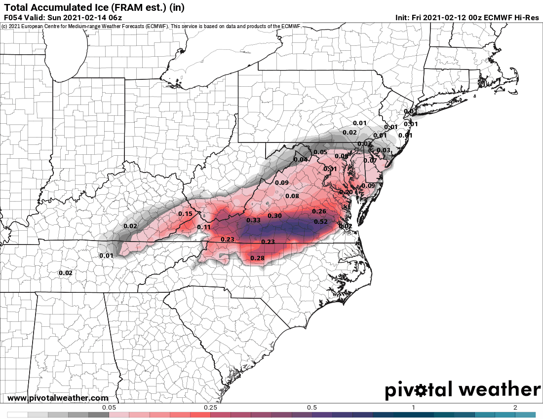
Here is an animation showing the possible ice accumulation from the various models:
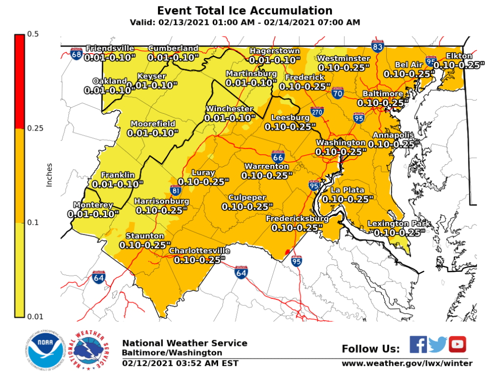
With all of that in mind, here is the latest Ice Accumulation forecast from the NWS:
Be sure to stay up to date with the latest forecasts, and be prepared for adverse travel conditions tomorrow evening into Sunday morning, especially along and east of I-95.