
Low pressure will develop across the southeastern US late tomorrow and intensify along the SE coast. The system will pass by to our southeast, during the early morning hours on Sunday, spreading snow into our state. Today’s models continue to trend stronger and more amplified, with a moderate snowfall now likely across most of the state.
There are a few factors that will limit the snowfall: surface temperatures and the speed of the system. As you may have noticed if you have stepped outside today, there is a lack of cold air, and despite snow falling overnight, temperatures will remain near or just above freezing which will somewhat limit accumulations. Additionally, the system is a fast mover, and should move through in about 9 hours or so, winding down by Sunday afternoon, as depicted on today’s NAM run:
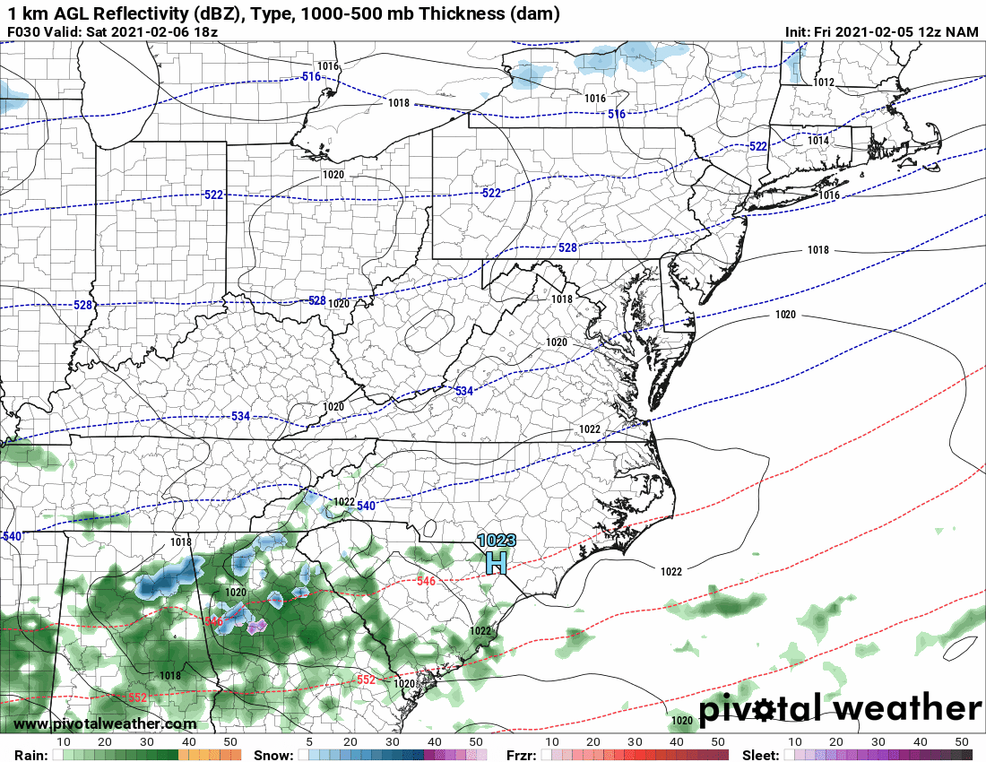
Here you can see the NAM developing the low off the South Carolina coast, and pushing snow into our area between 1 and 4am Sunday morning. Snow continues, moderate to heavy at times through the morning hours, before tapering off and ending by 1 or 2pm.
Taking the various factors into account, here is my first call forecast:
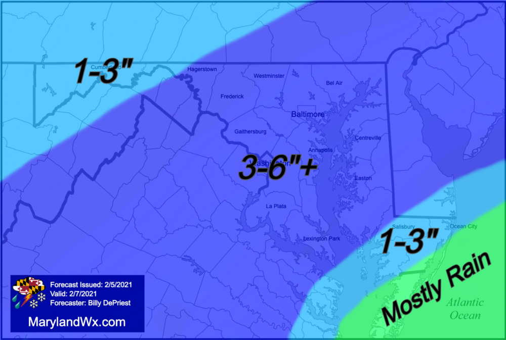
Right now, it looks like the heaviest snow bands will set up across central parts of the state, where a general 3-6″ could fall. There will be some heavier bands of snow that develop, and this could lead to isolated amounts over 6″. Further south and east, temperatures will hold accumulations down a bit, especially closer to the coast where rain will likely mix in with the snow.
This is how I see it currently, but as new data comes in tonight and tomorrow, I may need to adjust this forecast. If so, I will post an update and final call tomorrow afternoon.