
Here is my first call for the storm that will affect our area Wednesday into Thursday morning. Winter Storm Watches have been issued for areas west of I-95, where confidence is highest for heavy snow.
Right now, it looks like snow will break out Wednesday afternoon before mixing with and changing to rain east of I-95, with mostly rain expected across southern Maryland and the lower Eastern Shore. The rain should change back to snow for areas along and west of I-95 Wednesday night, with several inches of snow possible after the change back to snow. As is usually the case, areas north and west of I-95 will see much more snow, with some spots likely to exceed 12″.
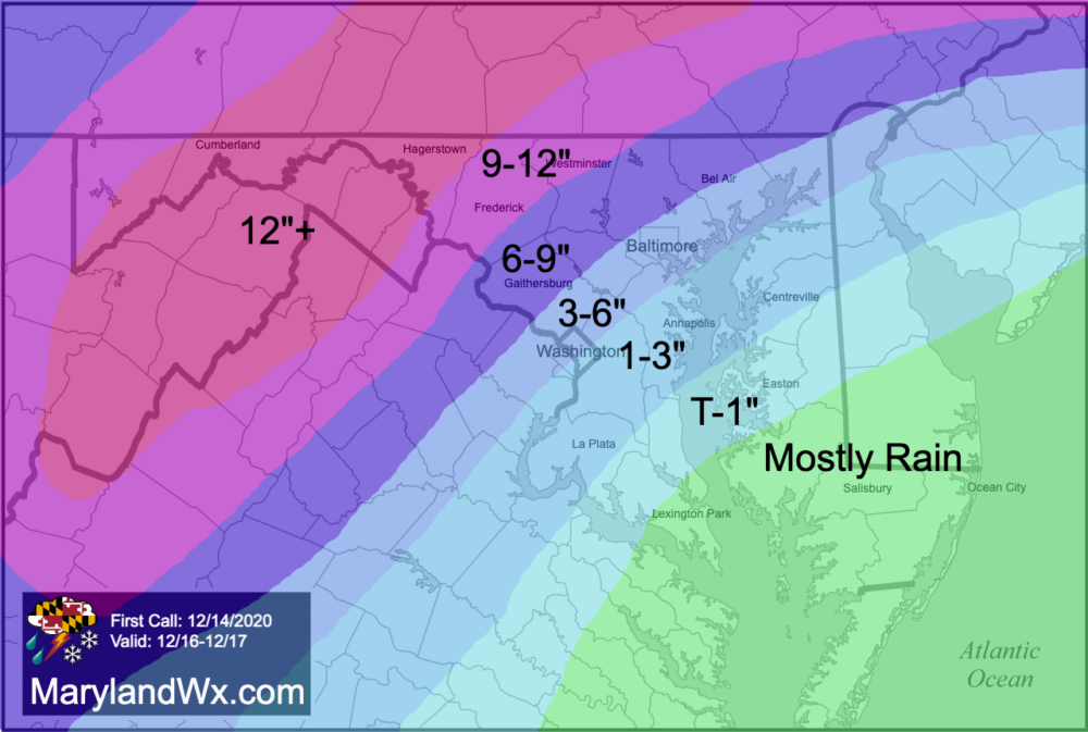
As you can see in my forecast, there is a sharp gradient to the snowfall. Any shift in the storm track will have major implications and could change snow totals dramatically. I will update this forecast as warranted as details come into focus over the next 24-36 hours.