

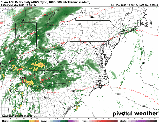
A strong storm system to our west will move into our area tonight, spreading rainfall across the state. Showers will develop this evening and last into tomorrow morning. The shower activity will become more scattered during the late morning and afternoon hours, as southerly winds ahead of a cold front increase. This will push temperatures into the low to mid 70s as a line of showers and thunderstorms develops along the front to our west.
The front will move into the area tomorrow evening, with a line of showers and storms first arriving in western Maryland during the late afternoon, progressing eastward during the evening. At this time, it looks like it there should be a window for Trick-or-Treaters in most of the state before the rain arrives.
Right now, it looks like a squall line of storms will move into central Maryland between 8 and 11pm before pushing eastward and across the Eastern Shore later.
The front and remaining showers should clear out during the early morning hours on Friday, followed by cooler and drier air that will settle in for the weekend.
This is the current thinking, and the timing could change, but right now, it looks like most of the state should be dry, but windy and warm for trick-or-treating. Fingers crossed!
Happy Halloween!