
Scattered showers will push through the state over the next few hours, into the evening hours. This rainfall will be spotty and generally light, but may impact trick-or-treaters this evening. It will be warm and windy, with temps into the mid 70s for most of the day, and wind gusts developing this afternoon up to 30 mph.
The bigger issue for today is a line of strong to severe thunderstorms that are expected to cross the state this evening as a strong cold front moves through.
This line has the potential to produce damaging winds, very heavy rainfall, and isolated tornadoes. The Convective Outlook from the Storm Prediction Center highlights the threat:
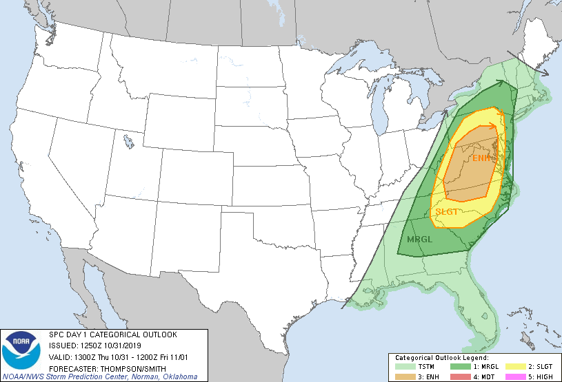
Enhanced Severe Threat 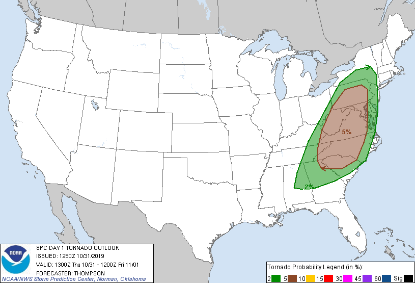
Tornado Threat 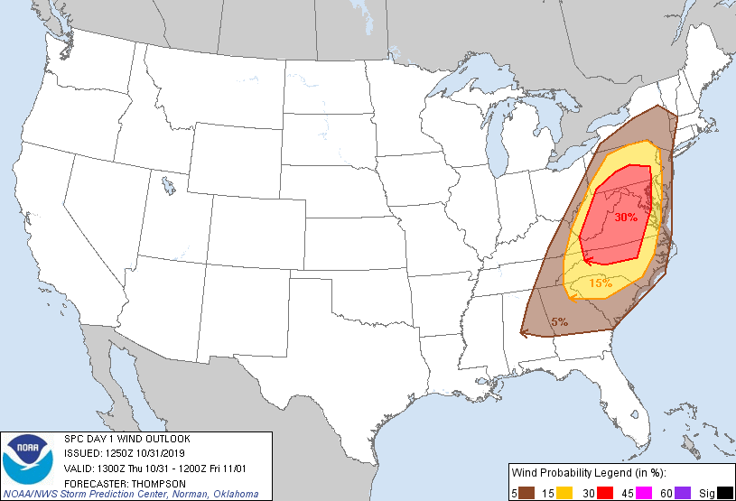
Damaging Wind Threat
Timing wise, it still looks like this line will push through during the late evening into the overnight hours. It will approach western Maryland around 4pm and rapidly move eastward. It will reach the Frederick area around 8pm, and enter the metro areas between 9 and 10pm before pushing into the Eastern Shore around midnight, as seen below on the HRRR model:
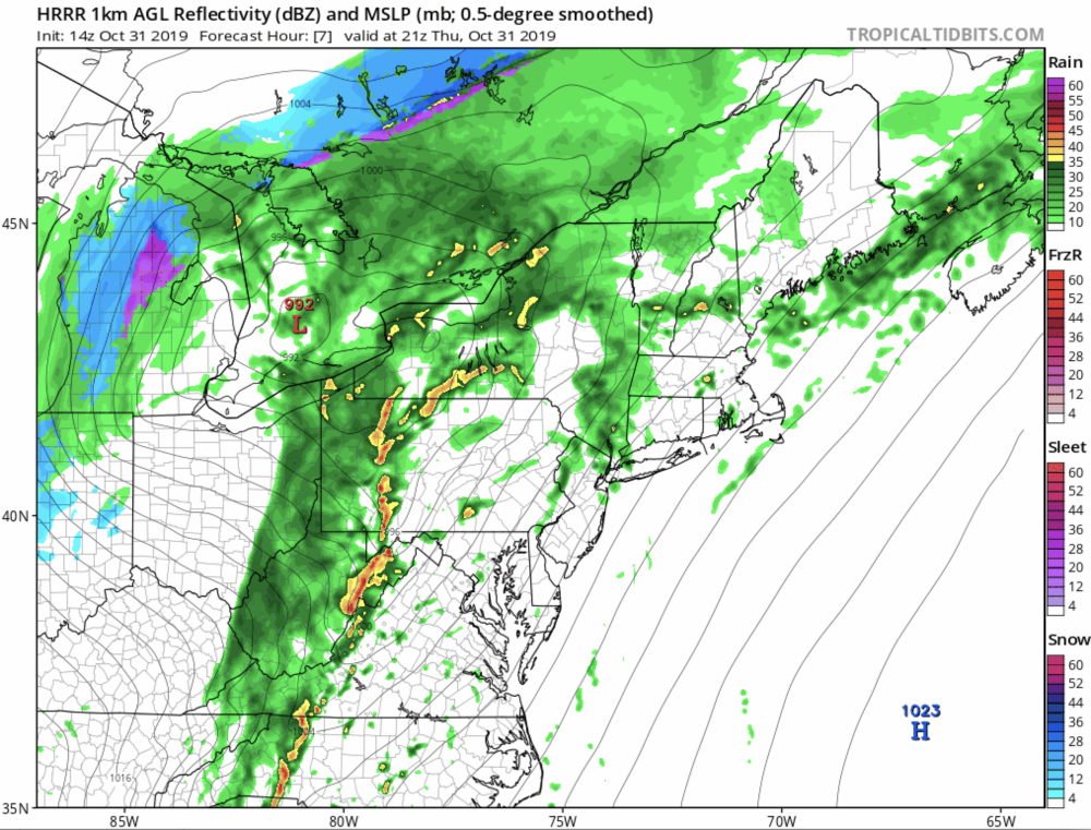
5PM 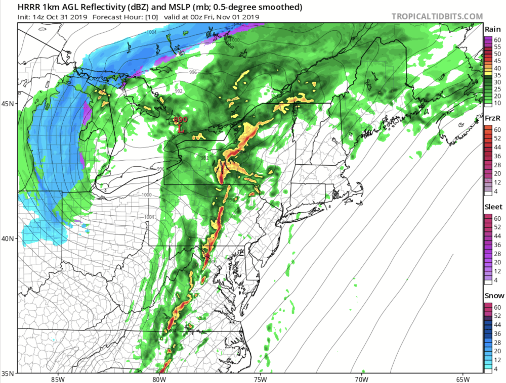
8PM 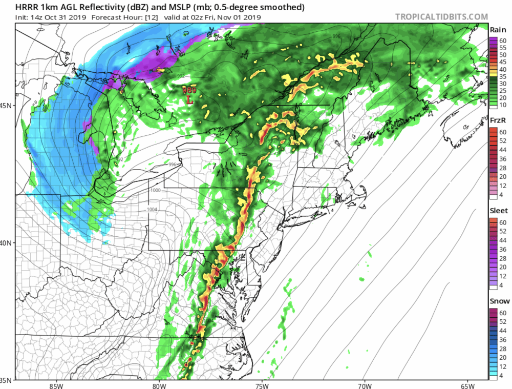
10PM 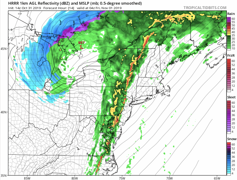
12AM
This is a particularly hazardous situation, considering many folks will be out and about this evening, and it will be dark as this line moves through. If you are planning to trick-or-treat, please be sure you have a way to receive updated information including possible watches and warnings.
Have a Happy Halloween , stay weather aware and stay safe!