
An area of low pressure and associated cold front will approach our region tomorrow. At the same, low pressure developing along the Gulf coast will move up along the eastern seaboard. These two systems will bring widespread, desperately needed rainfall to our state tomorrow.
Showers will move into the area west to east during the morning hours, becoming widespread and heavier during the late morning and afternoon. A rumble of thunder is possible during this timeframe as well. The heaviest activity will likely occur between 10AM and 4PM, as shown on the NAM loop below:
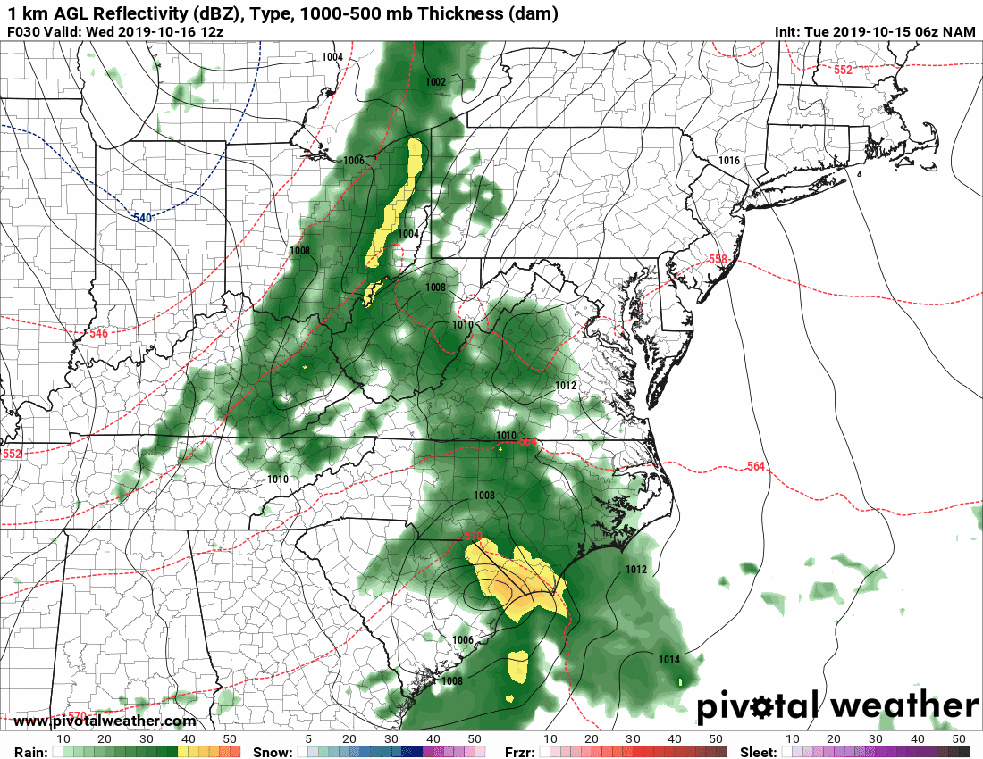
The rain will taper off during the late afternoon and evening hours as the front pushes through and the coastal low moves towards New England.
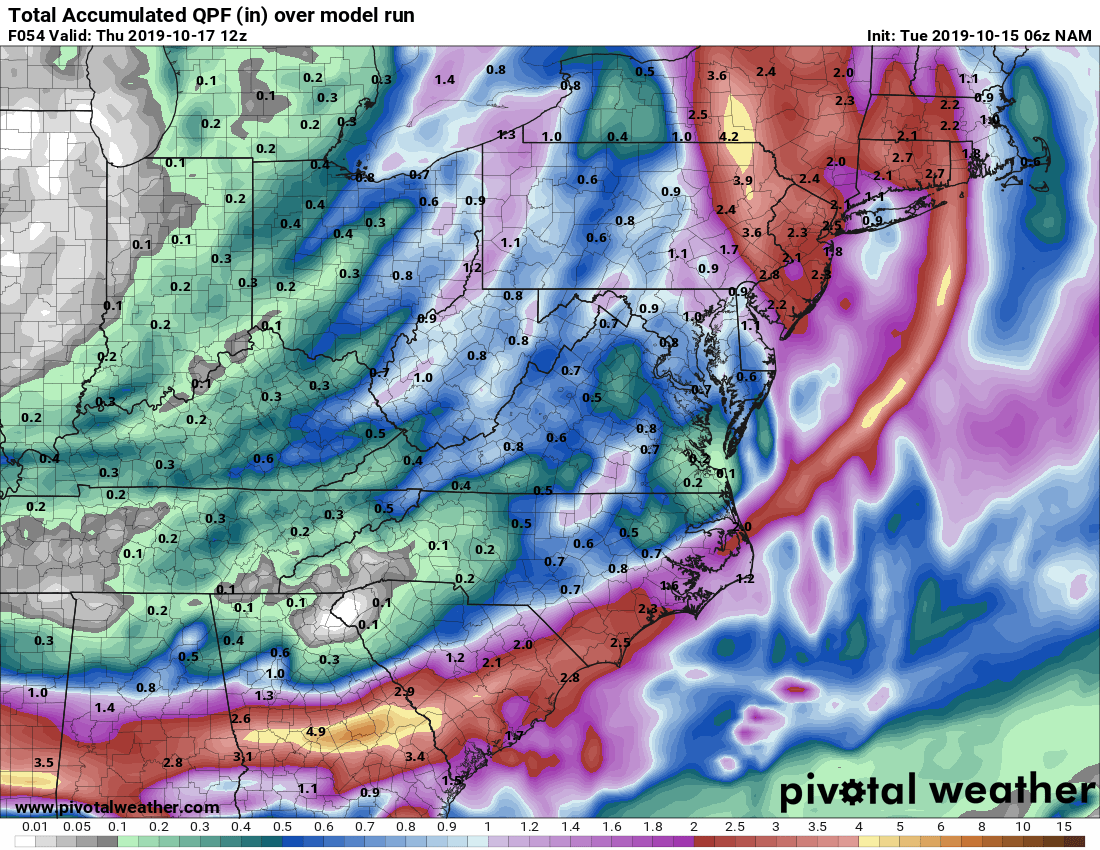
As mentioned, between .50 and 1.0″ of rainfall is a safe bet, with locally higher amounts:
Behind the systems, gusty northwest winds will develop, bringing in cooler and drier air for the remainder of the work week and into the weekend.
Want the latest blog posts emailed to you?