
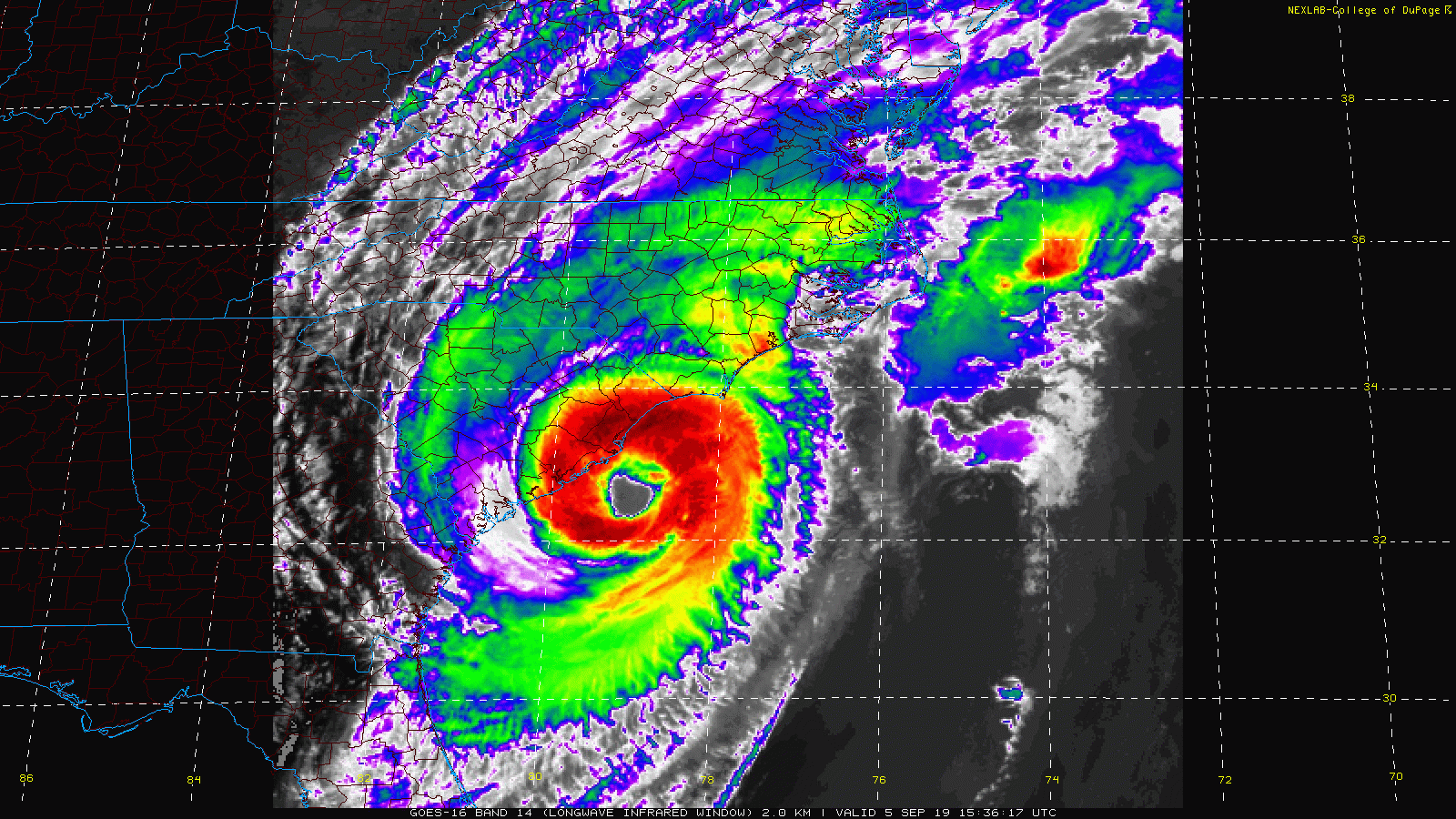
Hurricane Dorian will continue its northward trek, impacting our area tonight through tomorrow, with the greatest impact across southern Maryland and the lower Eastern Shore. A Tropical Storm Warning is in effect for St. Mary’s county, as well as the lower Eastern Shore.
The system will move off to the northeast late tomorrow, and winds and rain chances will decrease as we head into the evening hours.
Here is how the system is expected to impact our state:
Rainfall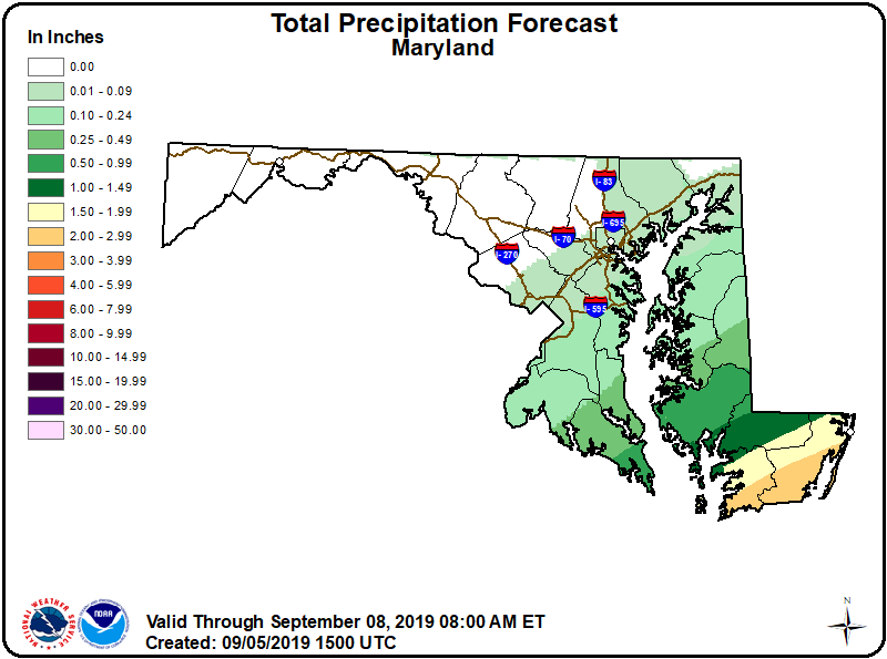
Wind Gusts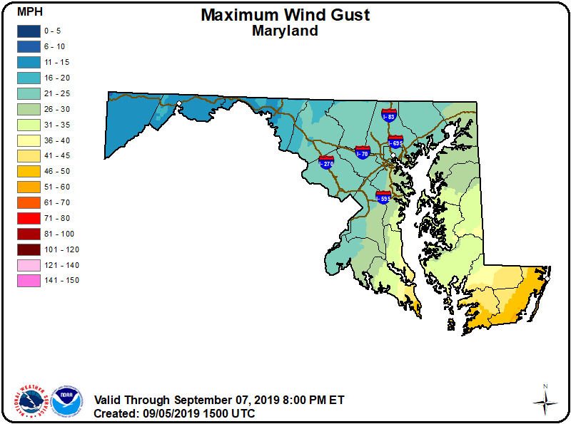
Generally, areas north and west of I-95 will be largely unaffected by the storm. Areas between I-95 and the Bay will see scattered showers, and winds gusting to near 30 mph.
Southern Maryland and the Eastern Shore will see more rainfall, and wind gusts to 35-40 mph.
The Lower Eastern Shore, including Ocean City will see the greatest impact. Rainfall of 1-3″ and wind gusts to near 50 mph are likely.
Stay updated with the latest forecasts and advisories from the National Hurricane Center, and the National Weather Service.
Want the latest blog posts emailed to you?