
Summary: A cold front will move through the area tomorrow with light rain changing to light snow. Arctic air will flow into the region behind the front.
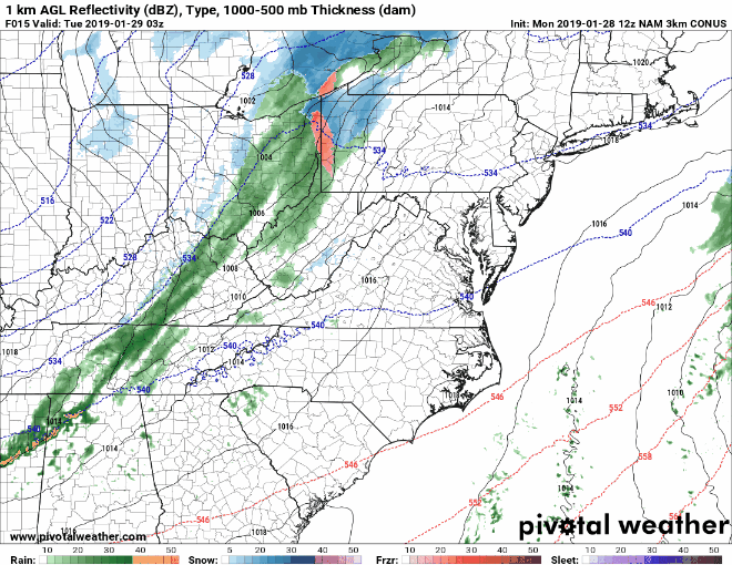
We are about to see drastic changes to our weather, as a cold front brings arctic air back into the region. Light precipitation will break out during the early morning hours, with northern parts of the state likely to see a wintry mix, while further south, it should be rain (see animation below).
As the front moves closer, the rain/mix will continue, and begin changing to snow from west to east. Rain will change to snow during the late morning west of I-95, with the rain/snow line reaching I-95 during the afternoon.
With temperatures falling, the snow will begin to accumulate, impacting the evening commute. The snow should taper off from west to east during the early evening hours, exiting the I-95 corridor by about 7pm and the eastern shore by about 10pm.
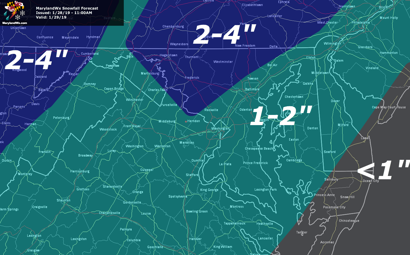
In general, 1-3″ of snow is expected, with spots near the PA border possibly seeing up to 4″. With temperatures falling well below freezing, the snow/ice will likely impact the Wednesday morning commute as well.
The true arctic front will move through on Wednesday, with another round of snow flurries or snow showers. Temperatures will fall throughout the day, as northwest winds gust into the 40mph range, creating dangerous wind chills. Lows Wednesday night will fall into the single digits (below zero in the mountains) and highs on Thursday will struggle into the 10s to low 20s.
Want the latest blog posts emailed to you?