
Summary: A weak area of low pressure continues to spread a wintry mix across the area this morning. Another, stronger system will bring more precipitation tonight and tomorrow.
A wintry mix, with snow, sleet, freezing rain, and plain rain continues across our state this morning, with the usual colder spots seeing the most frozen precipitation. A Winter Weather Advisory remains in effect for areas mainly north and west of I-95.
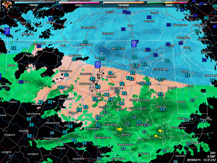
Temperatures will climb a few degrees this morning and afternoon, which will allow areas south and east of I-95 to continue to transition to plain rain, while areas north and west of I-95 will continue to see snow, sleet and freezing rain. The precipitation should taper off a bit this afternoon as another system begins to spread more moisture our way.
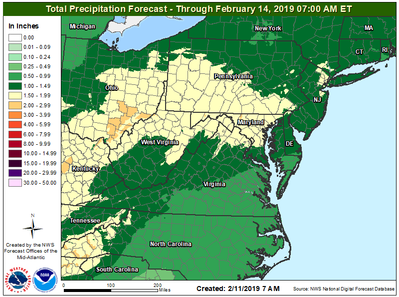
This stronger system will move by to our northwest, allowing southerly flow to bring warmer air into our area. Most parts of the state will see plain rain, while northern areas may start out frozen before changing over. The northern counties (that are currently under a Winter Storm Watch) may pick up a few inches of snow and a bit of ice accumulation before changing to rain tomorrow morning.
The rain will continue tomorrow, heavy at times, with most areas seeing between 1-2″ of rainfall before it ends tomorrow night, as a cold front crosses the area.
Behind the front, it will turn windy late tomorrow night and Wednesday, with winds gusting to near 50mph at times.
Want the latest blog posts emailed to you?