
Summary: A weak, fast moving area of low pressure will pass by to our north and west, bringing a period of light wintry mix to our area.
With marginally cold air in place, low pressure tracking by to our northwest will bring a period of light precipitation to our area tomorrow afternoon into Friday morning.
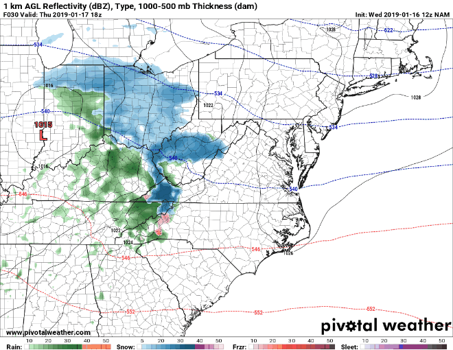
North and west of I-95, temperatures should be sufficiently cold for mainly snow to fall. Generally, snowfall will be under an inch, but isolated areas may see up to 2″, especially along the PA border.
Further south, the snow will likely mix with sleet, freezing rain, or plain rain. Again, this will be a light event, and temperatures will warm above freezing in these areas, minimizing the impact. Nonetheless, the precipitation will be falling overnight and into the early morning Friday, and could impact the AM commute.
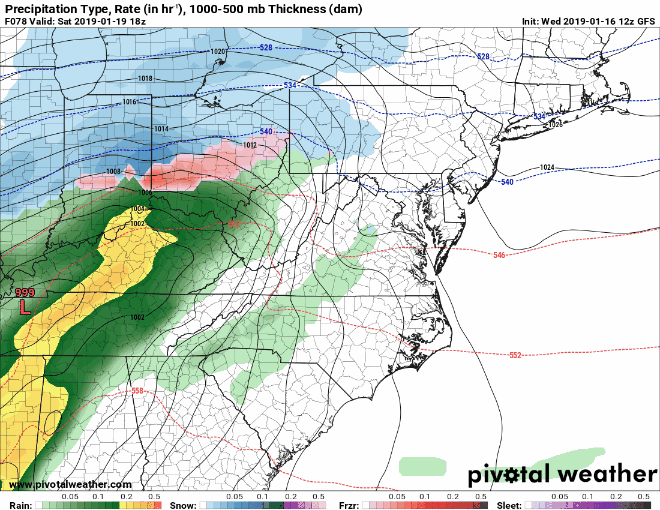
Looking ahead to this weekend, it still appears that the system will be too far west to bring widespread wintry precip to our area, as depicted on this morning’s GFS. I will continue to monitor this system and post updates as needed.
One thing remains certain: Behind the system, arctic air will flow into our area on gusty northwest winds, bringing the coldest air of the season thus far and even colder wind chills.
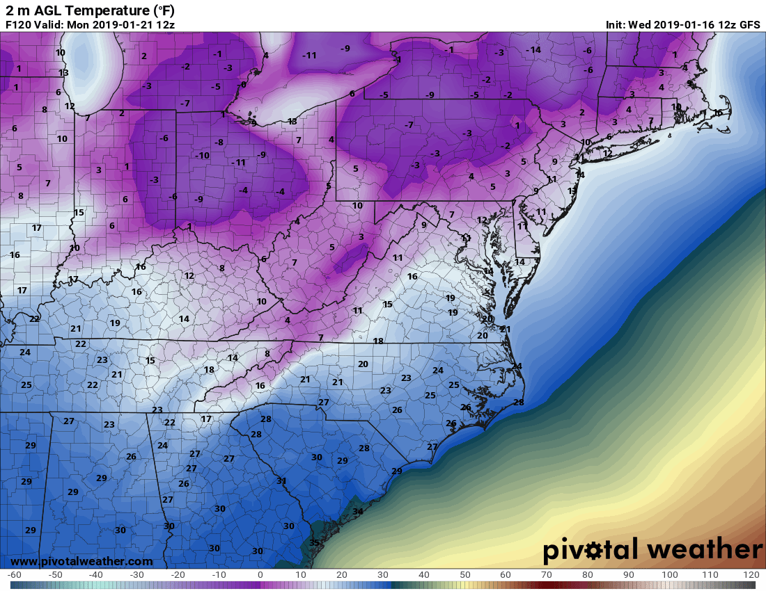
Temperatures will fall into the single digits to mid 10s by Monday morning, and will struggle into the 10s and 20s Monday afternoon. Temperatures will slowly moderate as we head towards mid-week.
Want the latest blog posts emailed to you?