
A developing area of low pressure will move up the east coast, spreading precipitation into our area late tonight into tomorrow morning. As it does, cold high pressure over eastern Canada will funnel cold air into the region, creating a cold air dam. This will cause the initial push of precip to fall as snow or a snow/sleet mix west of the bay. Southern Maryland and the lower eastern shore will see very little if any frozen precip before changing to plain rain.
During the morning hours tomorrow, warmer air will overtake the cold, changing the snow and sleet to rain along and east of I-95, while the usual colder spots north and west of the cities will be slower to transition.
Eventually, all areas outside of far western Maryland should warm and transition to rain. In western Maryland, Winter Storm Watches are in affect for Allegany, Garrett, and Washington counties where several inches of snow/sleet and significant icing are possible.
Here is my initial forecast:
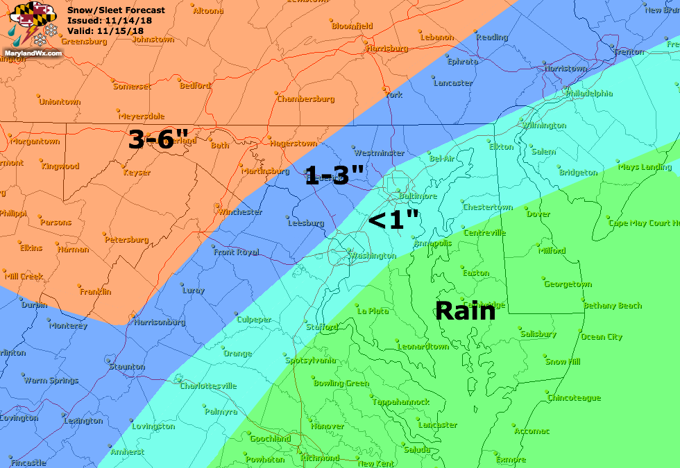
Any frozen accumulation east of the mountains will likely be confined to grassy and elevated surfaces, but a few slick spots are possible during the morning commute, especially on bridges and overpasses.
The snow, sleet, freezing rain, and rain will continue through the day tomorrow and into tomorrow night before tapering off early Friday morning.
This is a tricky forecast, as are all cold air damming/changeover scenarios. Updates to this forecast will be made later today if warranted.
Want the latest blog posts emailed to you?