
Summary: An area of low pressure will slide by to our south tomorrow night into Sunday. The system will intensify off the coast as it pulls away.
An area of low pressure currently over the central US will move eastward today and tomorrow, passing by to our south tomorrow night into Sunday. With very cold air in place, and a strong high pressure to the north, light snow is expected for most of the state.
Timing wise, expect snow to develop west to east late tomorrow morning into the afternoon, reaching the metro area during the late afternoon and early evening hours. Snow will continue tomorrow night and into Sunday morning, tapering off during the morning and ending during the afternoon.
This animation of the 6z GFS for 7am tomorrow through 1am Monday gives a general idea of the timing and evolution of the system:
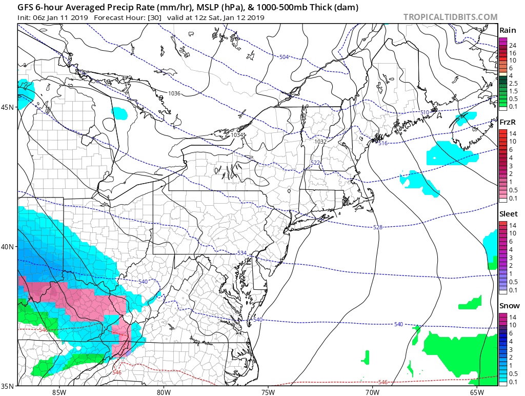
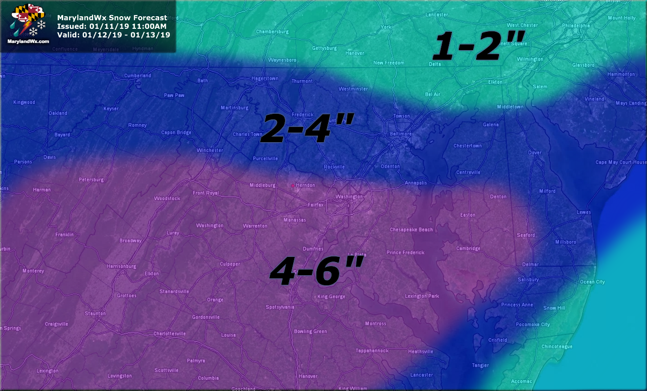
Generally, several inches of snow are likely, with the highest amounts in the mountains and across southern Maryland and the lower Eastern Shore.
Here is my initial forecast for this storm:
At this time, confidence in this forecast is fairly high. Nonetheless, I will monitor the data today and I will update this forecast this evening, if needed.
Want the latest blog posts emailed to you?