
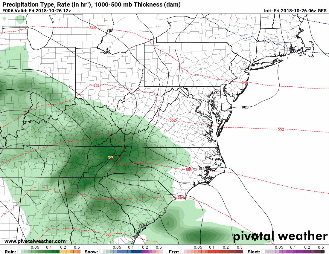
Low pressure containing the remnants of Hurricane Willa will continue to develop and move towards our area today. Rainfall will overspread the state this afternoon, becoming heavy at times tonight and moving out of the area during the morning hours tomorrow.
Here is a GFS loop, showing rainfall entering the state around 2pm, overspreading the entire state between 2-5pm and becoming heavy during the overnight. The rain tapers off tomorrow morning, clearing most of the state by 11am:
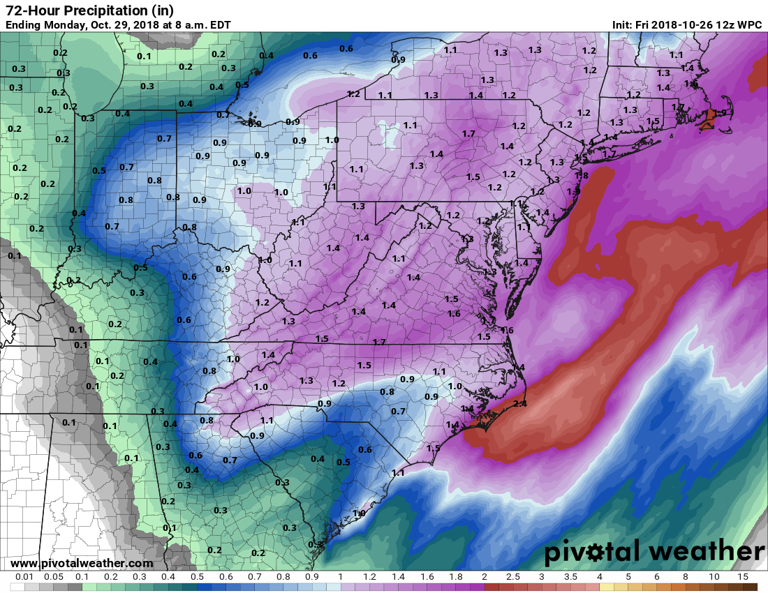
When all is said and done, a general 1-1.5″ of rainfall is likely, as shown in this WPC forecast:
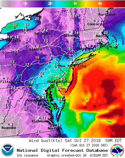
The other story will be the winds. As the system moves up the coast and strengthens, northeast winds will increase across our area, with the strongest winds expected late tonight into early tomorrow morning. Gusts of 20-30mph are likely, especially along the coastline:
We will dry out tomorrow afternoon as the system moves away and winds shift to northwesterly. There will be a slight chance of a shower, especially in the mountains as an upper level low impacts the region. A clipper system will move through on Sunday, resulting in another chance of showers.
Want the latest blog posts emailed to you?