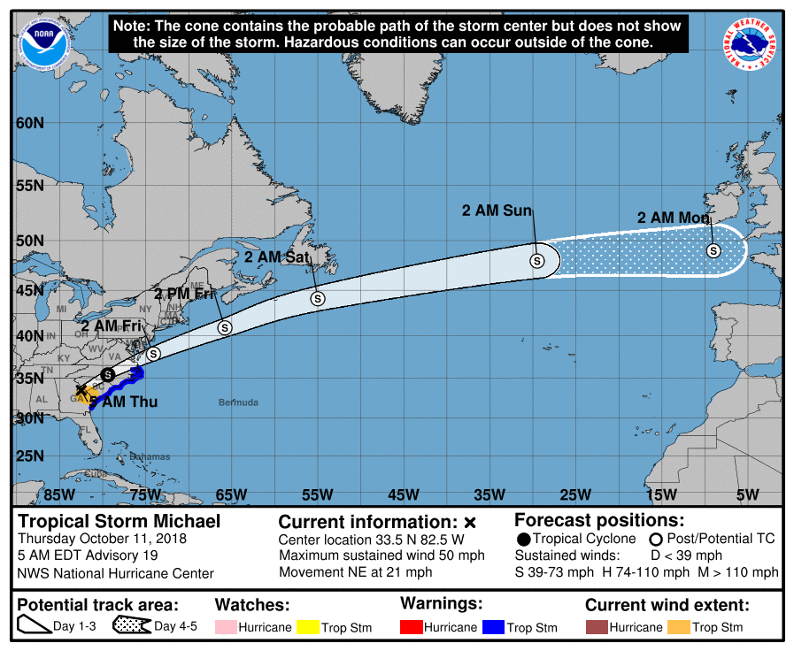
Unlike some of the other major hurricanes that have stalled out after making landfall, Michael hit the Florida panhandle yesterday and has made steady progress northeastward since. The system is now moving through South Carolina as a tropical storm with maximum sustained winds of 50 mph.
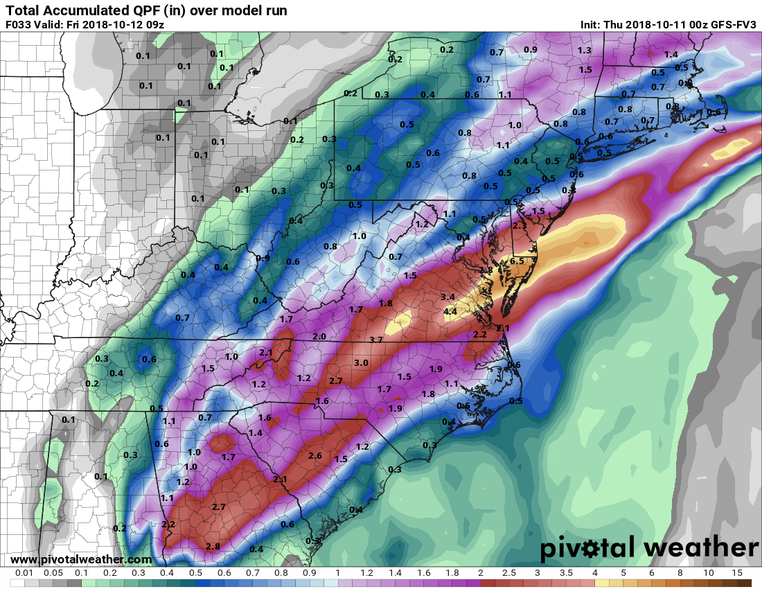
A strong cold front is steering the system and will push it off the coast to our south. Southerly flow ahead of the front combined with moisture from the system will give us periods of heavy rain and thunderstorms today into tomorrow morning. The heaviest rainfall will occur over southern Maryland and the lower Delmarva, where several inches of rain are likely. 1-2″ of rain is possible across the metro areas, with lesser amounts to the north and west. It will also be breezy, with wind gusts to near 35 mph, especially across the Delmarva. Flash Flood watches are posted for areas south and east of I-95, and Wind Advisories are posted for southern Maryland and the Eastern Shore.
The aforementioned cold front will clear the area tomorrow, ushering in our first real shot of fall-like weather. Highs will be in the 60s this weekend, with overnight lows in the 40s.
Want the latest blog posts emailed to you?


