
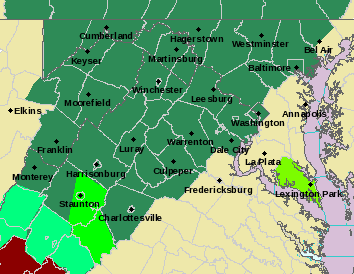
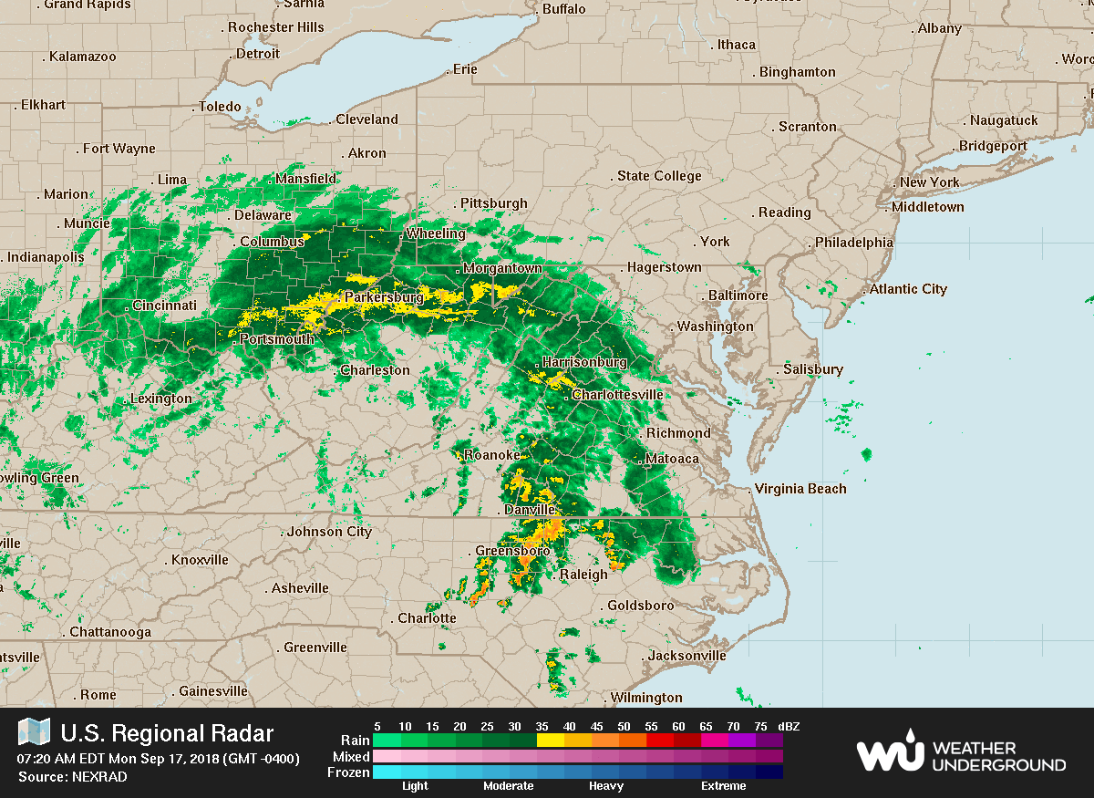
 As I had mentioned last week, the remnants of Hurricane Florence will pass through our area today and tomorrow bringing showers and thunderstorms. Some of the rainfall could be heavy at times, leading to a flash flood risk, mainly north and west of I-95, where a Flash Flood Watch is in effect. 1-3+ inches of rainfall are likely across western portions of the state, with lesser amounts further east.
The system will move to our northeast, dragging a cold front through tomorrow. Additional showers and storms are possible before we dry out as we head into Wednesday.
Want the latest blog posts emailed to you?